
12 PM UPDATE
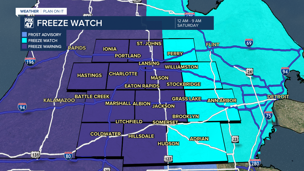
The National Weather Service has upgraded the Freeze Watch to a Freeze Warning across all of our neighborhoods. The warning goes into effect at midnight tonight and lasts through 9 AM Saturday.
Temperatures are expected to fall below freezing across all of our neighborhoods overnight tonight. These temperatures could be harmful to crops and plants. Make sure to bring potted plants inside or cover up outdoor plants. Also make sure to give plants some water this afternoon ahead of the freeze.
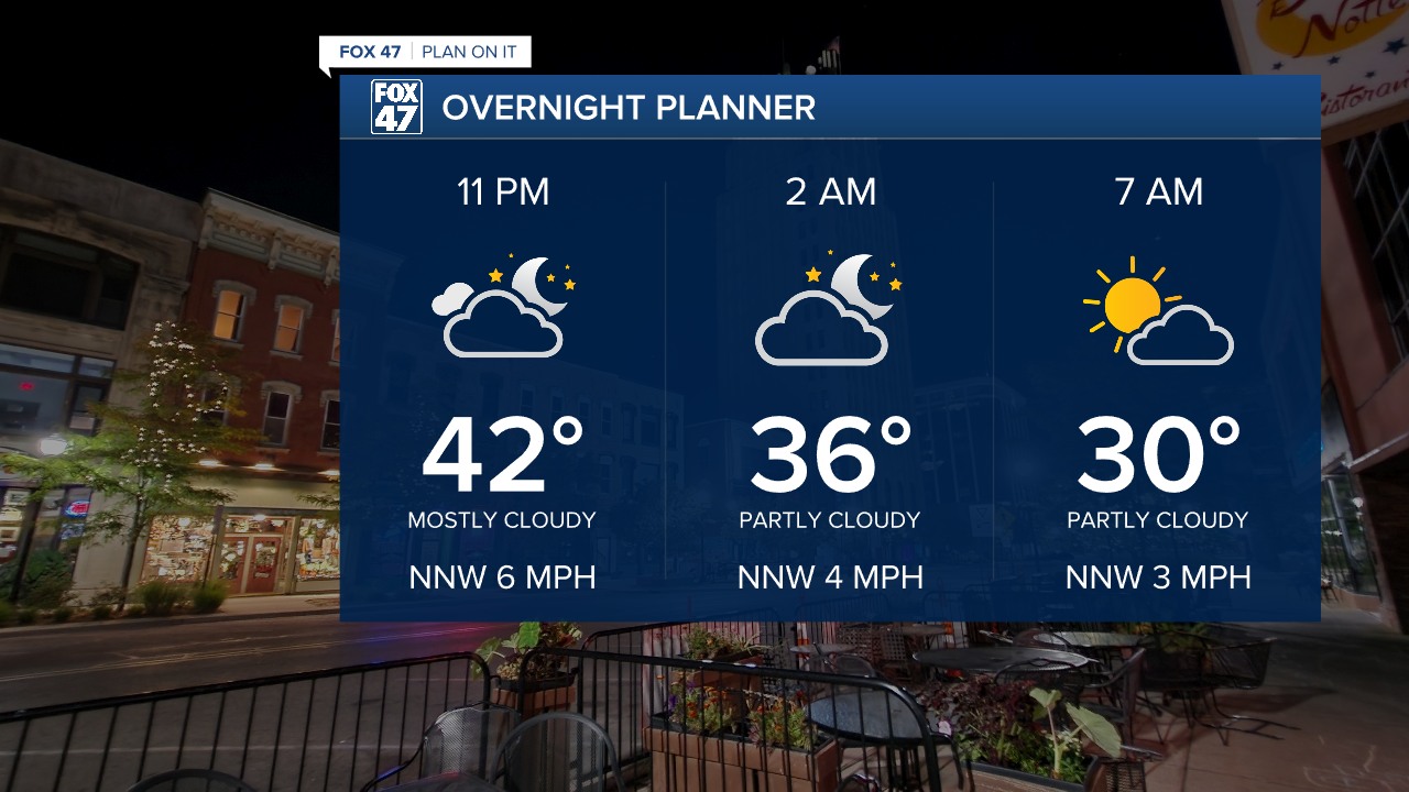
If you are heading out the door early Saturday morning, bundle up as it will feel more like early spring. We will start to warm up again heading into the new week with returning chances for showers. We could still see temperatures into the mid to lower 30's Saturday night into Sunday morning.
ORIGINAL POST
It is another chilly start across Mid-Michigan with temperatures cooling into the 30's as of 6 AM Friday morning. A few showers in the form of rain are advancing through neighborhoods along and south of I-94 making frost potential difficult due to the cloud cover and rainfall keeping temperatures a bit warmer at the surface. Make sure to grab a jacket when heading out the door this morning as you might need it during the daytime hours with highs only reaching the upper 40's/lower 50's.
All of our neighborhoods, however, have a chance to see a possible freeze overnight tonight into Saturday morning as temperatures dip below freezing. The National Weather Service has issued a Freeze Watch which will go into effect at midnight tonight and last through 9 AM Saturday morning. This watch has been issued for all of our neighborhoods.

WATCH THE FULL FORECAST BELOW
The showers advancing through our southern neighborhoods this morning should exit by the time we reach the late morning hours where we will see a few shortwave troughs advance through the region during the daytime hours which could allow for a light shower. We remain dry at the surface meaning whatever falls today shouldn't bring much of any impacts or rainfall accumulations to our neighborhoods. Expect mostly cloudy skies during the afternoon hours today.

We will dry up heading into the evening hours past sunset with a gradual clearing trend. Clear skies and calm winds are favorable conditions for frost as well as rapid cooling at the surface called radiational cooling. Temperatures should drop below freezing by the morning hours which could harm plants and crops.
Make sure to keep plants covered during the overnight period through Sunday morning as we will stay with lows in the 30's, but gradually warming following Saturday morning. You can also bring potted plants inside during this below average cold spell.
The upper level area of low pressure continues to usher cooler air into the region which is expecting to continue through most of next week. A brief warm up will occur early in the new week on Monday with highs in the mid to upper 60's. However, a cool down will bring temperatures right back down into the lower 50's by Thursday with lows returning to the 30's.
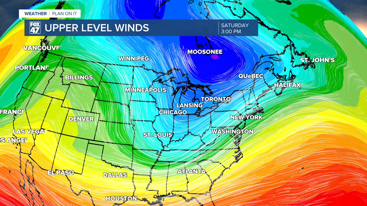
We dry up Saturday with partly cloudy skies as Sunday brings a chance for showers back to our neighborhoods. However, no major impacts or accumulations are expected. The same goes for most of the day Monday with a chance for thunderstorms late in the day and possibly into the evening. We could still see some changes to this forecast, especially for next week, as we cool our temperatures again. We will keep you updated.

Have a great weather picture or video to share? Send it our way and we may feature it on-air or online!

