
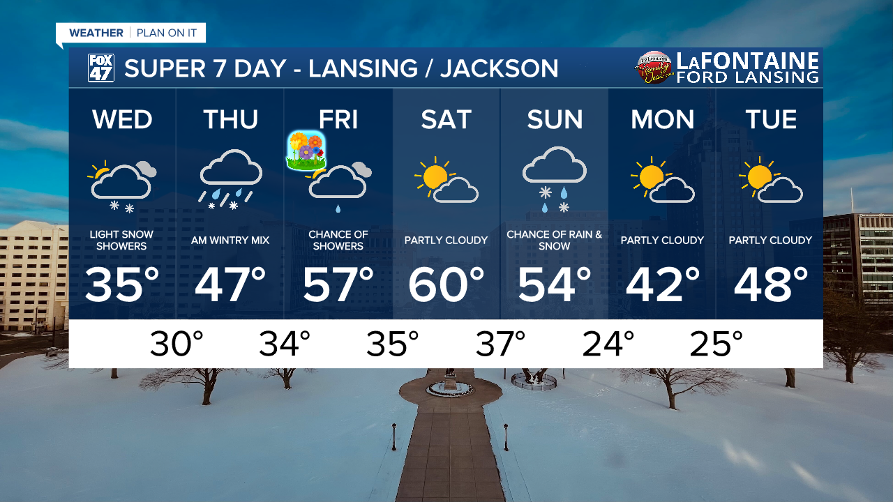
LANSING, Mich. — We still don't feel like spring when stepping out the door across our neighborhoods today. As winds turn out of the south, air temperatures will warm back into the mid 30's today. However, wind chills will still be an issue along with continued snowfall due warm air advection.
Wind gusts out of the south could reach 25-30 mph today during the afternoon hours with feels like temperatures dropping into the mid 20's. Make sure to have that jacket ready when leaving the house during all parts of the day today.

WATCH THE FULL FORECAST BELOW
These winds will die down in the overnight hours and will become much less of an issue Thursday as we continue warming. However, Friday breezy conditions are expected to return as temperatures return to the 50's.
Snowfall begins during the mid to late morning hours Wednesday with light scattered snow showers continuing through the mid to late afternoon hours. These snow showers could drop visibility as well as bring light accumulations up to an inch across our neighborhoods. Similar to yesterday, we could see some slick spots on roadways today. Stay weather aware when getting behind the wheel.

We will continue to warm with air temperatures back in the 40's Thursday with a chance for some morning wintry mix that could bring additional slick spots for the morning commute. Shower chances continue into Friday in the form of rain with no major impacts expected at the moment. We get a break from precipitation Saturday with temperatures at its warmest in the upper 50's/lower 60's. Another cool down is expected as we end the weekend and begin a new week.
Severe Weather Awareness Week continues across the state of Michigan today with the Statewide Tornado Drill taking place at 1 PM Wednesday afternoon. Depending on location, you could hear and see alerts on your mobile devices, TV's, and radios. You might also hear outdoor sirens being tested as well. This is a great opportunity to go over your severe weather plan as we continue to inch closer to the warmer months.
We've already seen all severe impacts across our neighborhoods this season with Watches and Warnings being issued. Below, you can check out the difference between a watch and a warning.

Want more FOX 47 News? Here's how you download our Roku app
You can also see the latest news from across our mid-Michigan neighborhoods by liking us on Facebook or following us on X.
