
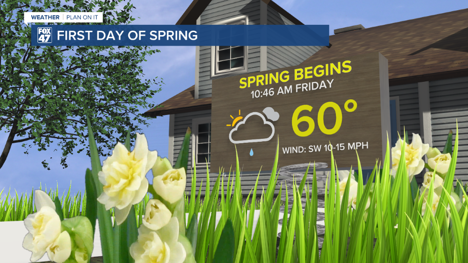
LANSING, Mich. — Spring is in full swing at 10:46 AM as we observe the spring equinox where the sun lies parallel to the equator. We have already observed the start of meteorological spring back on March 1st.
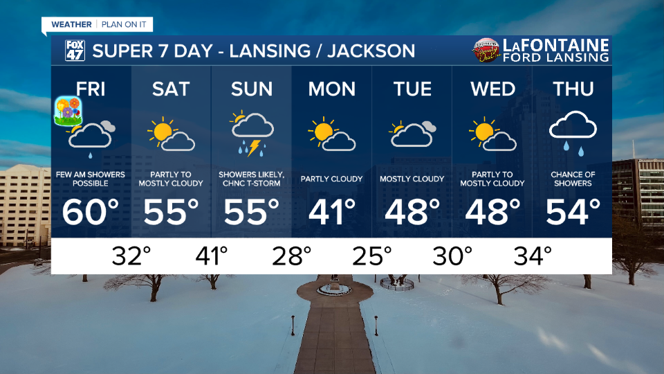
Temperatures today will feel more like spring reaching 60 degrees. Similar to yesterday, it will be more of a struggle for northern neighborhoods to reach this high temp today, but it is still possible and some sunshine ushers into the forecast this afternoon. Southern neighborhoods should have a much easier time getting into the lower 60's this afternoon. However, timing of a passing cold front could shake up how warm we get today.
WATCH THE FULL FORECAST BELOW
Shower potential remains only in the AM hours and focused more in our northern neighborhoods as a clipper system advances through our neighborhoods. Showers should come to an end by noon and no major impacts are expected if you run into any of this light rain.
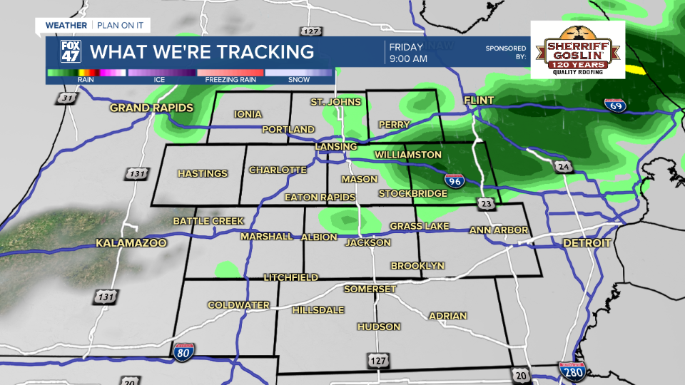
Into the afternoon hours, sunshine is expected to return for all of our neighborhoods with partly cloudy skies. Another feature to watch out for this afternoon is a passing cold front affiliated with the clipper system bringing the rain this morning. This cold front will keep winds present with gusts from 20-25 mph which shouldn't impact our feels like temperatures.
At the moment, the frontal passage looks to advance through our neighborhoods around 3 PM. Once it advances, temperatures will start to cool gradually as more cloud cover filters in overnight and the winds weaken. High temperatures will be dependent on the timing of this advancing cold front.
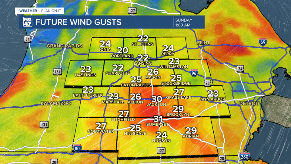
Winds return Saturday with gusts during the daytime hours ranging from 15-20 mph. This shouldn't impact our feels like temperatures and highs for the day will warm into the mid 50's for another spring like day with some chances to see the sun.
However, gusts will strengthen overnight Saturday into Sunday as another clipper approaches the region and an affiliated warm front advances through our neighborhoods. Temps are still expected to stay warm on Sunday with highs in the mid 50's but we will also be tracking chances for showers and storms.
At the moment, no severe impacts are forecast for Sunday's round for precipitation, but we will monitor closely for any changes.
Temperatures cool overnight Sunday into the new week with highs back in the 40's which is around where they should be and lows below freezing. Our next best chance for showers next week arrives on Thursday as temps warm back into the mid 50's.
We are closing out Severe Weather Awareness Week talking about tornadoes. This phenomenon has already been seen in the state this year with 4 confirmed. Below, you can learn how a tornado forms. Make sure to have a severe weather plan for when any severe impacts hit our neighborhoods during the warmer months.
Want more FOX 47 News? Here's how you download our Roku app
You can also see the latest news from across our mid-Michigan neighborhoods by liking us on Facebook or following us on X.
