
LANSING, Mich. — Rain exits our neighborhoods this morning as the low pressure system continues to track north. To the south of the center of low pressure, strong winds out of the northwest will enter our neighborhoods as we gradually cool our temperatures throughout the day.
A Wind Advisory will go into effect at 7 AM Friday morning for all of our neighborhoods with strong wind gusts this afternoon possibly reaching 45 mph. We also can't eliminate the chance to see an isolated 50 mph gust as well. The Wind Advisory is set to expire at 9 PM Friday evening.

WATCH THE FULL FORECAST BELOW
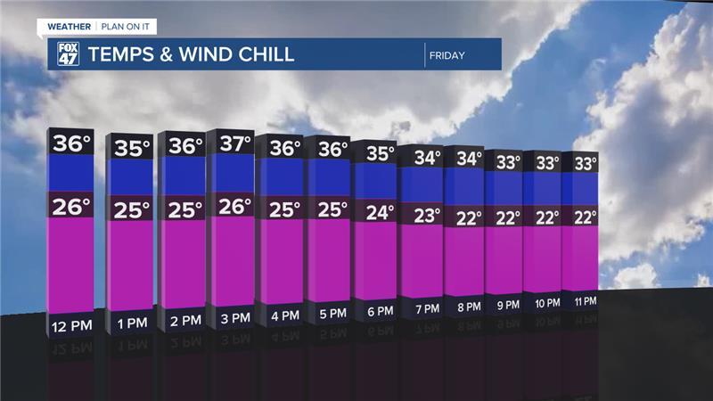
Temperatures across our neighborhoods this morning remain mild in the upper 30's/lower 40's. However, strong winds have already dropped feels like temperature down into the mid to lower 30's. Make sure to grab the winter attire like hat, gloves, and heavy jackets when heading out the door because the false start to spring has ended.
This afternoon, wind speeds will drop feels like temperatures into the mid 20's as air temperatures gradually fall throughout the day today. Air temperatures will make it into the mid 30's Friday afternoon.
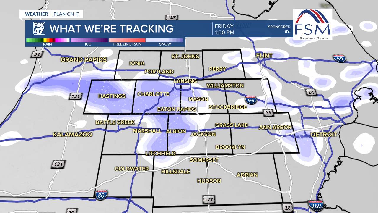
During this period of strong winds, we will also be tracking the return of snow to our neighborhoods. Now that cooler air is rapidly entering our neighborhoods, snowfall is looking to begin in the early afternoon hours today and last through the early evening hours. We could see occasional snow and flurries overnight tonight and throughout the day Saturday with snowfall potential through Saturday evening possibly up to 1"-1.5". These light snow accumulations could create slick spots on roads during the late evening commute Friday night into Saturday morning and similarly Saturday evening into Sunday morning.
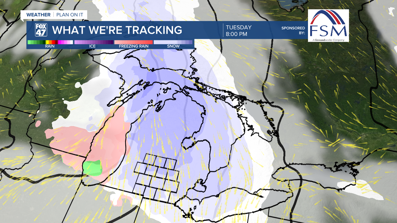
Another round of snow is expected to move through Sunday morning which could bring more accumulations to our neighborhoods. We will also see rounds of snow Tuesday of next week as temperatures warm again with rain and snow possible heading into the mid to late week period.

Want more FOX 47 News? Here's how you download our Roku app
You can also see the latest news from across our mid-Michigan neighborhoods by liking us on Facebook or following us on X.
