
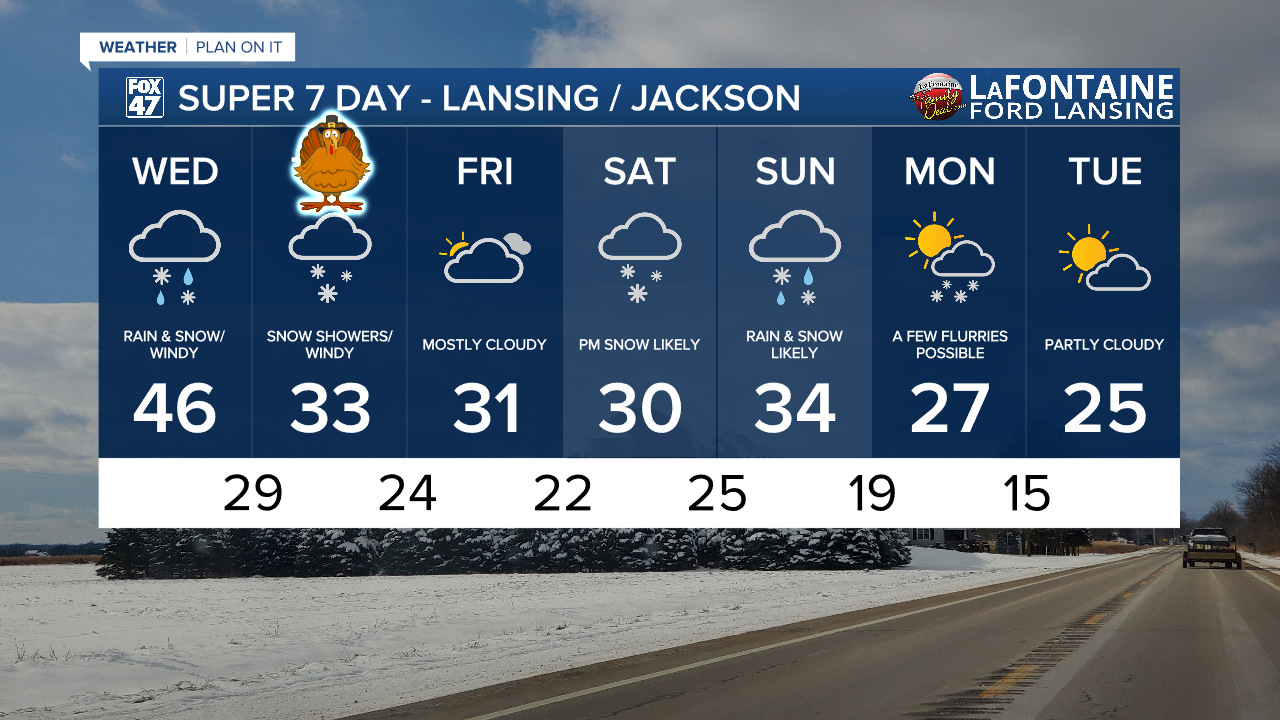
LANSING, Mich. — Rain showers have exited our neighborhood ahead of the 6 AM hour as a cold front will be advancing through our neighborhoods. This will switch up our weather pattern and aid in bringing wintry weather back to our neighborhoods. Temperatures gradually cool from the mid 40's this morning down into the lower 30's by this evening.

WATCH THE FULL FORECAST BELOW
A strengthening low level jet streak will aid in strengthening winds with gusts up to 45-55 mph today and into this evening. Due to these high winds, a Wind Advisory is in effect across all of our neighborhoods. This advisory is set to expire at 7 AM Thursday morning. Strong winds could allow for limited visibility while on the roadways once snow begins. We also can't eliminate the potential for power outages with these high winds as well.

Feels like temperatures will drop due to these strong winds with the 3 PM hour bringing those feels like temps down into the mid to upper teens. This trend will continue during the daytime hours Thanksgiving as well.

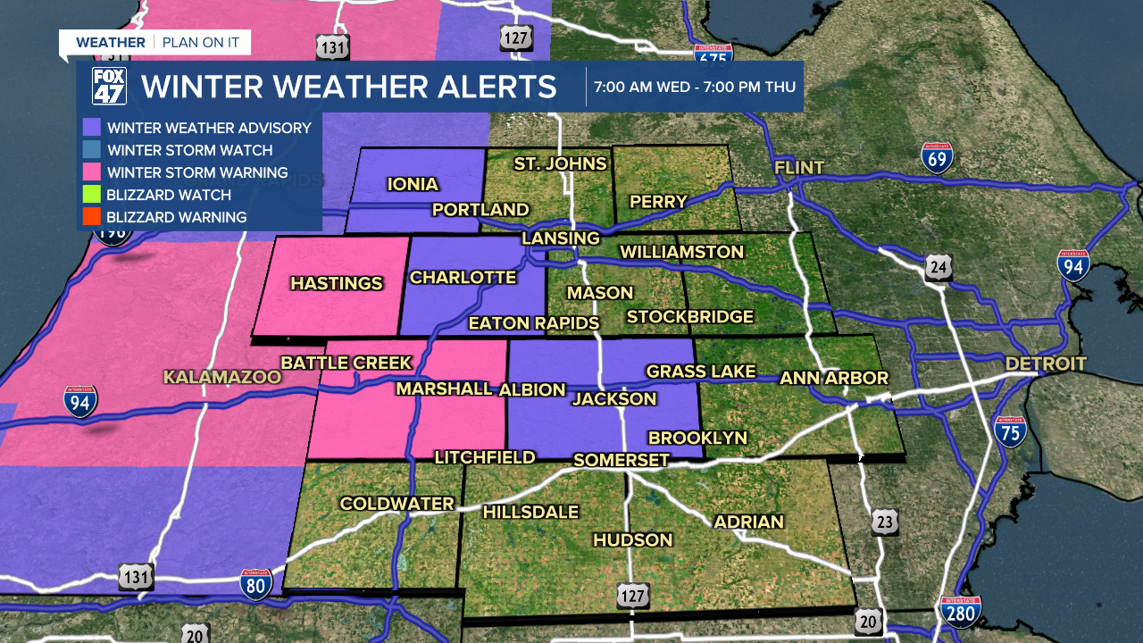
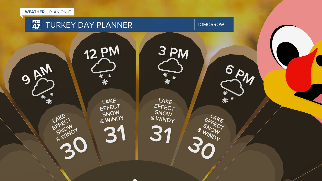
Once the cold front passes through, incoming precipitation in the form of snow will set up. Lake effect snow could begin as early as 8 AM in our neighborhoods and continue through the rest of the day today with accumulating snowfall possible. A Winter Weather Advisory is in effect for Jackson and Eaton counties. This advisory is set to expire at 7 PM Thursday as lake effect snow will continue throughout the daytime hours of Thanksgiving, but more scattered.
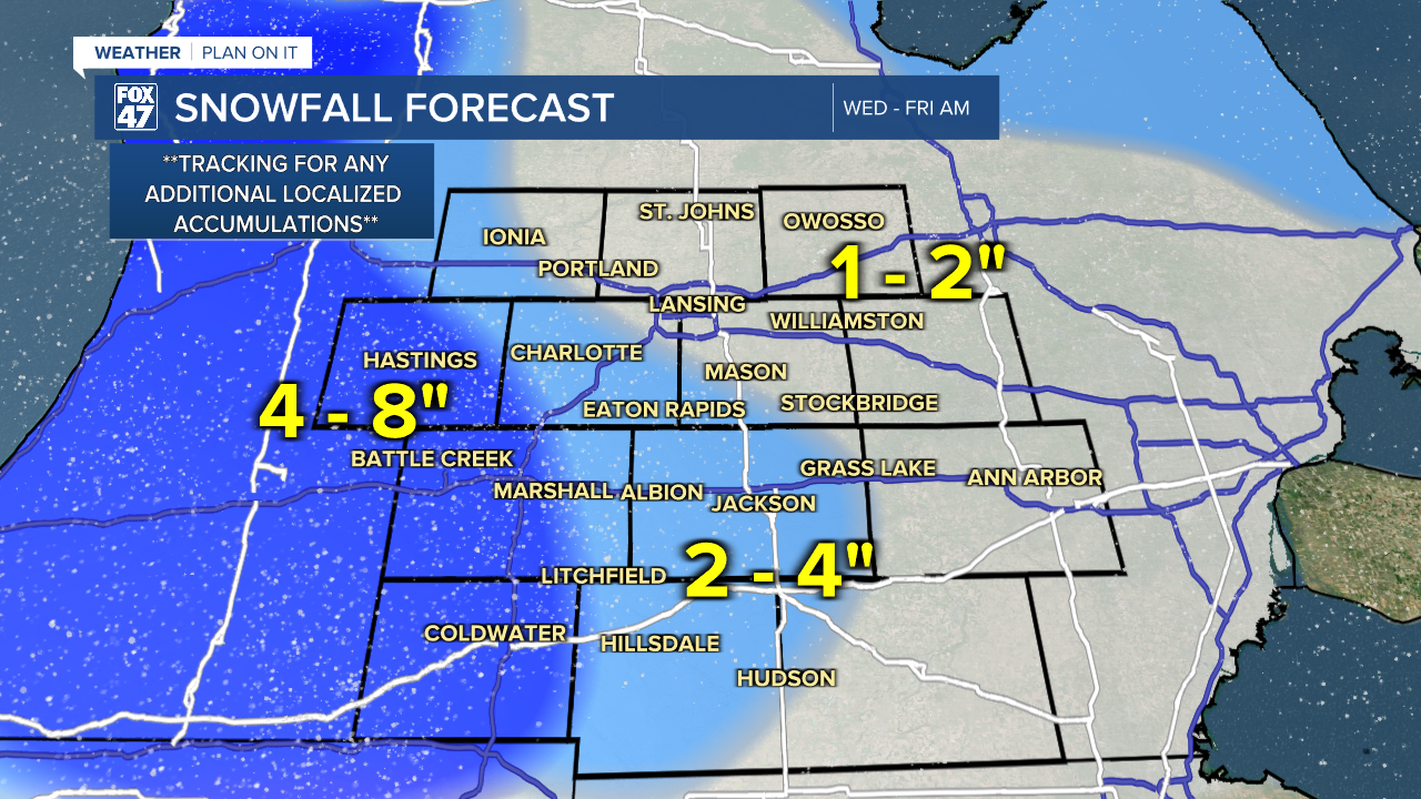
We could see southern neighborhoods like Jackson and Hillsdale measure up to 4" of snow when all is said and done. Southwestern Eaton County could also see some higher accumulations of snow up to 3-4" with Ingham and Clinton expected to see up to 2 inches of snowfall. We will continue to track for any additional accumulations we could see as the lake effect bands set up today.
If you're heading out the door for Thanksgiving, give yourself some extra time as you could run into some hazards including slick spots and limited visibility. Air temps will cool to around freezing with feels like temps plummeting into the mid teens.
Another round of snow is expected to arrive this weekend with additional accumulations of snow possible. This precipitation could take us into a new week Monday as temperatures remain on the cooler side. It is still a bit too early to talk details about weekend snow, but make sure to have the winter gear ready.
Want more FOX 47 News? Here's how you download our Roku app
You can also see the latest news from across our mid-Michigan neighborhoods by liking us on Facebook or following us on X.
