
It feels more like spring this morning across Mid-Michigan with temperatures soaring into the upper 50's and in some neighborhoods bordering on 60 degrees. We are still awaiting the cold front to advance through our neighborhoods which will allow for gradual cooling for the rest of the day today.
In Lansing on January 9th, the record high is set at 56 degrees from the years 1939 and 1876. As of 5:53 AM Friday morning, temperatures in Lansing have warmed to 58 degrees, breaking this record.

WATCH THE FULL FORECAST BELOW
Showers come to an end once the cold front advances through our neighborhoods. Just ahead of the frontal passage, winds will strengthen with strong gusts possible. Because of this, a Wind
Advisory has been issued for all of our neighborhoods currently in effect and set to expire at 4 PM Friday.
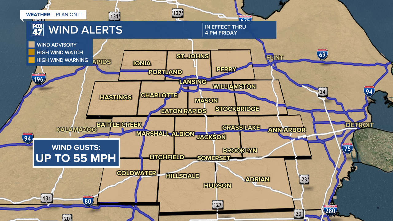
Wind gusts in the late morning hours could reach up to 55 mph. This could knock out some power across our neighborhoods as well as blow around light objects left outside. Again, once our winds shift following the cold front, strong winds will gradually weaken.
Heading into the weekend, winter weather is expected to return to our neighborhoods with snow showers arriving in the mid to late morning hours Saturday and lasting through the afternoon and evening hours as a northern wave and southern wave tracking towards the great lakes interact. Temperatures for the day hover just above freezing in the mid 30's as we are now expecting mainly a snow even rather than mixing. However, there is still a small chance that our most southern neighborhoods like Hillsdale could still see some of that mix.
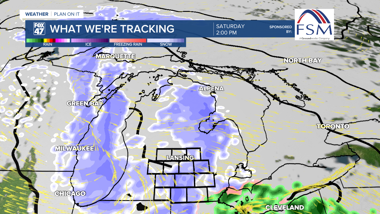
Remnant snow showers continue across our neighborhoods during the fist half of the day Sunday as the system exits our neighborhoods. We could see up to 3" across some of our neighborhoods for this event Saturday and Sunday. Below you can find what we can expect for snow totals.

A brand new week brings warming temperatures again. Expect above freezing highs Monday and Tuesday with chances for rain and snow returning Tuesday with favorable snow for the first half of the day Wednesday. Midweek will bring a cool down to our neighborhoods with highs back in the 20's by the time we reach Thursday.

Want more FOX 47 News? Here's how you download our Roku app
You can also see the latest news from across our mid-Michigan neighborhoods by liking us on Facebook or following us on X.
