
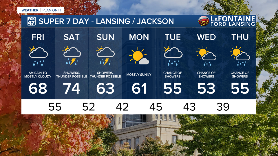
LANSING, Mich. — We are expecting a wet weekend ahead. Make sure you have an umbrella ready. We have seen some light rain moving through the state Friday morning. We have observed light rainfall in areas just north of our neighborhoods with no major impacts. We are starting the day with cloudy skies across our northern neighborhoods and some clear skies with increasing cloud cover in our southern neighborhoods through the morning.
We will stay dry following these morning showers with cloudy skies across our neighborhoods. Winds turning out of the south will aid in temperatures warming today as well as this weekend. High temperatures today will reach the upper 60's.

WATCH THE FULL FORECAST BELOW
As we head into Saturday, we will start the day dry with the trough pattern starting its trek across the state. Ahead of an incoming cold front, we will see showers and possible storms develop any time after 12 PM and lasting through the early evening hours. We could damaging winds gusts, isolated, up to 40 mph and heavy rainfall rates. We are not expecting any severe weather, but make sure to stay weather aware.
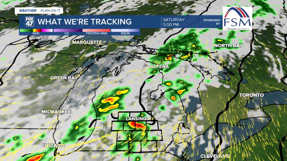
Heading into the overnight hours, more steady rainfall is expected as the center of low pressure tracks northeast right through our neighborhoods. All of the steady and heavy rainfall rates are aided from the moisture that will move into our neighborhoods with these southern winds. This moisture is not too common in our neighborhoods during this time of year. These steady, widespread, showers will last through Sunday morning with renewed shower potential during the daytime hours Sunday as well.
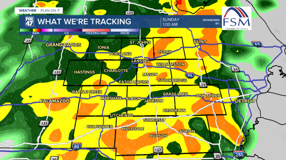
Once all is said and done we could see rainfall totals up to 2" across our neighborhoods. Impacts we could see include ponding on local roadways. However, with river levels low due to how dry we have been, river flooding is not expected. We could, however, see some sites reach action stage. This rainfall will be helpful given the majority of southern Michigan ranges from Abnormally Dry to a state of Moderate Drought from the U.S. Drought Monitor.

Once the cold front advances through, we will see renewed shower potential through the daytime hours Sunday with winds, strong, out of the northwest. We could see gusts exceed 40 mph into the afternoon hours.

Monday brings a break from precipitation with mostly sunny skies and highs in the lower 60's. Midweek temperatures will drop into the mid 50's with overnight lows in the lower 40 and upper 30's by Wednesday night. We also have renewed potential for showers during this period as well. It is too early to talk details, but we will watch closely.
Want more FOX 47 News? Here's how you download our Roku app
You can also see the latest news from across our mid-Michigan neighborhoods by liking us on Facebook or following us on X.
