
LANSING, Mich. — We're starting a brand new week watching the Radar as a round of winter weather heads southeast towards our neighborhoods. Southern Michigan, however, is lacking moisture in the environment this morning making all of this incoming winter weather a struggle to reach the surface.
With winds out of the south, we are also tracking for possible mixed precipitation this morning associated with this round. Again, we are looking to stay dry this morning, but if we are able to see any of this winter precipitation reach the surface, we could run into some isolated slick spots.
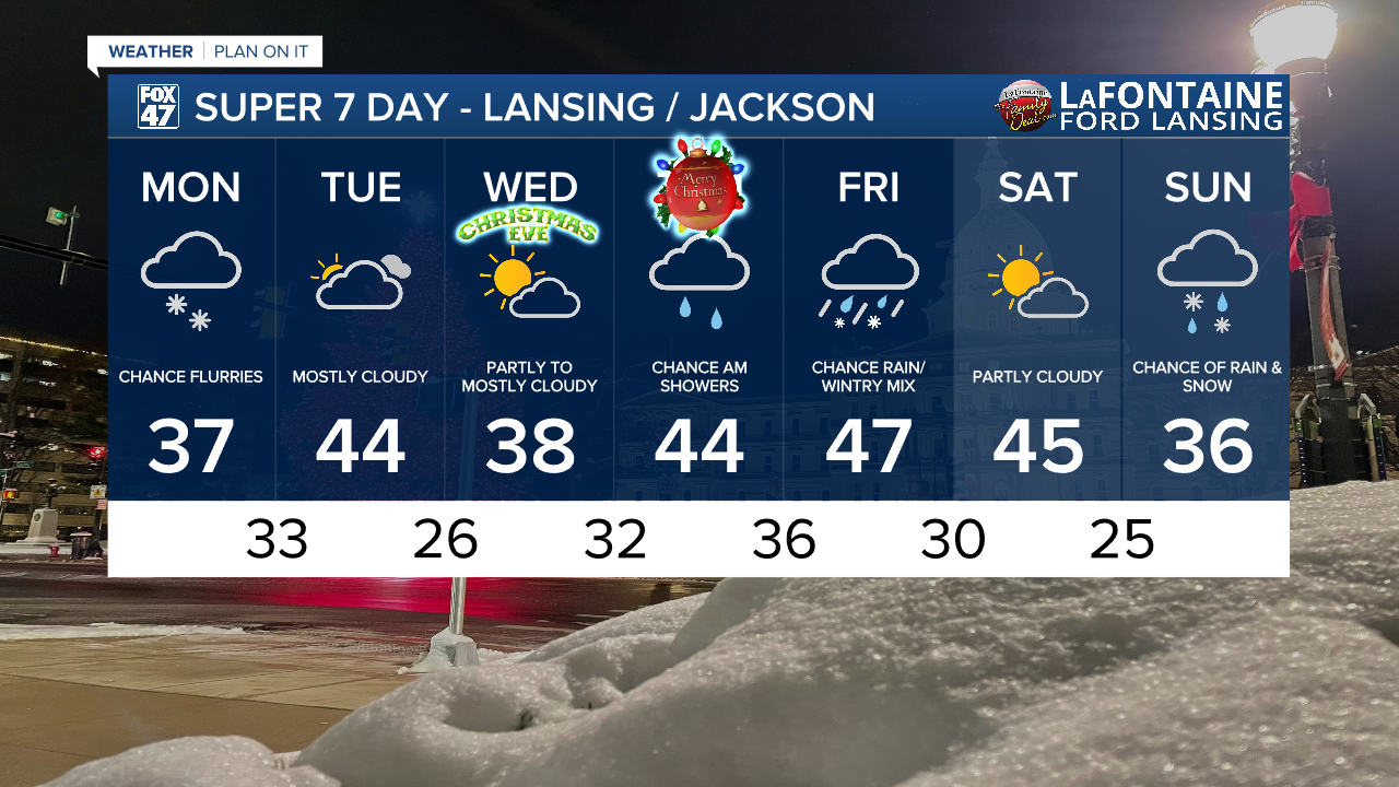
High temperatures today will warm into the upper 30's as we dry up for the afternoon hours. We will be left with cloudy skies for the entire afternoon period into this evening.

WATCH THE FULL FORECAST BELOW
Another system approaches our neighborhoods out of the east ,tracking northeast which will aid in the continued warm up in our neighborhoods paired with some possible mixed precipitation in the form of freezing rain from late Monday evening through Tuesday morning. Some slick spots could be possible when heading out on the roads Tuesday morning.

We will dry up for the remainder of the day Tuesday with strong winds out of the west allowing for feels like temperatures to drop into the lower 30's/upper 20's. This is much cooler than air temperatures that are expected to warm into the mid 40's Tuesday. Gusts Tuesday afternoon could reach up to 25 mph.

Inching closer to the holidays, Christmas Eve brings dry conditions with partly to mostly cloudy skies and temperatures cooling back into the upper 30's.
Christmas Day could see some rain showers in our southern neighborhoods during the morning hours. No major impacts are expected. However, late Thursday night, we will be tracking our next uniform area of showers that could bring some rain as well as wintry mix to our neighborhoods with temperatures continuing in the 40's. There are still a lot of unknowns to Friday's forecast and we will keep you updated as we progress through the holiday week.
Want more FOX 47 News? Here's how you download our Roku app
You can also see the latest news from across our mid-Michigan neighborhoods by liking us on Facebook or following us on X.
