

Snow Showers and Strong Winds on Friday
A high wind warming remains in effect until 8:00 p.m. Winds gusting up to 60mph could cause tree branches and even trees to come down, as well as power outages.
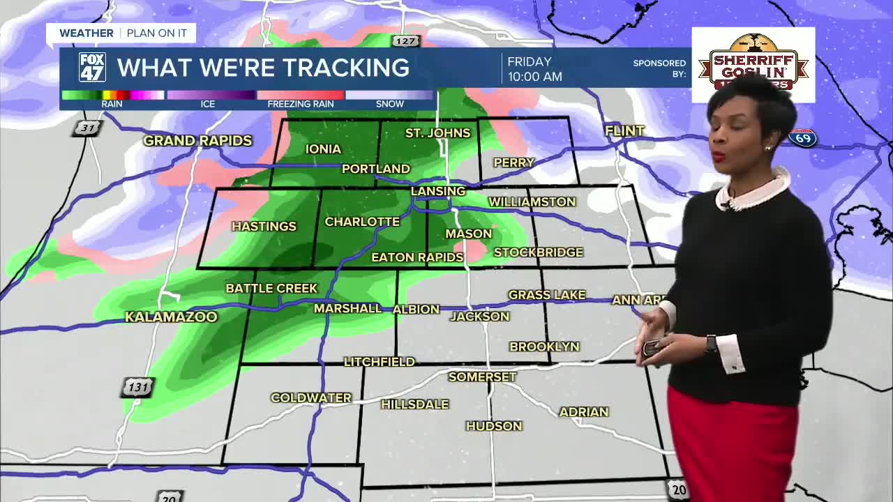
Because this system could bring a messy mix of snow, freezing rain, and rain, especially during the Friday morning commute, use caution out on the roads. The most widespread snow showers are tracking from 7-9 A.M., but several additional rounds of light snow showers will move across our neighborhoods until we dry out about 8:00 p.m.
Snow and Thunderstorms for The Weekend Ahead
The active weather pattern continues through the weekend.
We are tracking a low that is expected to bring snow showers Saturday night through early Sunday. However, Sunday evening thunderstorms start to move across our neighborhoods, which could become severe.
Temperatures will remain near 40 on Saturday, but soar to a high of near 60 on Sunday.
Colder Air Returns Early Next Week
By Monday, temperatures drop significantly, with highs falling to the low 40s. Expect snow showers on Monday.
Conditions should begin to dry out by Tuesday, bringing a break from several days of mixed precipitation. But temperatures drop further, reaching the upper 20s.
Want more FOX 47 News? Here's how you download our Roku app
Want more FOX 47 News? Here's how you download our Roku app
You can also see the latest news from across our mid-Michigan neighborhoods by liking us on Facebook or following us on X.
