
LANSING, Mich. — We are tracking showers in the form of rain across our neighborhoods Thursday morning ahead of an incoming cold front. Temperatures this morning remain well above average in the 50's as showers remaining non-impactful. The warmer air comes from a warm front that advances through our neighborhoods on Wednesday. Make sure to grab the umbrella when heading out the door this morning

WATCH THE FULL FORECAST BELOW
We will continue to see showers through the late morning hours mainly focused in our southern neighborhoods as all neighborhoods dry out this afternoon around lunchtime. The cold front is expected to advance through our neighborhoods in the early afternoon hours, switching wind direction out of the west. This means temperatures won't be too impacted and highs should still be able to reach the mid 60's today across our neighborhoods during the afternoon.
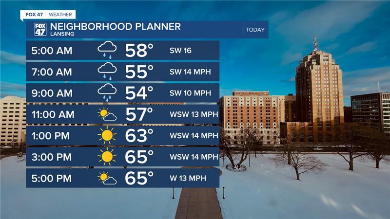
Winds will gradually weaken this morning with gusts still up to 35 mph possible while we track showers. Once the cold front passes through, winds will calm and become less of a problem for both Friday and Saturday.
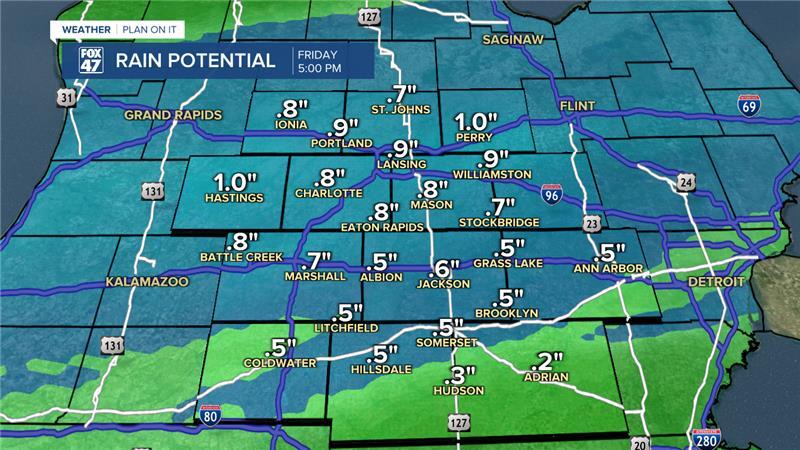
However, the umbrella will still be needed as another sandwiched between two areas of high pressure will keep a stalled out front along the Michigan/Indiana/Ohio border Thursday evening allowing showers to return for southern neighborhoods as early as 10 PM. Showers increase past midnight tonight and become widespread during the Friday morning hours.

These showers carry heavier rainfall rates and larger rainfall accumulation. We could see up to an inch of rainfall Friday morning across our neighborhoods with flooding concerns remaining low. Make sure to stay weather aware when on the roads Friday morning with heavier rainfall rates. This second round of showers will also move out around lunchtime with dry conditions for the second part of the day.
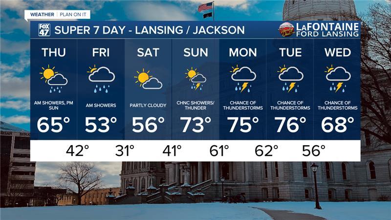
Saturday remains dry as temperatures cool into the 50's both Friday and Saturday. A sharp warm up is on the way beginning Sunday with highs in the 70's and chances for showers returning. Sunday doesn't look to bring impactful weather to our neighborhoods, but as we continue into the week, thunderstorm chances return as we stick with highs in the 70's or close to the 70's. We will be monitoring closely.
Have a great weather picture or video to share? Send it our way and we may feature it on-air or online!

