
LANSING, Mich. — We are starting our Tuesday with calm winds and clear skies due to surface high pressure centered over the state of Michigan. Clouds act as a blanket to help keep temperatures warm, but with no clouds and no winds, temperatures are able to rapidly fall across our neighborhoods with air temps in the lower 20's/upper teens possible. No major travel impacts are expected Tuesday morning, but make sure to grab that jacket when heading out the door.
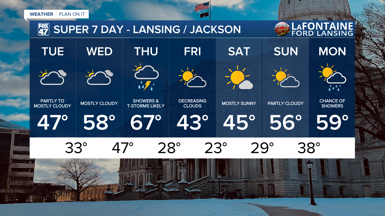
Temperatures during the day will warm back to normal in the upper 40's with mostly cloudy skies continuing through the day.

WATCH THE FULL FORECAST BELOW
Winds today are much weaker compared to yesterday with gusts ranging from 15-20 mph. We could still see some impacts to our feels like temperatures through the early afternoon hours with improvements during the mid to late afternoon hours.

Winds out of the south continue into Wednesday where highs will warm into the upper 50's with mostly cloudy skies. Our next system arrives Thursday as a highs warm into the mid to upper 60's ahead of an incoming cold front that could produce some strong to severe thunderstorms.

The Storm Prediction Center has issued a marginal risk for isolated severe storms across all of our neighborhoods Thursday PM with a slight risk for scattered severe storms issued for southern Hillsdale County. At the moment, severe impacts are primarily focused on damaging wind gusts, but we can't eliminate the chance to see some hail and even an isolated tornado. Threat begins around 4 PM Thursday and continues through around midnight.

Following Thursday's storm potential, we will observed cooling temperatures back into the 40's with multiple chances to see some sunshine through the weekend. Temperatures will gradually warm back to the upper 50's by the time we start next week with a chance for some tame showers.
Want more FOX 47 News? Here's how you download our Roku app
You can also see the latest news from across our mid-Michigan neighborhoods by liking us on Facebook or following us on X.
