
LANSING, Mich. — A cold front sweeping south across the state will push more showers and thunderstorms into our neighborhoods this evening. Severe weather remains possible, but the threat has scaled down a bit for our northern communities around the Capital Region. Damaging winds and large hail are still the main concerns, with a low risk for isolated tornadoes south of I-94.
Storms will taper off after 10:00 PM, leaving mostly cloudy skies overnight. Temperatures will take a steep dives as the cold front moves south of us, leading to lows in the middle and upper 30s by daybreak. With WNW winds remaining in place at 10-25 mph, wind chills will fall closer to the upper 20s on your way out the door.
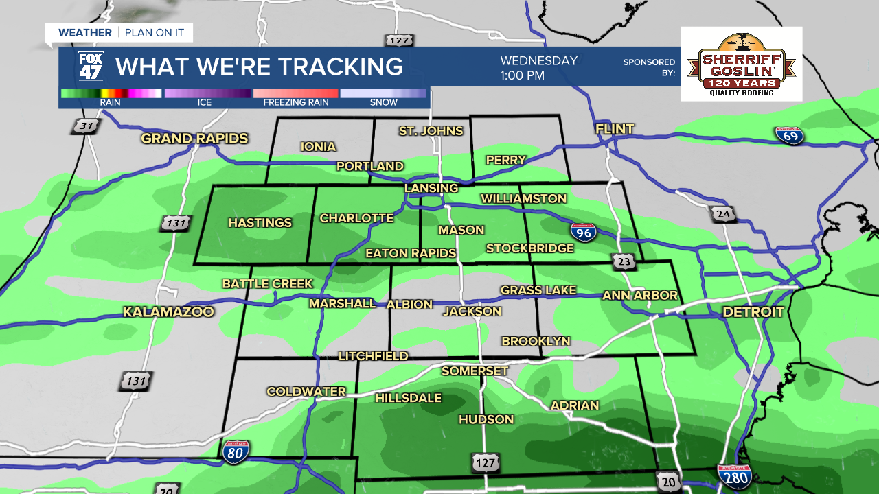
The chilly air will stay locked in for Wednesday, limiting highs to the low and mid 40s. With the cold front expected to stall across northern Indiana and Ohio, additional showers will be possible for neighborhoods like Jackson, and south of I-94. Mostly cloudy skies are expected outside of any wet weather, with the possibility for a few sunny breaks from time to time.
GET YOUR FOX 47 FORECAST HERE
Showers will become more widespread on Wednesday night as the front begins to track north again, and moves across lower Michigan. Temperatures will fall to the mid 30s, which could leave us open to the possibility of freezing rain before daybreak Thursday. Latest forecasts have appeared to trend away from this, but it's still likely to be a close call. Be prepared for potential icy spots early Thursday.
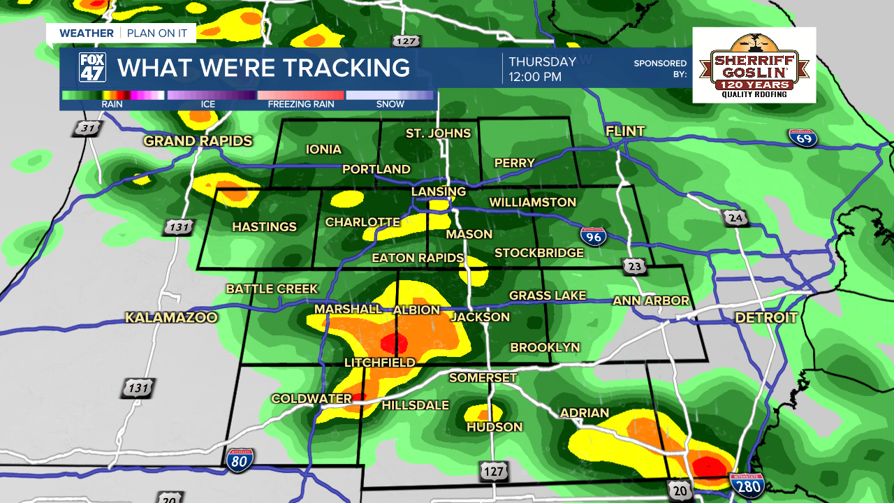
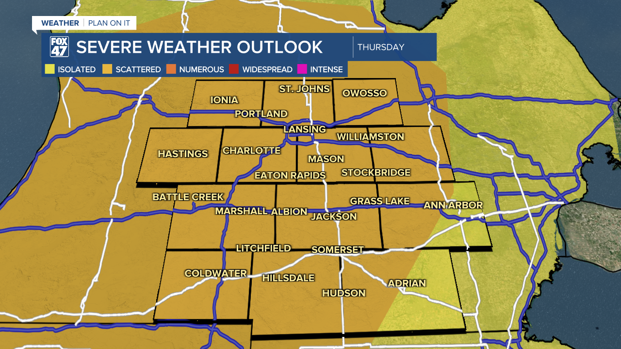
Renewed thunderstorm potential returns Thursday as we warm back into the upper 60's and possibly reach the lower 70's. The Storm Prediction Center has issued a slight risk for scattered severe storms across all of our neighborhoods for Thursday afternoon and evening. Impacts including damaging winds and a tornado or two exist as another system advances through our neighborhoods.
Another round of showers and rumbles of thunder exist Friday with thunderstorm potential back on Saturday with temperatures continuing in the upper 60's. We finally see a change for the Easter holiday with highs dropping to the upper 40's with a chance for rain and snow showers.

Have a great weather picture or video to share? Send it our way and we may feature it on-air or online!

