
LANSING, Mich. — Dense fog remains possible this morning as we are still holding onto the influence of low level moisture. Limited visibility is expected across all of our neighborhoods through the morning hours with a gradual improvements as the daytime hours progress. Lingering fog into the afternoon should not remain much of a problem as it did Tuesday now that the shortwave has exited the region.
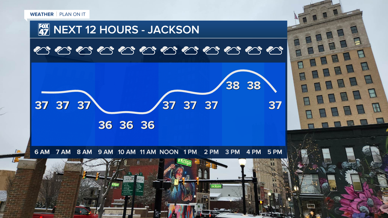
Showers have also ended today with cloudy skies remaining for the majority of the daytime hours. Temperature trends will be similar to Tuesday with highs ranging in the upper 30's and possibly reaching lower 40's. We will continue this warm up as we head into the back half of the work week.
WATCH THE FULL FORECAST BELOW
Surface ridging today gives us the influence of high pressure keeping us dry Wednesday across our neighborhoods. However, this pattern won't last long as decreasing clouds this afternoon into evening will allow for a partly cloudy overnight period. Once we reach the daytime hours Thursday, cloud cover will quickly spread over the area ahead of another low bringing warmth and moisture back to our neighborhoods.
Temperatures Thursday are expected to soar into the mid to upper 40's with some neighborhoods possibly tapping into the 50's. This will occur late in the day Thursday as the next low arrives during the evening hours and brings showers into the overnight hours Friday into Saturday.

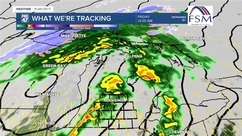
These showers are expected to begin as early as 5 PM Thursday and last through 8 AM Friday. These showers will arrive in a few rounds during this period with more steady rain tracking further north where the center of low pressure is tracking as it heads northeast.
We could see around .5" of rainfall across most of our neighborhoods with some localized areas possibly seeing up to .75". At the moment, no major flooding concerns are expected.
We will continue to monitor returning rainfall closely.
Another low arrives in our neighborhoods Saturday bringing chances for rain and snow with some discrepancies still on the track of the system. Once this system moves through, we could expect some remnant lake effect snow showers into Sunday. It is still a bit too early to talk snowfall accumulations, but we will keep monitoring closely.
Temperatures are expected to exceed 50 degrees on Friday and begin falling this weekend. We will see temps around normal Sunday with highs nearing freezing. A new week brings another gradual warm up in temperatures.

Want more FOX 47 News? Here's how you download our Roku app
You can also see the latest news from across our mid-Michigan neighborhoods by liking us on Facebook or following us on X.
