
LANSING, Mich. — Our neighborhoods and much of southern lower Michigan has been dealing with well above average temperatures and dry conditions. A majority of our neighborhoods are in a state of Moderate Drought according to the U.S. Drought Monitor.
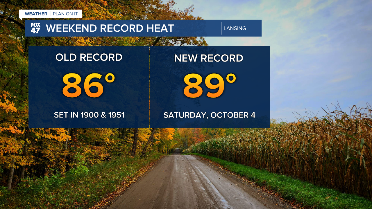
These conditions were felt over the weekend as Lansing broke records for high temperatures. A new record high was observed Saturday, October 4th. Temps warmed to 89 degrees, beating the existing record of 86 degrees set in both 1951 and 1900.
WATCH THE FULL FORECAST BELOW
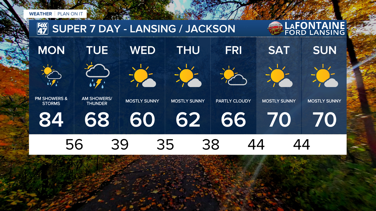
Moving into a new week, a pattern change brings much needed rainfall back to our neighborhoods with cooling temperatures expected by the time we reach midweek. High temperatures today are still expecting to reach the mid to lower 80's with mostly sunny skies. However, once the sun sets, we will be tracking the return of showers affiliated with the incoming cold front.
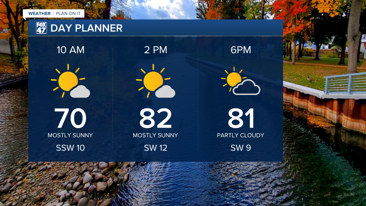
Cloud cover is expected to start increasing by the late afternoon hours. Showers and tame thunderstorms could arrive as early as 8 PM this evening. Main impacts we could see are heavy rainfall rates and gusty winds up to 30 mph. The best time to see these impacts will be at any time after 8 PM and into the overnight hours, coming to an end by the time we reach mid morning hours Tuesday. We could see some of these impacts for Tuesday's morning commute.
Make sure you have the umbrella packed and ready with rainfall totals possibly from .25" to .75".


Once we reach Tuesday afternoon, clouds will clear up with winds turning out of the north. This will aid in cooling our temperatures for the remainder of the work week. Overnight lows will range in the mid to upper 30's. With clear skies and calm winds we could see frost development for the morning hours. This would be in line with our average first freezing in our neighborhoods which usually occurs in early October. We will stay dry through the rest of the work week and through the weekend with daytime highs warming to the lower 70's.
Want more FOX 47 News? Here's how you download our Roku app
You can also see the latest news from across our mid-Michigan neighborhoods by liking us on Facebook or following us on X.
