
LANSING, Mich. — A Dense Fog Advisory is currently in effect Wednesday morning for Hillsdale County with visibility dropped to less than a quarter of a mile possible. This advisory is set to expire at 10 AM Wednesday morning. We could see reduced visibility due to fog formation across all of our neighborhoods this morning. Stay weather aware when heading out the door.

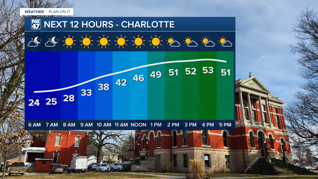
Temperatures today will continue to warm with highs expected to reach the lower 50's across our neighborhoods. This warm up will also see some help from returning sunshine during the late morning into mid afternoon hours. Cloud cover will increase ahead of a few possible showers Wednesday night.
WATCH THE FULL FORECAST BELOW
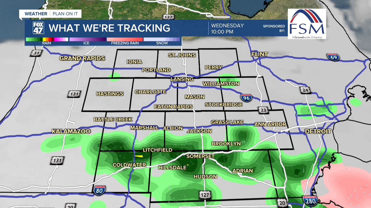
Light rain could start as early as 5 PM Wednesday evening in our most southern neighborhoods as cloud cover this afternoon increases from the south and filters in across all neighborhoods. We will continue to see showers fill into our neighborhoods tonight, coming to an end past midnight. No major impacts are expected as we don't have much instability to work with.
Ample moisture returns Thursday as widespread rain showers are expected beginning in the early afternoon hours Thursday and running through around midnight. Steadier rainfall rates are possible so make sure to bring the umbrella when heading out the door. Rainfall totals with Thursday's event range from .5 - .75". Flooding concerns are not expected to be an issue.

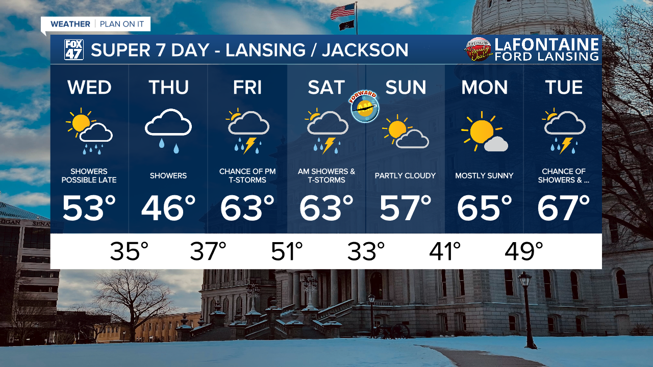
We have much better chances to see thunderstorms to close our week Friday night and into the AM hours Saturday as instability builds ahead of an incoming cold front. Storms Friday night are more focused in our most northern neighborhoods like Lansing and St. Johns while all neighborhoods have a chance to see thunderstorm impacts with storms ahead of the frontal passage.
The Storm Prediction Center has all of our neighborhoods under a Marginal risk for severe weather Friday into Saturday morning with possible impacts including hail, severe wind gusts, and an isolated Tornado. However, with continued loss of instability in the overnight hours, storm potential could really drop. It really depends on timing which we will continue to iron out as we progress through the week.
Temperatures are expected to reach the 60's beginning Friday and stay mild with more 60 degree days to start the new week Monday and Tuesday.
Want more FOX 47 News? Here's how you download our Roku app
You can also see the latest news from across our mid-Michigan neighborhoods by liking us on Facebook or following us on X.
