
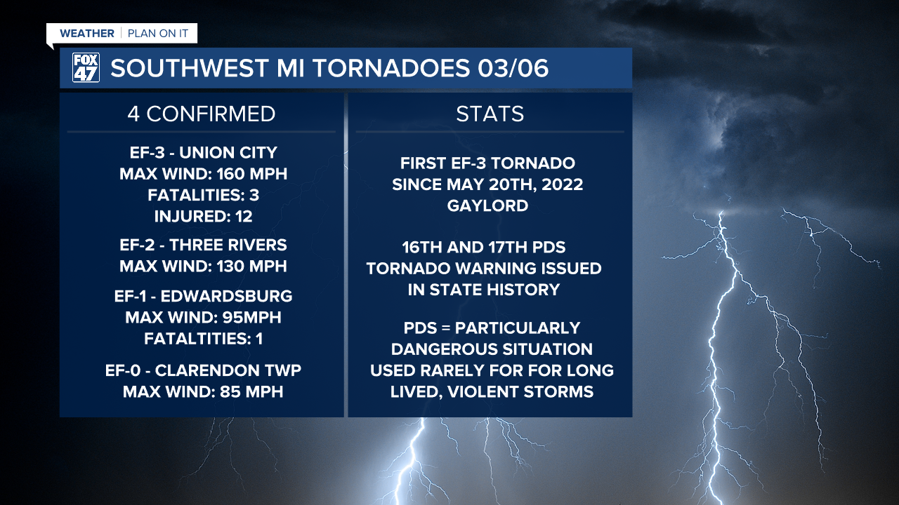
LANSING, Mich. — Friday brought severe storms and 4 confirmed tornadoes to southwest Michigan. St. Joseph, Cass, Branch, and Calhoun counties were all impacted with a total of 4 fatalities and 12 injuries from the event. You can see more information on these tornadoes below.
WATCH THE FULL FORECAST BELOW
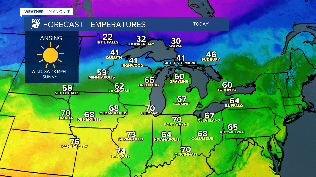
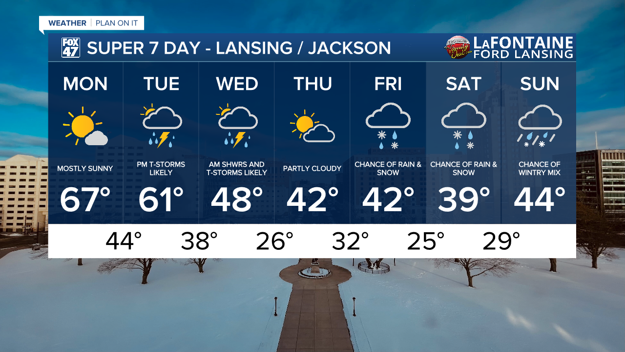
We will keep on with stronger winds today out of the southwest with gusts up to 30 mph during the daytime hours. We will still feel warm, however. Today marks the best day of the week to get outside to either walk the dog or do any other outdoor activities.
As we head into the overnight hours, we will see cloud cover increase with a few isolated rain showers possible as a warm front advances through the area. These rain showers, if we do see any, won't bring any major impacts to our neighborhoods during the overnight hours as well as for the morning commute.
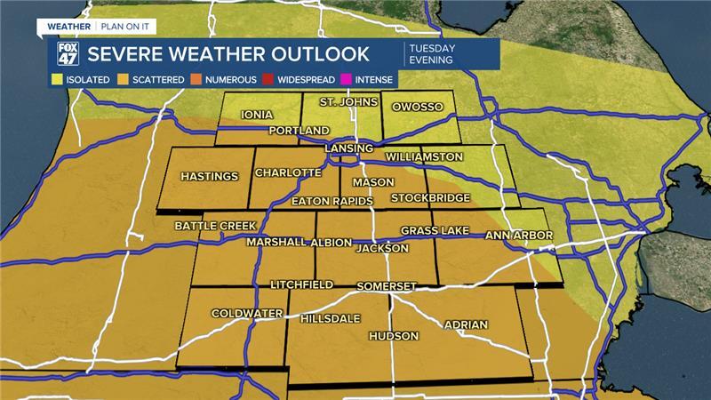
We will be turning our attention to the evening hours as thunderstorms begins to setup between the 5PM to 8 PM hours with storms continuing through the evening and overnight into Wednesday morning.
Severe storms are possible with all impacts on the table for Tuesday evening. Heavy rainfall and hail are possible as we continue with storms into Wednesday morning with travel impacts possible due to flood concerns.
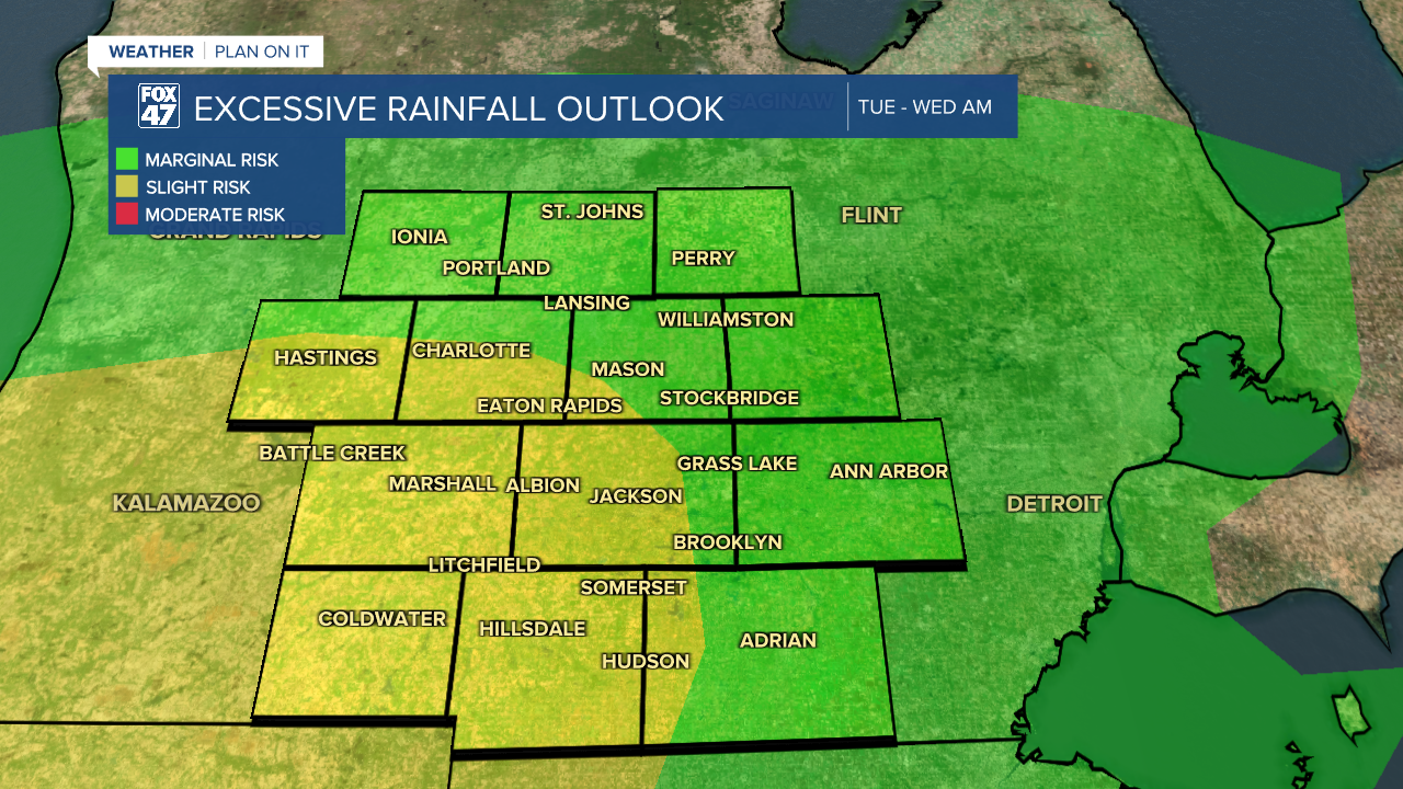
The Excessive Rainfall Outlook has portions of Jackson, Eaton, and Hillsdale counties under a slight risk for excessive rainfall. The rest of our neighborhoods fall under a marginal risk. This is from Tuesday evening through Wednesday morning. Heavy precipitation rates could allow for flash flooding in urban areas, especially in areas with poor drainage.
Remember to turn around, don't drown if you are heading out the door Wednesday morning as we continue to track showers and storms.
Temperatures will gradually fall through the rest of the week with highs in the 40's and overnight lows cooling back around and below freezing. This will allow for some winter weather to return to our neighborhoods beginning Friday. It is too early to talk potential accumulations of snow, but impacts are possible. We are watching closely.
Want more FOX 47 News? Here's how you download our Roku app
You can also see the latest news from across our mid-Michigan neighborhoods by liking us on Facebook or following us on X.
