
LANSING, Mich. — The weekend brought lots of sunshine and temperatures that were feeling a lot more like spring than late winter. We will continue with winds out of the south today aiding in warming temperatures back into the mid to lower 50's. This is well above average for this time of year. Sunshine will still be favored during the afternoon hours.

WATCH THE FULL FORECAST BELOW
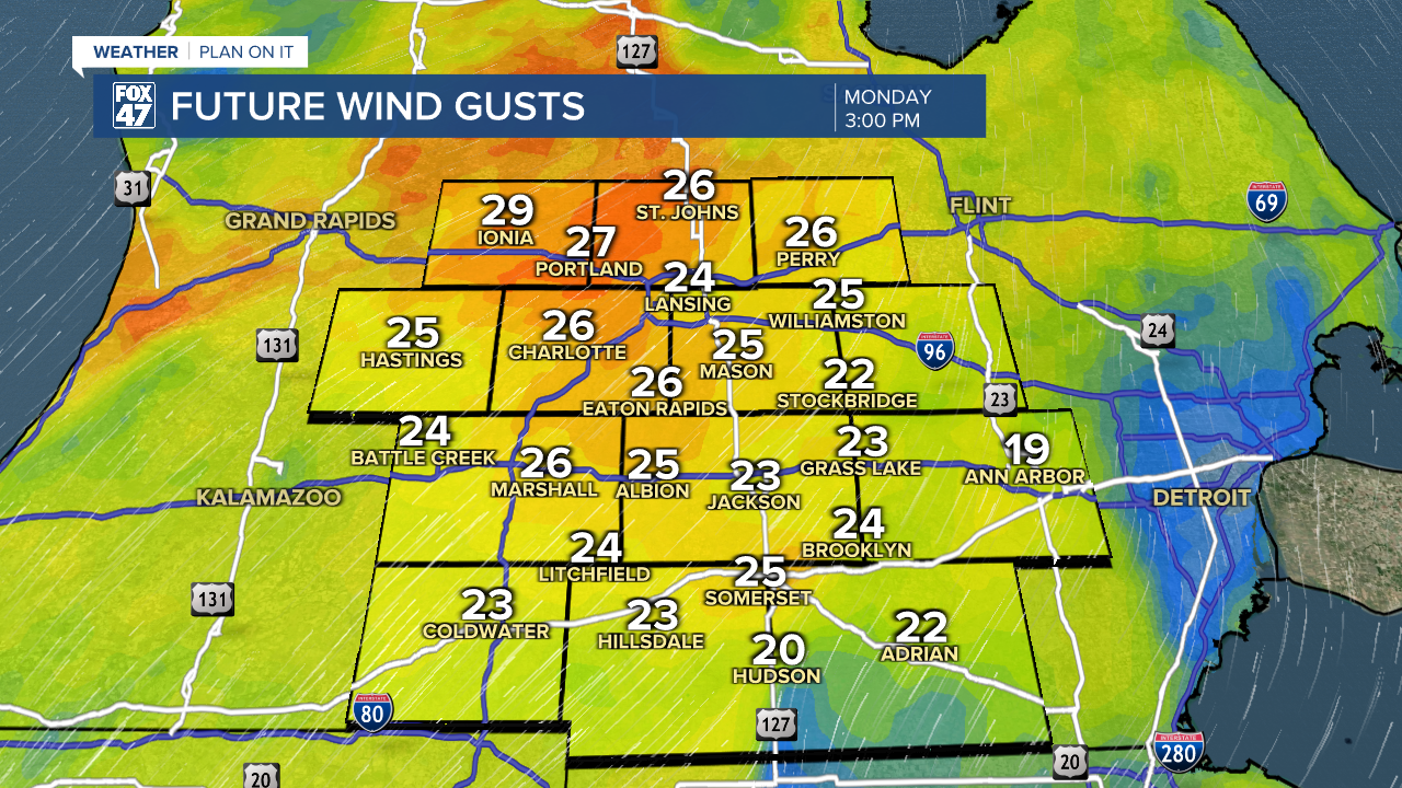
Winds will strengthen this afternoon ahead of an incoming cold front affiliated with a passing clipper system further north of the state. We could see wind gusts up to 30 mph. We will still feel warm, however, with sunshine still expected throughout the afternoon hours.
The same cold front that will sweep through could produce some light rain as it advances through our neighborhoods this afternoon and into this evening. No major impacts are expected. Cloud cover will increase overnight tonight as the frontal passage stall out right at the Michigan/Indiana/Ohio border. This could renew light drizzle across our neighborhoods overnight tonight. Fog is also expected to develop overnight with present moisture. Tuesday brings mostly cloudy skies ahead of our next system which will bring precipitation back to our neighborhoods.

An area of low pressure tracking east will bring uniform precipitation back to our neighborhoods beginning overnight Tuesday and into Wednesday morning. At the moment, our neighborhoods will still be placed in the warmer sector of this system favoring rain showers as our main precipitation type. Areas to the north of us could see mixed precipitation and snow. These showers will continue through the first half of the day Wednesday with drying conditions into Wednesday afternoon with some potential clearing. If we see any redevelopment of showers in afternoon hours Wednesday, with building instability, we could see a tame thunderstorm. However, impacts remain low for Wednesday's round of showers.

We will watch the midweek system closely as there still remain a chance that we could see a shift in where the center of low pressure will track separating what kind of precipitation we could see in Michigan.
We will take a break from showers Thursday during the day with another system expected to impact our neighborhoods beginning overnight Thursday and taking us into the weekend where cooler air will return to our neighborhood with temps back to freezing by Sunday for daytime highs and chances to see lake effect snowfall.

Want more FOX 47 News? Here's how you download our Roku app
You can also see the latest news from across our mid-Michigan neighborhoods by liking us on Facebook or following us on X.
