
LANSING, Mich. — Fog starts our Thursday across southern neighborhoods where surface moisture remains present along and just south of the frontal passage. Visibility has dropped below a mile in Hillsdale County and we could continue to see this through the morning hours. The fog should lift once the sun rises. Stay weather aware when heading out on the roads in Hillsdale this morning.
High temperatures today are expected to reach the upper 70's and possibly the lower 80's across our neighborhoods. Wednesday saw temperatures in the upper 70's for most of our neighborhoods with 79 degrees observed in Jackson. We can still expect a lot of sunshine, however an isolated thunderstorm is not out of the question.

WATCH THE FULL FORECAST BELOW
The same stalled out frontal passage that aided in showers and storms Wednesday across southern neighborhoods is expected to lift north again bringing warm moist air back to our northern neighborhoods that remain dry this morning. As moisture returns, instability will also remain present. This will setup an environment prone to producing an isolated shower or thunderstorm. If we do see anything in our neighborhoods today, it will remain non severe with main impacts including strong winds up to 40 mph and heavy rainfall rates.
The shower and storm chance is dependent on the track and orientation of the warm front as is advances through. If northern neighborhoods remain north of the front, we could continue to see sunshine through the day. However, if the passing front advances through all of our neighborhoods, more cloud cover is expected during the afternoon hours mixed with some sunshine.

Overnight hours will remain mild in the mid 50's. We will start Friday with returning showers staying tame around 8 AM. These scattered showers won't bring much in the way of impacts, but make sure to bring the umbrella when heading out the door. The first round of showers should come to an end around 2 PM Friday.
Another round of showers and storms is expected to advance through from around 4 PM to 8 PM Friday. These storms could become stronger out ahead of the incoming cold front.
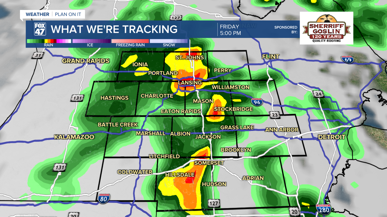
A marginal risk for isolated severe thunderstorms has been issued by the Storm Prediction Center for Friday and includes the far southeastern corner of Hillsdale County with possible impacts including strong winds up to 60 mph, heavy rainfall rates, and quarter sized hail. This severe threat remains far south in the state of Michigan. We will be watching closely for any changes.

High temperatures Friday should still reach the mid 70's across our neighborhoods ahead of the cold front. However, heading into the weekend, temperatures will drop into the mid 60's. This is right around where temps should be for this time of year. Expect cloud cover Saturday with a better chance at some sunshine on Sunday.
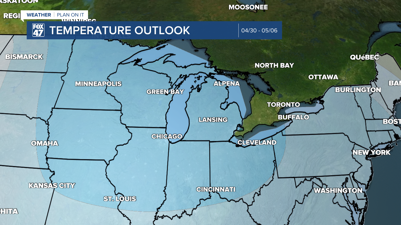
Enjoy the heat and near normal temperatures while they are here because looking ahead at the temperature outlook from the Climate Prediction Center, we could be starting May with below average temperatures. This goes for the entire region.
Heading into next week, showers and storms are expected Monday with some tame remnant showers possible into Tuesday morning. We dry up Wednesday with temperatures gradually cooling and staying near normal in the mid to lower 60's.

Have a great weather picture or video to share? Send it our way and we may feature it on-air or online!

