
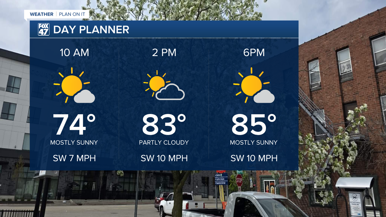
LANSING, Mich. — All of our area was able to warm into the 80's on Wednesday with lots of sunshine and today will be no exception. With winds out of the southwest, high temperatures should reach the mid 80's across Mid-Michigan. We will see an abundance of sunshine today with a few afternoon clouds.
Due to the southwesterly flow, moisture influence will return to the area today making some areas feel a bit muggy in the late afternoon hours. We will see more hot and humid conditions as we continue through the 7-Day period.
WATCH THE FULL FORECAST BELOW
Showers and storms return Friday evening to Mid-Michigan ahead of an incoming cold front. We will start Friday with sunshine with increasing cloud cover as the day goes on with showers beginning as early as 3 PM with storms developing more in the evening hours after 6 PM.

Storms after 6 PM Friday could produce isolated severe impacts such as large hail up to an inch in diameter and some heavy rainfall rates that could lead to some localized ponding. The cold front will continue to advance south through Michigan with heavier rainfall rates possible overnight Friday into Saturday morning.

We are still ironing out the severe threat for Saturday, but the Storm Prediction Center has issued another marginal risk for isolated severe storms across our entire area Saturday for PM storms that could produce strong to damaging winds and large hail. This is due to continued moisture being brought in from a low level jet. We will have to watch the timing and track of the cold front for timing and potential changes for Saturday's threat. Make sure to have a way to get alerts heading into the weekend and dust off that umbrella.

We dry up Sunday with partly cloudy skies with more sunshine to start the week. Temperatures over the weekend will drop to the lower 80's, but humidity will still be present, making the outdoors feel uncomfortable.

A gradual warm up is expected into next week with highs reaching the upper 80's Tuesday and Wednesday with potential for showers and storms to develop. We will be watching this forecast closely as we could run into the some dangerous heat.
Overnight lows beginning tonight will be well above average in the mid 60's. We could potentially see lows in the 60's through the rest of the 7-Day. It is best to now shut the windows during the overnight hours because of these trends following the nice stretch of cooler nights.

Have a great weather picture or video to share? Send it our way and we may feature it on-air or online!

