
LANSING, Mich. — Temperatures are expected to reach the 80's again Friday across Mid-Michigan ahead of an incoming cold front which will bring showers and storms back to the area. We will start Friday with partly cloudy skies as temperatures gradually warm into the mid 80's by the early afternoon hours.
Around 4 PM, showers and storms will arrive in the area ahead of the cold front.

WATCH THE FULL FORECAST BELOW
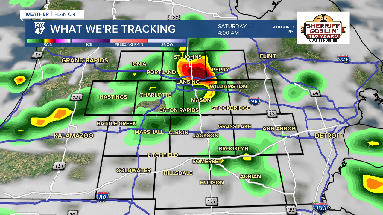
The cold front is expected to stall out to the west which will allow for upper level disturbances to continue to pass through the area during the overnight hours, continuing showers and storms overnight and into the first half of the day Saturday.
We are lacking ample instability this afternoon and evening meaning the severe threat with storms Friday have decreased with heavy rainfall rates left as the only impact with developing storms as well as strong winds.
The cold front should advance through the area during the day Saturday. This will allow for some possible redevelopment of showers and storms Saturday afternoon and evening with better instability expected.

Saturday shows some potential signs for severe impacts with storm redevelopment. The Storm Prediction Center continues the marginal risk for isolated severe thunderstorms across all of our area with damaging wind gusts, heavy rainfall rates, and possible hail as main impacts. We could see t-storm redevelopment during the mid-afternoon hours and into the evening hours Saturday. Make sure to have a way to receive alerts.


Temperatures overnight remain warm in the mid 60's as we continue to see showers and storms roll through the area with ample moisture present. High temperatures will only reach the lower 80's Saturday with a gradual warming trend into the new week. We will take a break Sunday with lots of sun to end the weekend.
A new week brings chances for showers and storms as well as hot and humid conditions. The heat could become dangerous as highs could potentially reach the 90's during the mid to late week period. Storms could also cause disruptions across the area next week and we will be monitoring closely.

Have a great weather picture or video to share? Send it our way and we may feature it on-air or online!

