
LANSING, Mich. — Following heavy rainfall in our neighborhoods Tuesday morning, conditions will become more tame as high pressure builds into the region. Below are some precipitation reports across our neighborhoods Tuesday.

WATCH THE FULL FORECAST BELOW
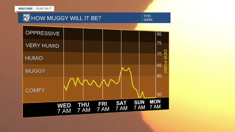
As the cold front and area of low pressure continue its easterly track away from the state, our neighborhoods will hang on to lingering cloud cover during the majority of the daytime hours today. We will be staying dry with dew points dropping to the upper 50's and lower 60's. This will allow for comfortable conditions when spending time outside today.
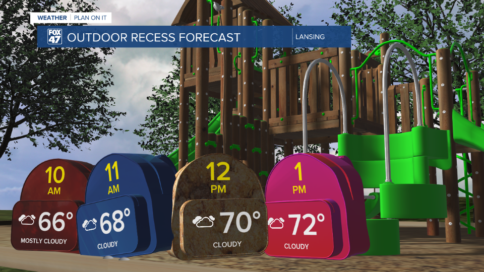
For those starting school today in Lansing, Jackson, Mason, and Holt, conditions will be good for outdoor play for recess as well as this afternoon after the bell rings for any extra curriculum's. Cloud cover will continue to linger as temps warm to the upper 70's.
This is a similar temperature trend to yesterday as winds out of the north today will keep our temps a bit below average.
As high pressure builds in, temps will return to the mid to lower 80's with mostly sunny skies. Clearing will begin as early as this evening in our northern neighborhoods.
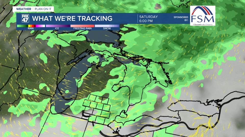
Our next best chance for showers returns Saturday as a cold front sweeps through the state. We could expect to see these showers develop late Friday night into the first half of Saturday with possibilities to see these showers and storms linger into the afternoon. At the moment, we are not tracking any severe impacts, but we could still see some gusty winds as the frontal passage advances through.
Beyond Saturday, we will have another chance for showers on Monday with a preview to fall expected with high temps possibly reaching the lower 70's with overnight lows in the lower 50's. This is well below average for this time of year.

Want more FOX 47 News? Here's how you download our Roku app
You can also see the latest news from across our mid-Michigan neighborhoods by liking us on Facebook or following us on X.
