
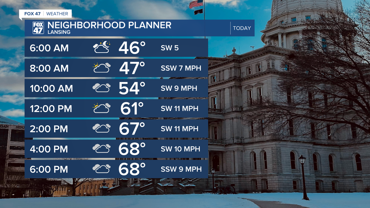
LANSING, Mich. — We should stay dry during most of the daytime hours to start our week Monday. Partly cloudy skies are expected during the first half of the day with increasing cloud cover into the afternoon with pop up showers and thunder possible anytime after 6 PM through 10 PM. This possible first initial round of showers shouldn't carry many impacts.
High temperatures today continue to climb above average reaching the upper 60's today with breezy conditions continuing today as well. We will observe max wind gusts around 11 AM this morning up to 25 mph. We will see this trend continue through around 3 PM today with returning stronger winds overnight tonight.
WATCH THE FULL FORECAST BELOW
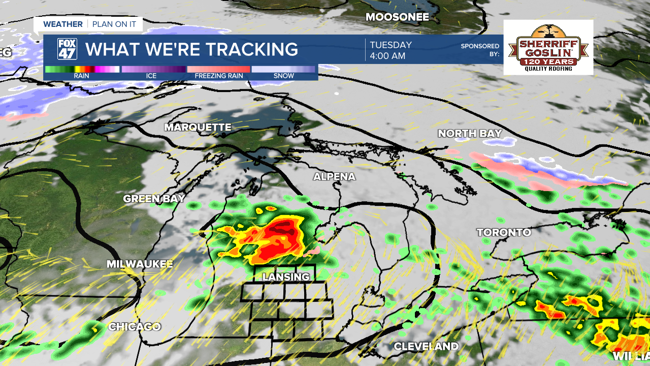
Storm potential begins overnight tonight as the frontal passage located north of our neighborhoods sags south ahead of incoming low pressure. This first round of storms will stay isolated and track through southern Michigan from around 2 AM to 5 AM Tuesday morning.
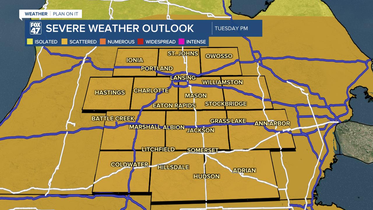
The Storm Prediction Center has issued a marginal risk for isolated severe storms during this overnight period across all of our neighborhoods.

At the moment, location of strongest storms looks to be oriented just north of Clinton County. We could still see some changes to this track as we continue throughout the day with main impacts including large hail and damaging winds. We will be monitoring closely.
Tuesday's severe impacts depend on how the environment responds to the first round of storms overnight tonight. If we continue to see shower and storm development into Tuesday morning and lasting into the afternoon hours with cloud cover, this will inhibit the redevelopment of stronger storms Tuesday afternoon and evening ahead of the incoming cold front. This is due to the loss of ample instability that will need to be regained.
If we can lose storm potential and some cloud cover during the first half of the day Tuesday, chance for stronger storms with severe impacts increases. We are watching the time frames of 6 PM Tuesday to around 12 AM Wednesday for all severe impacts possible including flooding concerns. The Storm Prediciton Center has issued a slight risk for scattered severe storms across all of our neighborhoods Tuesday afternoon into evening.
During the day Tuesday ahead of the second round of storms, we can expected temperatures to continue warming, possibly making it into the 70's with strong winds with gusts approaching 40 mph during the afternoon hours.

Chances for showers continue into Wednesday morning where temperatures drop and we track the chances for mixed precipitation, especially during the overnight hours where temperatures drop around and just above freezing. We will gradually warm again Friday and Saturday with temps into the 60's and chances for Thunderstorms Thursday and Saturday.

Have a great weather picture or video to share? Send it our way and we may feature it on-air or online!

