
LANSING, Mich. — As some step out the door and head to their first day of classes, temperatures will be feeling more like fall than late summer. Winds out of the northwest allows for cooler air to make its way into the state of Michigan. High temps today will struggle to reach 70 degrees as the high temp trend across our neighborhoods will be focused in the upper 60's.

WATCH THE FULL FORECAST BELOW
We also have a chance for some rain showers today as well as this cold air travels across the warm waters of Lake Michigan allowing for lake effect rain. These showers will stay tame as they move across our neighborhoods this afternoon as early as 12 PM through the early evening hours.

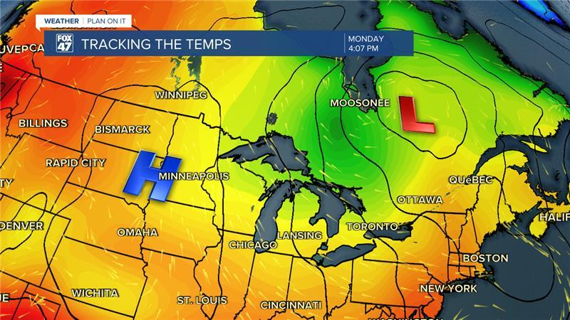
The setup we are looking at is an area of low pressure that drove showers and thunderstorms late last week is tracking east, further away from Michigan. Winds on the back end of this area of low pressure are oriented out of the north. Michigan is also ahead of an area of high pressure with winds also oriented out of the north. These northerly winds are bringing the premature fall conditions.
High pressure will continue to track east and push south of the state of Michigan with a brief warm up expected Wednesday into Thursday as incoming cold front and mid level trough will drive a possible round of thunderstorms. Following these showers, temps will fall yet again as winds shift back out of the north.
We'll begin to see temperatures warm again once we reach the weekend, staying dry, with partly cloudy skies both Saturday and Sunday with highs in the mid 70's and lows back into the 50's. For this time of year, we should be seeing high temps in the lower 80's/upper 70's.

Want more FOX 47 News? Here's how you download our Roku app
You can also see the latest news from across our mid-Michigan neighborhoods by liking us on Facebook or following us on X.
