


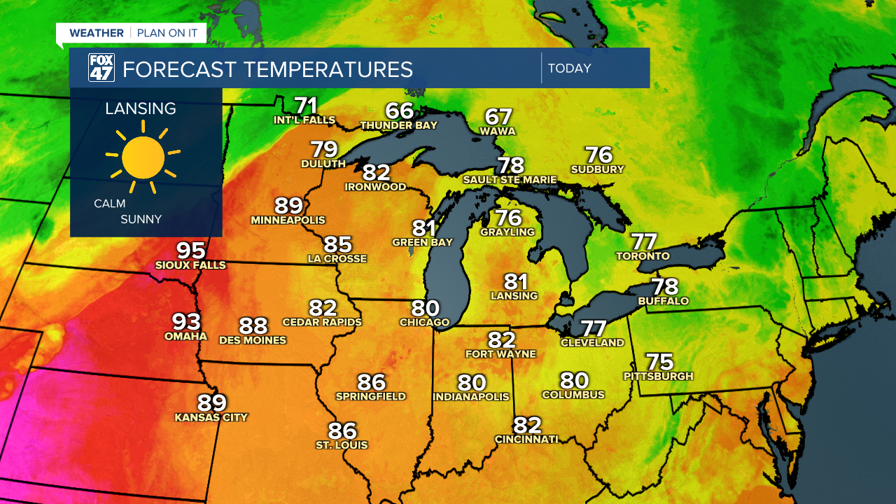
LANSING, Mich. — Following a cooler weekend filled with rain, we will be starting a new week across Mid-Michigan a tad bit warmer with lots of sun. High temperatures will reach the lower 80's today across the area which is right around where we should be for this time of year.
High pressure keeps us sunny today following showers and weak storms over the weekend. This trend will follow us into Election Day Tuesday as we begin to warm up. Today should be a great day to get outdoor work done or just spend some time outside.
WATCH THE FULL FORECAST BELOW
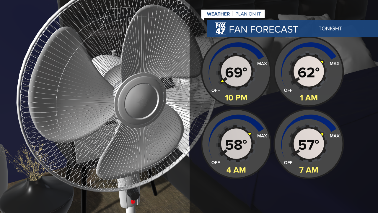
We will remain clear in the overnight hours tonight. Pair this with weak winds and we will see temperatures fall into the 50's similar to this morning. We should stay in the mid to upper 50's by early tomorrow morning, but this does give us another chance tonight to crack the window and start the fan. We will see warmer overnight lows beginning Tuesday night and remain warm through the remainder of the 7-Day.
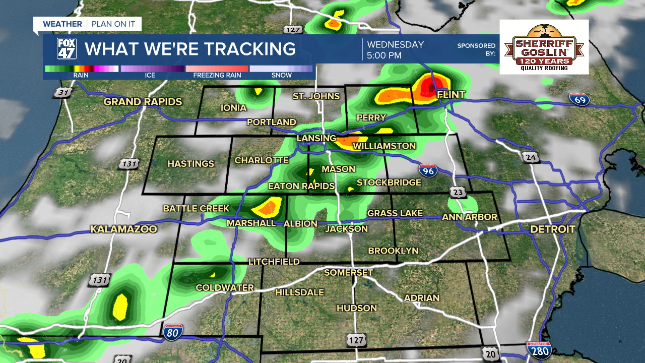
A cold frontal passage tracks east across the state of Michigan Wednesday driving showers and storms. Even with present instability, storms should remain weak with no severe impacts expected at the moment other than steadier rainfall rates and some breezier conditions. We could see a few showers and storms pop up in the AM hours, but most of the rainfall is expected during the afternoon into evening hours Wednesday with continued chances heading into Thursday and even Friday as the frontal passage stalls while on its easterly track.
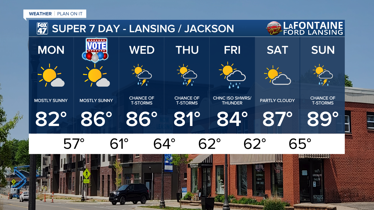
As these showers and storms arrive Wednesday, we will feel a bit humid when stepping out the door. Temperatures will cool from the mid 80's to lower 80's Thursday with another gradual warm up commencing taking us into the weekend where we remain dry on Saturday and potentially see some precipitation return Sunday. However, trends for this weekend's precipitation remain uncertain. We will keep you updated. Expect warmer conditions though, with highs in the upper 80's.
Have a great weather picture or video to share? Send it our way and we may feature it on-air or online!

