
LANSING, Mich. — We are waking up to better road conditions as we are only tracking a few passing clouds on satellite and radar. Smooth sailing is expected for your morning commute. Temperatures this morning are expected to range a bit cooler as our cloud cover clears for the AM hours. We could see temps dip into the mid 20's. Make sure to bundle up when heading out the door.
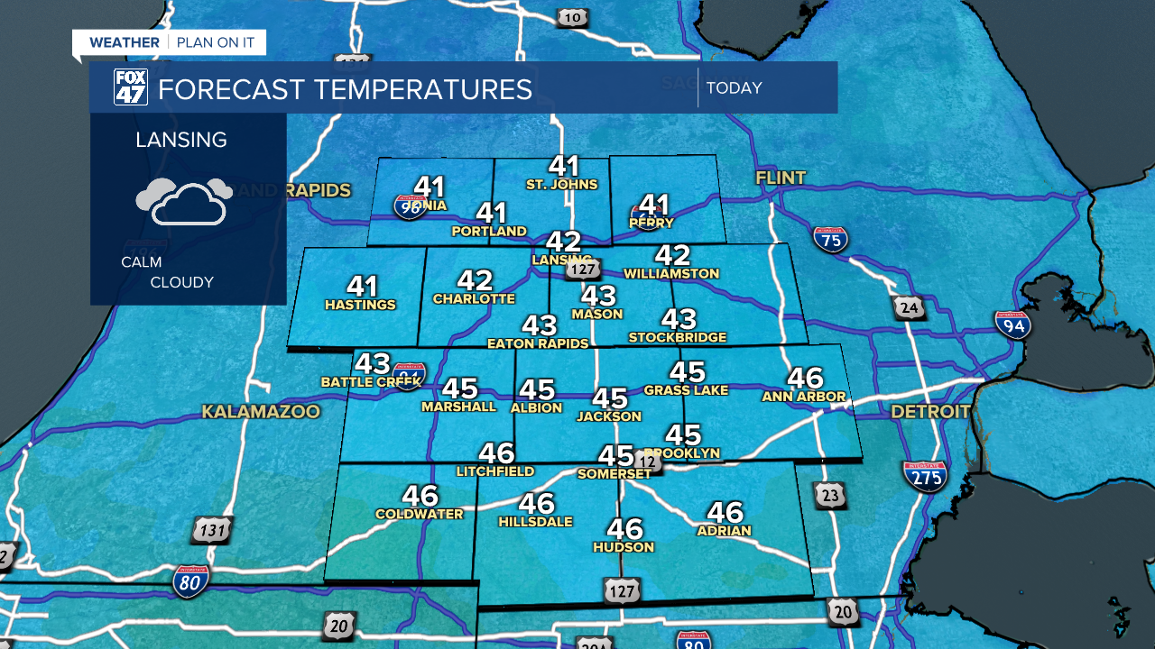
Throughout the day we will warm into the mid 40's for southern neighborhoods and lower 40's for northern neighborhoods. This trend is right around where we should be for this time of year. We will see increasing cloud cover this afternoon as surface high pressure exits the region.
WATCH THE FULL FORECAST BELOW
We will stay mainly dry during the daytime hours Thursday with cloudy skies continuing. Winds out of the south will bring moisture back into our neighborhoods. However, drizzle to light rain is the only impact we could see during the afternoon hours Thursday.
Ahead of an incoming cold front overnight Thursday into Friday morning, we could also see a stray rain shower develop as lows stay above average in the upper 30's. No major impacts are expected as we will cool heading throughout the afternoon hours Friday with dry conditions expected for Silver Bells in downtown Lansing.

We are looking to stay dry over the weekend with partly cloudy skies and temperatures warming back above average Sunday into Monday. Shower chances return on Tuesday in the form of rain, however, it is still a bit too early to talk details. We will keep a close eye on it throughout the rest of the week.

Want more FOX 47 News? Here's how you download our Roku app
You can also see the latest news from across our mid-Michigan neighborhoods by liking us on Facebook or following us on X.
