
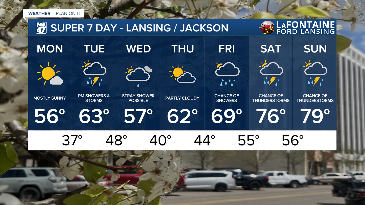
LANSING, Mich. — A new week in May brings a change in pattern with warmer weather expected to return mainly during the back half of the week. In the meantime, we are still dealing with lows dipping into the 30's this morning and again overnight tonight. A Frost Advisory will expire Monday morning at 8 AM across the majority of our neighborhoods.
Daytime highs will stay below average today in the mid to upper 50's while northern neighborhoods like Lansing and St. Johns can expect lots of sunshine today with gradually increasing sunshine across all of our neighborhoods as the day goes on. Winds won't be too much of a hassle, gusting up to 20 mph at times.

WATCH THE FULL FORECAST BELOW
As we head into the overnight hours, we will continue to track potential for frost as the influence of high pressure at the surface will keep skies mostly clear. This is a favorable conditions for frost development in springtime across Michigan. Other favorable conditions include weak winds. At the moment, wind speeds overnight range from 5-10 mph with wind direction gradually shifting out of the south. This could hinder frost development overnight, but make sure to stay safe and cover your plants or bring them inside. We will be dealing with warmer temperatures for the rest of the week where lows will escape the 30's.
Waking up tomorrow morning, feels like temperatures could dip at or just below freezing. Make sure to bundle up when heading out the door. Air temperatures overnight tonight are forecast in the mid to upper 30's.

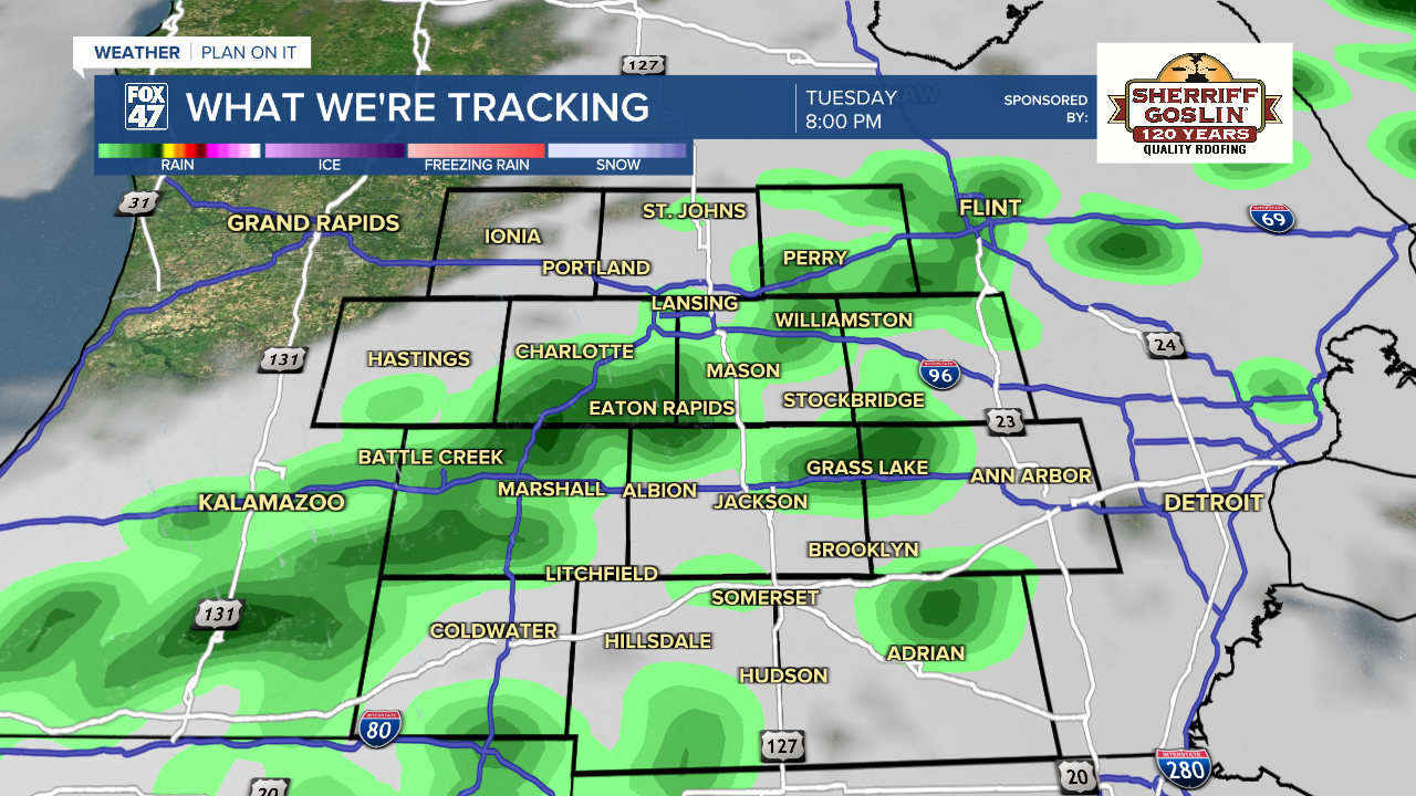
Tuesday brings a clipper system to southern Michigan where warming temperatures will reach the mid to lower 60's with the affiliated cold front aiding in shower and thunderstorms development during the evening hours. We could see a few tame showers in our northern neighborhoods during the late Tuesday morning hours into early afternoon hours, but the main round of measurable rainfall arrive anytime around and after 5 PM and lasts through around midnight.

Best chances for thunderstorms arrive around 9 PM or 10 PM Tuesday night with no severe impacts forecast at the moment. Rainfall accumulations look to range up to a quarter of an inch which isn't too bad. Areas that observed thunderstorms could see a bit locally higher rainfall amounts. A wash out is not expected, however. We could see wind gusts up to 30 mph across all of our neighborhoods tomorrow. If you have any evening plans, make sure to bring the umbrella.
We will cool down into Wednesday as a few remnant showers remain possible during the daytime hours with lots of cloud cover. We will see highs in the mid to upper 50's on Wednesday followed by a warming trend as an upper level low moves out of the region and we usher in some warmer air at the surface by the weekend, possibly exceeding 70 degrees. With these warmer temperatures, however, we are also tracking the chances to see some showers and thunderstorms. We will keep monitoring closely.
Have a great weather picture or video to share? Send it our way and we may feature it on-air or online!

