
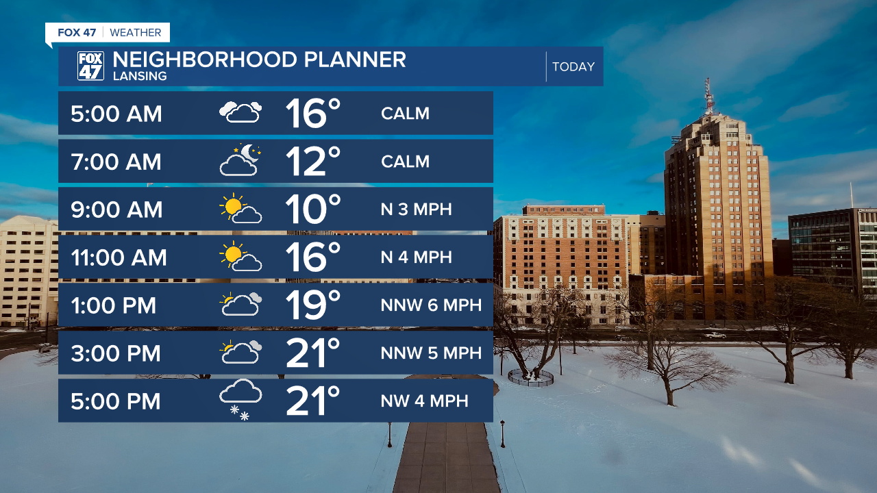
LANSING, Mich. — We are starting off our day with some more flurries as winds out of the north keeps most of our lake effect snow off to the west, however areas in Eaton County and Hillsdale County continue to see light snowfall this morning.
High pressure continues to build in today allowing for some possible sunshine during the late morning hours. However, as winds start to turn back out of the west later today, light lake effect snow is expected to return inland and impact our neighborhoods. We are only looking at a trace amount of snow from the mid afternoon hours through the overnight period ahead of an incoming shortwave.
Winds will stay weak today with high temperatures very similar to yesterday ranging from the mid to lower 20's.
WATCH THE FULL FORECAST BELOW
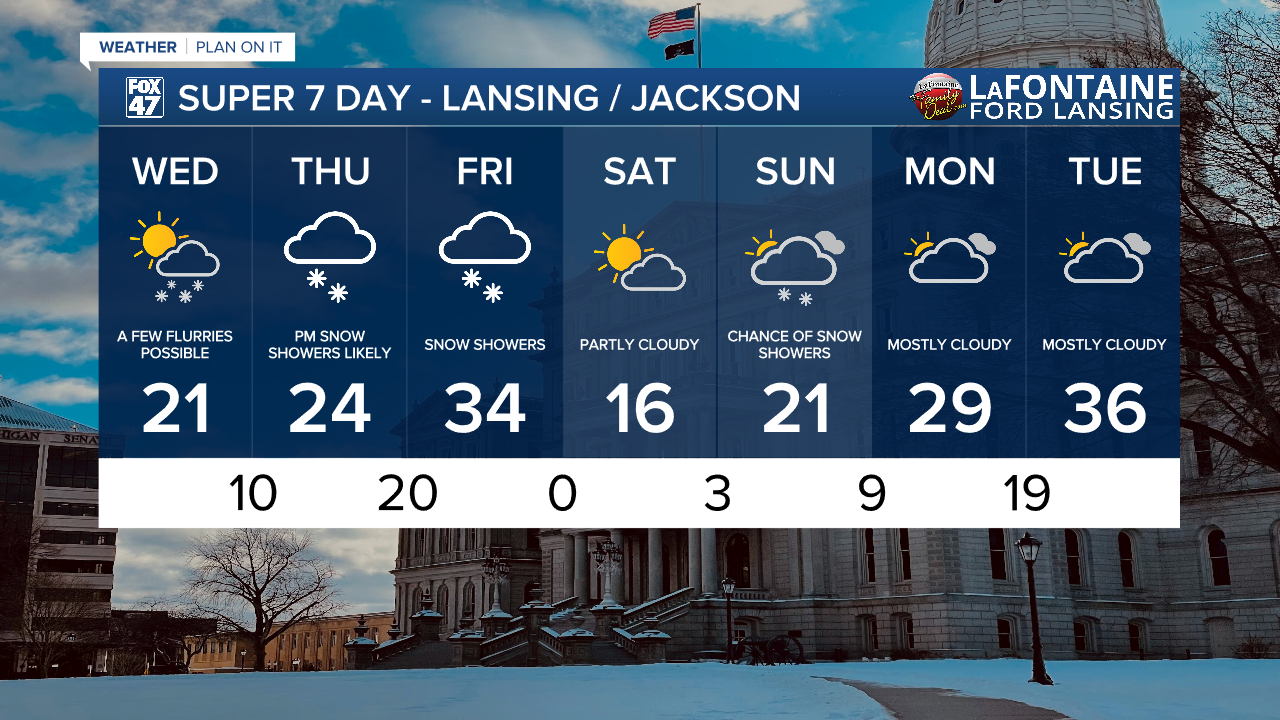
This incoming shortwave will drive two rounds of snowfall in our neighborhoods from Thursday to Friday. Thursday's round of snowfall arrives during the early afternoon hours and sticks around through the evening. We could see some limited visibility as well as light snow accumulations.
With temperatures warming with winds out of the south, there is also a chance for some possible light freezing drizzle during the Thursday evening time frame. This could create slick spots on roadways similar to what we saw Monday morning across our neighborhoods.

Thursday's snowfall arrives ahead of the incoming shortwave as round two arrives with the shortwave bringing stronger winds back to our neighborhoods. We can expect snow to re-ignite Friday morning which could impact the morning commute. Snow showers continue through those AM hours widespread, turning scattered into the afternoon.
We are looking at a range of 1-3" of snowfall across all of our neighborhoods Thursday and Friday. Snowfall totals could be dependent on Thursday's freezing drizzle chances. Expect slow downs on the road as we enter the weekend.

As the frontal passage advances through and winds shift out of the north, we could see wind gusts up to 40 mph during the late afternoon hours Friday. This will help to drop temperatures significantly Saturday with highs only in the teens.

Temperatures gradually warm through the weekend with a chance for some snow showers on Sunday. However, given a lack of moisture during this time, we could see changes to this forecast for the late weekend period. By the time we reach Tuesday, temperatures will warm to the mid to upper 30's. We haven't seen this temperatures trend in our neighborhoods for quite a while.
Want more FOX 47 News? Here's how you download our Roku app
You can also see the latest news from across our mid-Michigan neighborhoods by liking us on Facebook or following us on X.
