
LANSING, Mich. — Heading out the door this morning, you won't have to worry about any additional snowfall as we are dry and mostly cloudy. Main roadways have been treated and the morning commute should stay tame.
High temps today struggle to reach 30 degrees today. This is close to 10 degrees colder than where we should be for this time of year. This cold will continue on through the 7-Day period. Winds today will be a bit elevated compare to the start of the week with gusts ranging from 25-30mph today and tomorrow.
A cold front will advance through our neighborhoods today driving snow showers across our neighborhoods.

WATCH THE FULL FORECAST BELOW
This snowfall is affiliated with an advancing clipper system tracking east with snow beginning as early as 12 PM Wednesday afternoon. We could see flakes fly all the way through midnight tonight with a focus on the 5 PM to 11 PM time frame for possible slick roadways. We are not looking at any heavy accumulations with this snowfall. We could see .5 - 1" of snowfall across our neighborhoods today. These light accums could allow for minor impacts on roadways.
Heading into the overnight period, winds shifting out of the north will aid in cooling our neighborhoods down. Air temps are expected to make it to the lower teens and possibly flirt with single digits. Feels like temperatures, on the other hand, are looking to dip into the single digits and near zero by Thursday morning. Make sure to bundle up when heading out the door for the rest of the week.

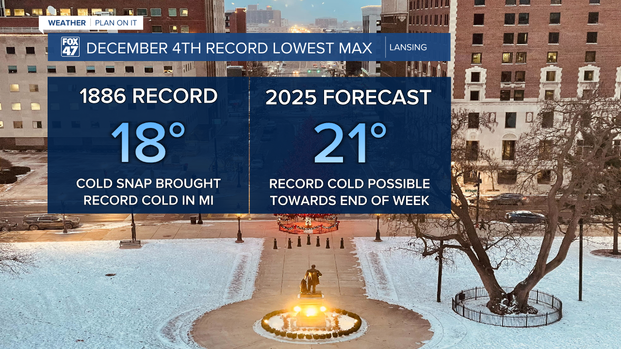
The cold doesn't stop Thursday morning as high air temperatures on Thursday in Lansing are epxected to reach 21 degrees. This is only 3 degrees shy from meeting the lowest recorded max temperature on the date December 4th. This record was last met all the way back in 1886 with a high temperature reaching 18 degrees.
Overnight lows Thursday into Friday will drop into the single digits with feels like temperatures possibly dropping below zero. We will rebound heading into the weekend with high temps hovering around freezing and a few snow showers possible. At the moment, we are not tracking any major hazards to travel or other impacts Saturday. Following this disturbance, we will cool down again with single digit lows possible to start next week.

Want more FOX 47 News? Here's how you download our Roku app
You can also see the latest news from across our mid-Michigan neighborhoods by liking us on Facebook or following us on X.
