
FORECAST UPDATE
The Winter Weather Advisory including our neighborhoods of Clinton, Jackson, Ingham, and Eaton counties has been extended to 1 PM Wednesday afternoon. Light to moderate snow will continue through these neighborhoods with renewed potential for limited visibility, blowing snow, and slick spots. Make sure to stay weather aware, keep it slow, and leave extra time to get to your destination.
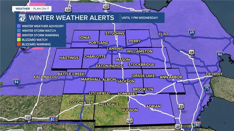
Earlier this morning, we saw snowfall reports from half an inch to 2" across our neighborhoods with heavier snowfall reports focused in our southern neighborhoods of Jackson and Hillsdale.
ORIGINAL POST
As of 6 AM this morning, our neighborhoods have observed light snowfall and present winds allowing for limited visibility down to 2 miles and blowing snow concerns. These impacts will continue through the morning commute hours today as a Winter Weather Advisory continues across all of our neighborhoods through 10 AM.

WATCH THE FULL FORECAST BELOW
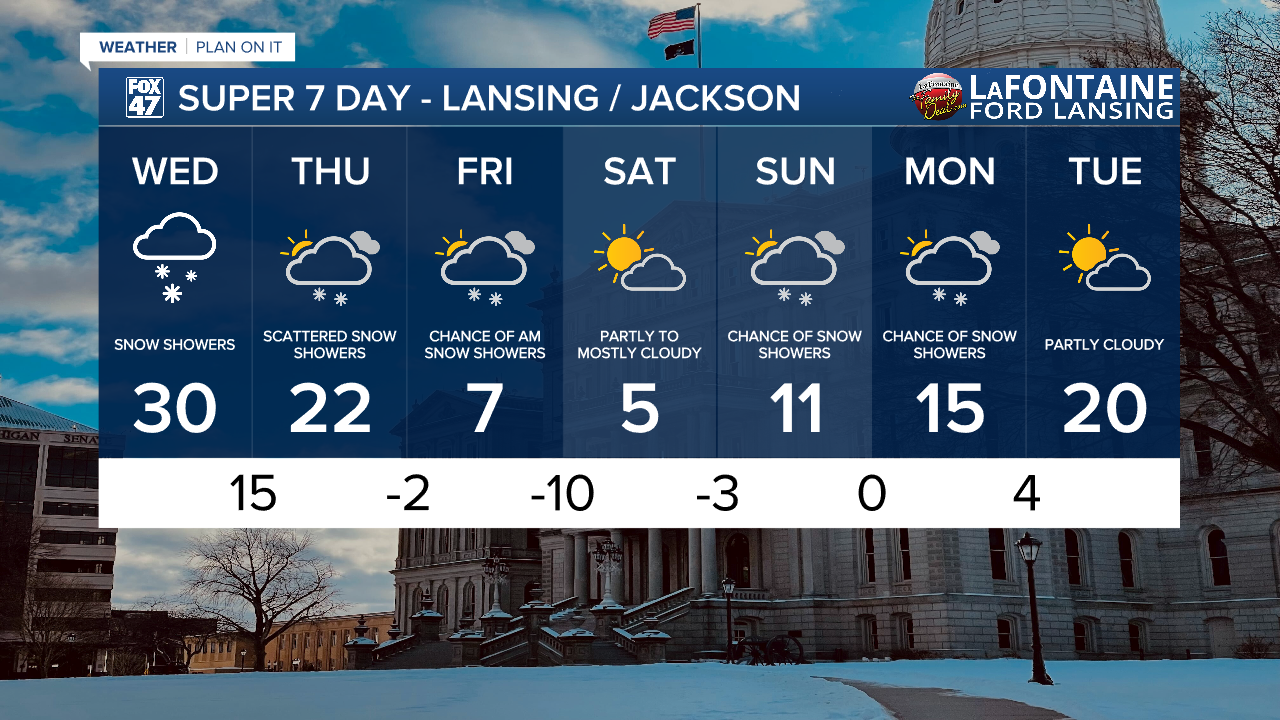
A warm front approaching the state will advances through our neighborhoods allowing air temperatures to return to normal at 30 degrees. This will make treating roads more effective. However, a passing cold front this evening and a secondary cold front advancing through overnight will renew scattered snow showers from Wednesday evening through Thursday morning followed by additional scattered snow showers in the form of lake effect snow with strong winds out of the west possibly exceeding 40 mph gusts.

Snowfall this evening won't bring much in the way of additional accumulations. We could see some renewed slick spots on roadways for the Thursday morning commute as well as blowing snow concerns as winds pick up.

Northern neighborhoods could see up to 3" of snowfall through Friday morning while southern neighborhoods are only looing at up to 2". On Friday, snow will come to an end as we turn our attention to the cold.

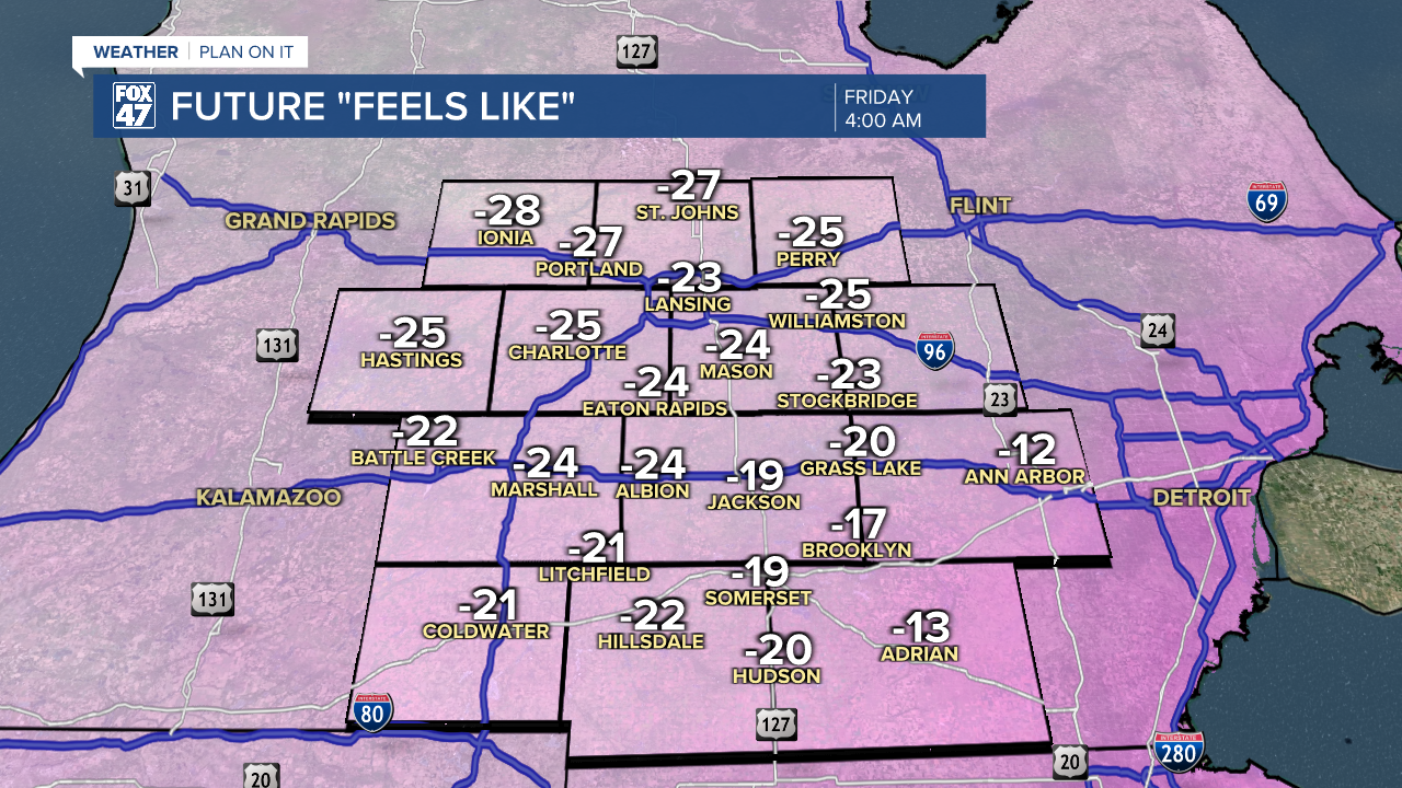
With strong winds and cooling temperatures below zero, we could see feels like temperatures drop to around 25 below. This risk occurs overnight Thursday into Friday with air temperatures ranging from zero to 5 below. This isn't even the coldest of the seven day as overnight Friday into Saturday, air temperatures could drop to ten below zero.
Limit your time outside overnight Thursday through Sunday morning as daytime highs will only hover in the single digits. Feels like temperatures cooler than 20 below could cause frostbite if not taking the proper precautions.
We will gradually warm heading into a new week with temperatures remaining well below average through Tuesday with renewed snow shower chances Sunday into Monday.
Want more FOX 47 News? Here's how you download our Roku app
You can also see the latest news from across our mid-Michigan neighborhoods by liking us on Facebook or following us on X.
