
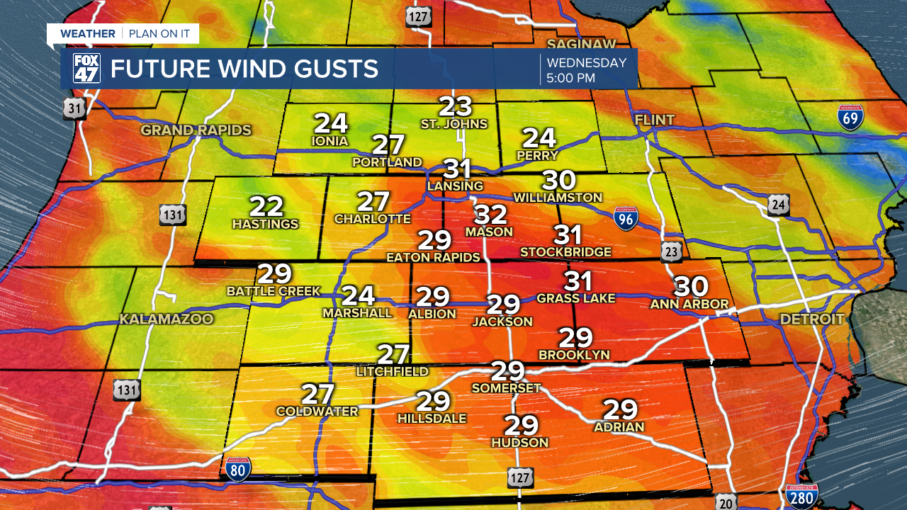
LANSING, Mich. — Following strong winds Monday, our neighborhoods will notice breezy conditions weakening throughout the morning hours Tuesday. Areas like Jackson have observed gusts up to 38 mph Tuesday morning. Once we reach the afternoon hours, gusts will drop to 25-30 mph. Paired with continued snowfall, visibility could remain limited today.
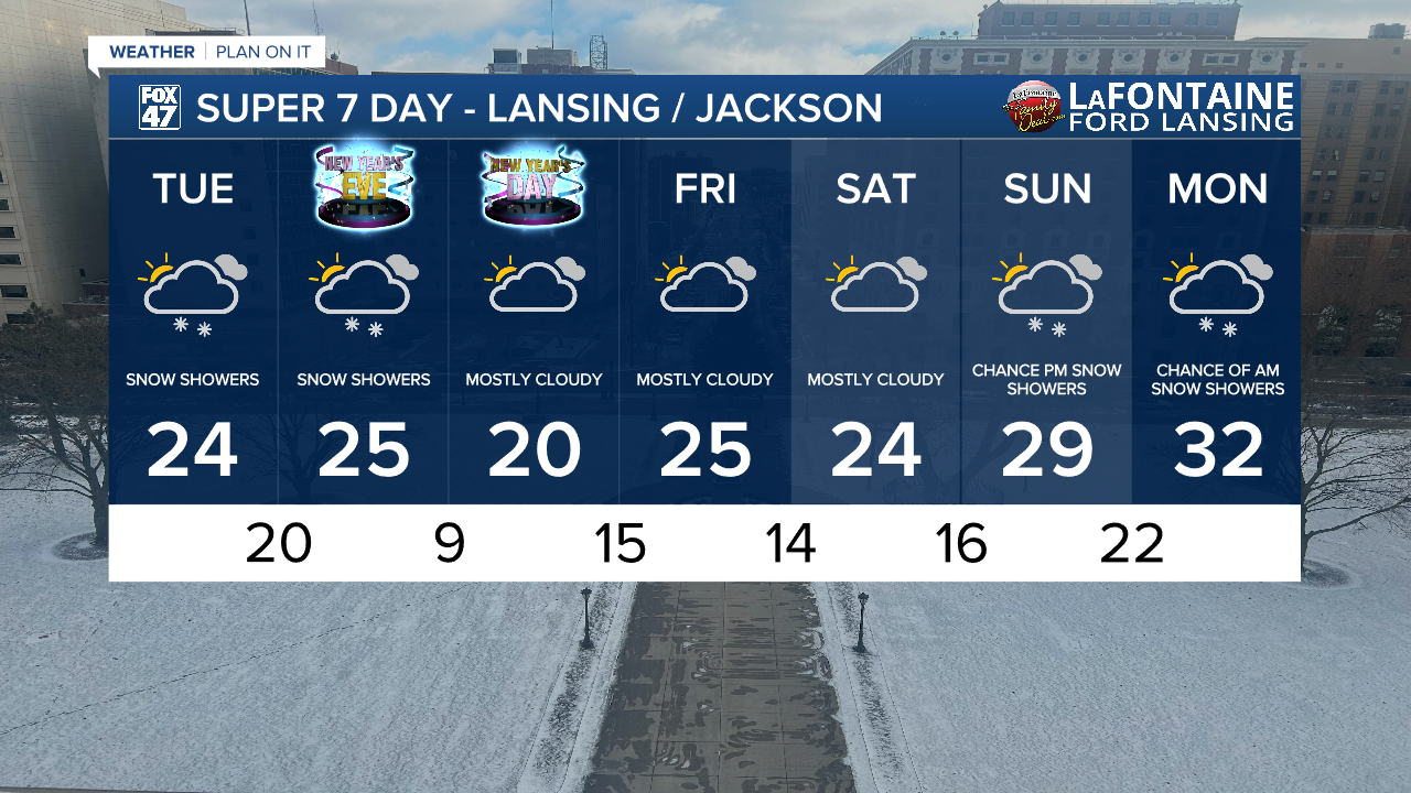
High temperatures will range in the mid 20's with feels like temperatures in the single digits throughout the first half of the day and into the lower teens by the late afternoon.
WATCH THE FULL FORECAST BELOW
Winds will continue out of the northwest with lake effect snow into the afternoon hours ahead of an incoming clipper system. This clipper will bring more snowfall to our neighborhoods with light additional accumulations beginning as early as 3 PM today and lasting through a little after midnight.
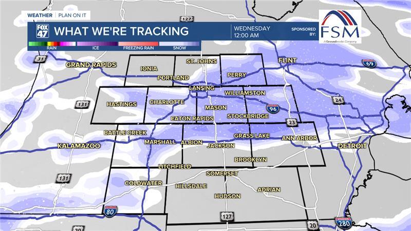
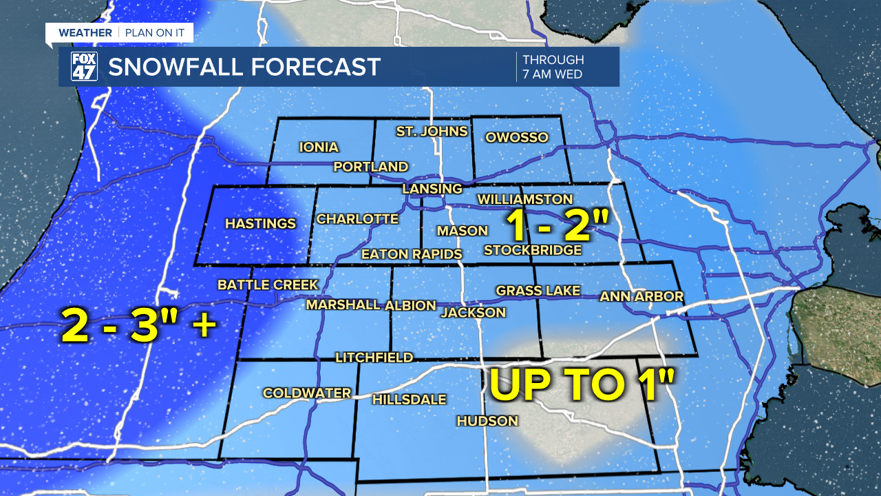
We can expect an additional 1 - 2" of snowfall today through Wednesday morning. We will see another round of snow as a cold front passes through our neighborhoods tracking south late Wednesday morning into early Wednesday afternoon with another 1 - 2" of snowfall possible across our neighborhoods. We could see some impacts to roadways, especially surface streets left untreated.
We will dry up as we begin a new year on Thursday with highs in the lower 20's and overnight lows in the single digits. Returning chances for snowfall comes late this weekend and into the beginning of next week.
Want more FOX 47 News? Here's how you download our Roku app
You can also see the latest news from across our mid-Michigan neighborhoods by liking us on Facebook or following us on X.
