
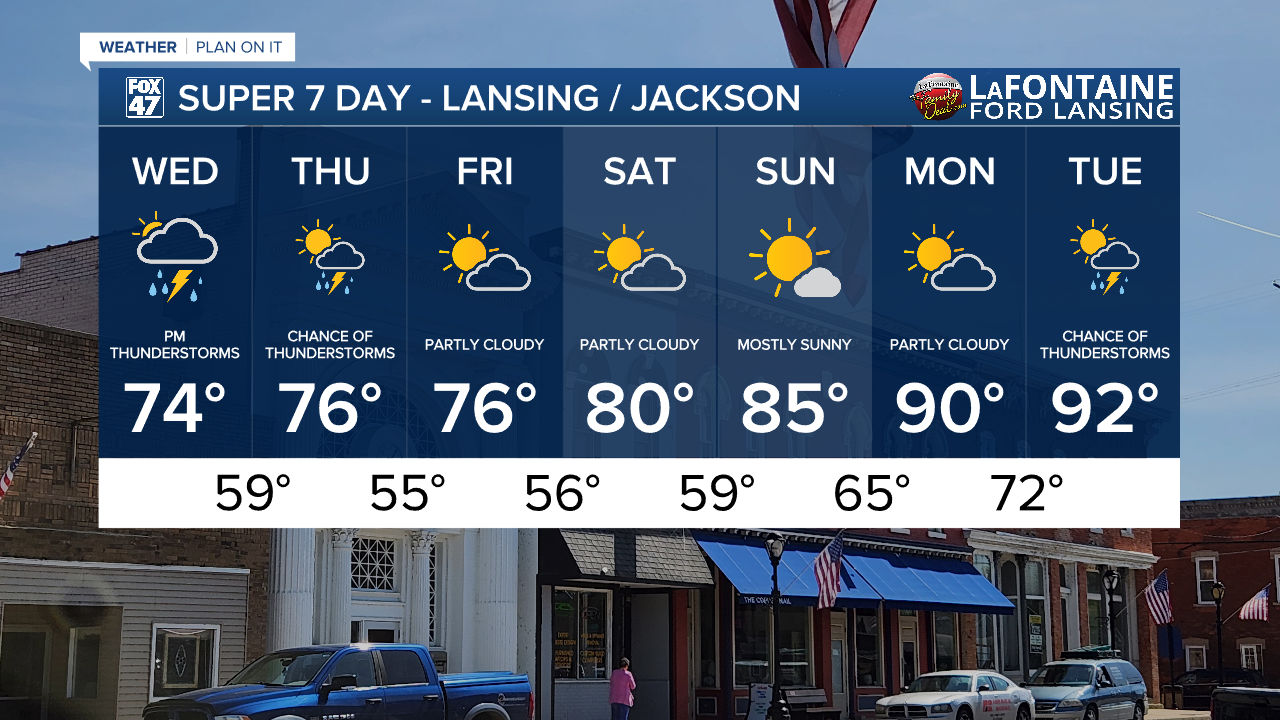
LANSING, Mich. — Grab the umbrella when heading out the door because showers and storms return to the forecast Wednesday. We will stay dry during the AM hours with no major impacts to the morning commute other than increasing cloud cover. We will observe temperatures climbing into the mid to lower 70's into the early afternoon hours. This will be around the time where we meet our daytime highs as once showers arrive, temps will begin to fall.

WATCH THE FULL FORECAST BELOW
An incoming low pressure system brings a surface warm front to the area with showers developing out ahead of it. Showers are looking to begin around 2 PM this afternoon and continue into the evening hours across our area. No major impacts are expected other than steady rainfall rates during the mid afternoon time frame.

Once the warm front inches closer to Mid-Michigan, storm potential will increase from around 6 PM to 1 AM tonight. We are really lacking thunderstorm energy with this round where severe impacts won't look to be present. Main impacts we could see include stronger winds and heavy rainfall rates.

The cold front advances through during the day Thursday with renewed potential for thunderstorms during the late morning into mid afternoon hours. Again, no severe impacts are expected, but we will keep you updated for any changes. We will dry up heading into Friday with partly cloudy skies.

We are watching closely for some potential, tame, showers overnight Saturday into Sunday, but for the most part, trends are showing a dry period through the weekend and into the new week. Temperatures will gradually warm back above average with lower 90's highs possible early next week as present moisture also brings potential oppressive conditions back to the area.
Have a great weather picture or video to share? Send it our way and we may feature it on-air or online!

