
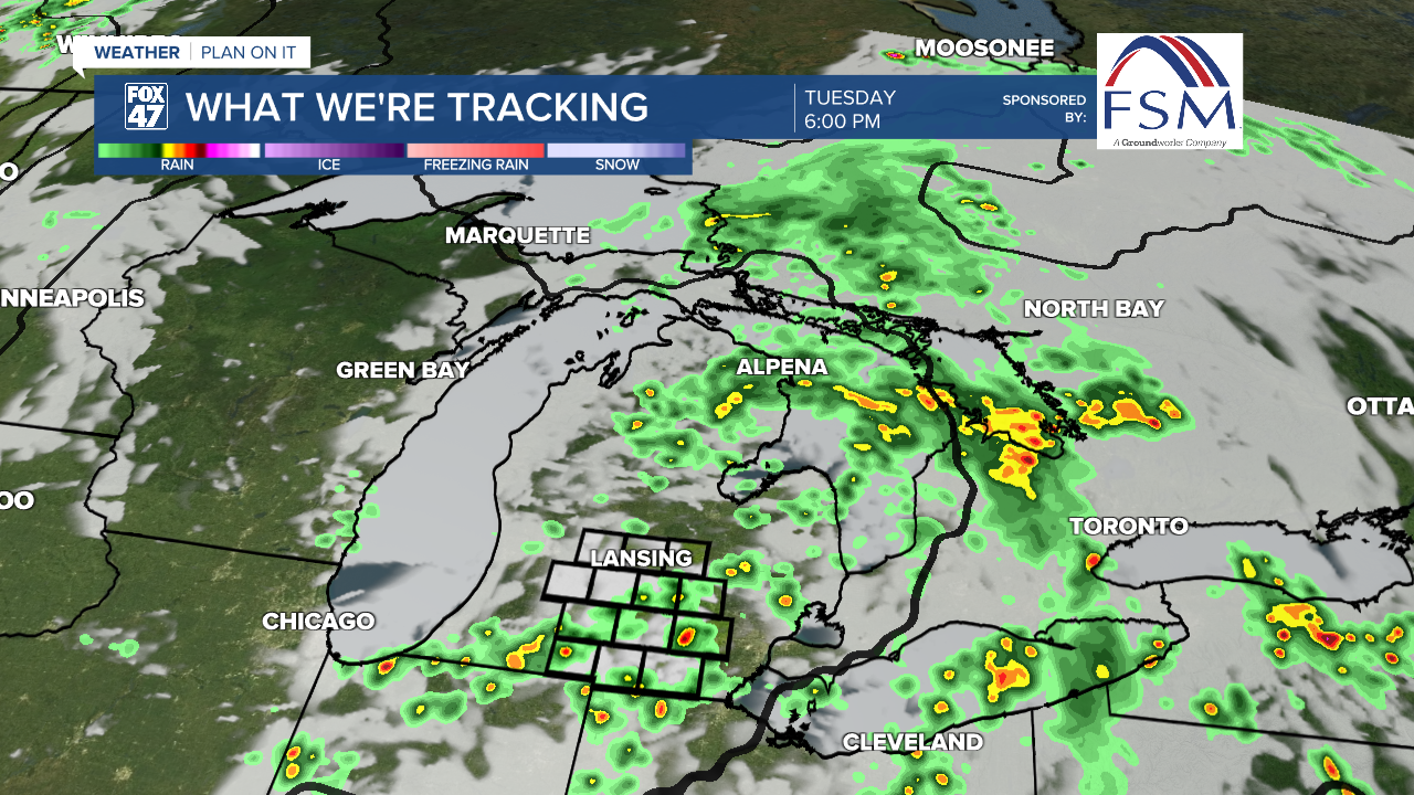
LANSING, Mich. — Grab the umbrella when heading out the door today because we are tracking showers and storms throughout the day. We won't be seeing any severe impacts with storms today, but we could see some heavy rainfall rates. Due to the arrival of showers, temperatures will remain a bit cooler than yesterday. Highs will range from the mid to lower 80's. This is still above average for this time of year.

WATCH THE FULL FORECAST BELOW
We will be tracking showers and heavier rainfall rates during the mid morning hours with more scattered thunderstorms developing during the afternoon hours. It is the latter that could carry heavy rainfall rates that could lead to localized flooding concerns. Stay weather aware when out on the roads today and if you encounter any flooded roadways, remember to turn around and don't drown. By the time we reach midnight, showers and storms will exit the area, leaving cloudy skies across the area.
As the low pressure system exits off to the northeast, we will usher in extreme heat with highs temperatures warming into the lower 90's Wednesday and Thursday.
During the day Wednesday & Thursday we could see afternoon pop up thunderstorms as we will also usher in ample instability post warm front. The severe impacts, however, arrive during the late afternoon and evening hours in the state of Michigan.

A slight risk for scattered severe storms exists for portions of Eaton and Clinton counties. The rest of our area remains in a marginal risk for isolated severe thunderstorms where we will be watching for damaging wind gusts as our main impact up to 60 mph possible. Other impacts include heavy rainfall rates and hail. We can't completely eliminate the chance for an isolated tornado threat as storms looks to arrive around 8 PM Wednesday.

A better chance for severe storms exists Thursday evening where an enhanced risk for severe storms exists for portions of Eaton and Clinton counties. The rest of the area remains in a slight risk for scattered severe storms where all impacts are at play. Have a way to receive alerts Thursday evening. We could see storms begin a bit later than when we might see them Wednesday, but we are still ironing out the timing of arrival.

We will stay uncomfortable today with dew points in the 70's. This is a trend that will stick around both Wednesday and Thursday. Some relief arrives as we end our work week on Friday and enter the weekend into Saturday.

Temperatures fall Friday into the lower 80's where we will see some more sunshine as we dry up. Sunshine continues into the weekend as we are seeing a drying trend for Saturday. A returning storm threat now exists for Sunday and takes us into Monday with temperatures still cooling down into the 70's with lows into the 50's. This is more comfortable than what we will see during the midweek period.

Have a great weather picture or video to share? Send it our way and we may feature it on-air or online!

