
LANSING, Mich. — High temperatures Monday were able to tap into the 70's for a lot of our neighborhoods making it feel a lot like spring across Mid-Michigan. Lot's of sunshine aided in these well above average temperatures. However, the heat is not expected to last long.
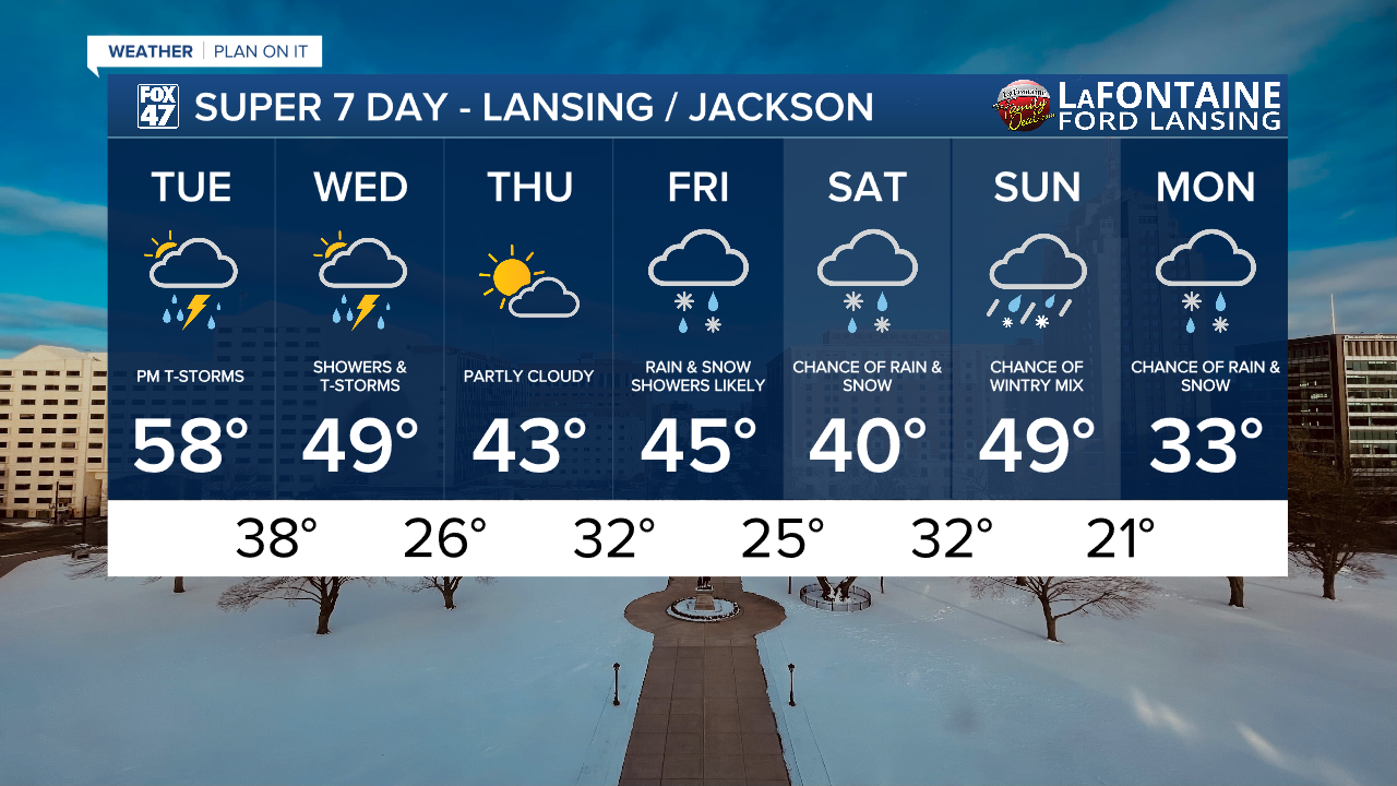
We remain mild Tuesday morning as a frontal passage sinks sought gradually throughout the day today with temperatures falling gradually from the upper 50's. By the time we reach the afternoon hours, temperatures across our neighborhoods will range in the mid to lower 50's. Depending on where the frontal passage stalls out, we could continue to see warming throughout the day in south Jackson and Hillsdale counties.
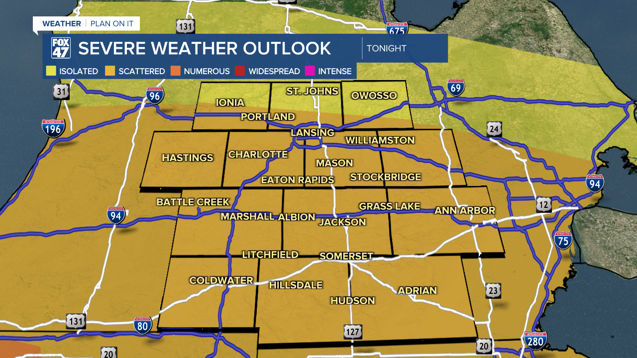
The threat for severe thunderstorms continues across all of our neighborhoods with a Slight risk across all of our neighborhoods minus the northern half of Clinton Co.
WATCH THE FULL FORECAST BELOW
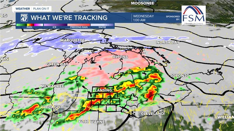
We stay dry with passing clouds through the majority of the daytime hours today. We could see some light pop up showers develop. If we do see any precipitation, impacts will remain low. Thunderstorms development begins anywhere between the 5 PM to 8 PM window Tuesday evening. Storms that develop will track east across our neighborhoods.
Ample instability will be found south of the frontal passage where the warmer air lies with impacts such as a tornado or two and large hail primarily sticking to our southern neighborhoods. However, this is dependent on where the frontal passage lands this evening. Other storms will be able to produce impacts such as hail, damaging winds, and heavy rainfall located north of the frontal passage with cooler air in place.

Heavy rainfall could lead to some scattered flash flooding concerns, especially for southern neighborhoods like Hillsdale County who remain under a slight risk for excessive rainfall during this evenings event. The rest of our neighborhoods are under a marginal risk with localized ponding possible. The storms and heavy rainfall from Friday have kept soil moisture high and river levels elevated which will heighten the flood concerns for this round of storms.

This event looks to wrap up early Wednesday afternoon as showers exit the region and we are left with cloud cover for the rest of the day Wednesday. Morning storms could still produce hail and heavy rainfall rates which could allow for a messy morning commute with renewed flooding concerns. Make sure to stay safe when out traveling beginning this evening.
We will take a break Thursday with partly cloudy skies and temperatures continuing to fall into the lower 40's. Winter weather returns to our neighborhoods Friday with chances for rain and snow. This will continue through the weekend and into next week with wintry mix possible Sunday as our next system advances through. There is a possibility to see some impacts to travel with this returning winter weather, but it is still a bit too early to talk numbers. Just make sure to keep the winter jacket nearby.
Want more FOX 47 News? Here's how you download our Roku app
You can also see the latest news from across our mid-Michigan neighborhoods by liking us on Facebook or following us on X.
