
LANSING, Mich. — It was a busy overnight period filled with severe storms bringing impacts to all of our neighborhoods including heavy rainfall, strong to damaging winds, and some structure damage in Clinton County.
The severe threat has come to an end Wednesday morning. However, if you are heading out the door and getting on the roads, watch out for potential localized flooding, especially in the Lansing/East Lansing area as well as other impacts such as downed power lines.
A Flood Advisory continues for the Lansing and East Lansing areas until 6:45 AM this morning. A Flood Watch continues across all of our neighborhoods until late Thursday night as we continue to track heavy rainfall with potential severe storms again Wednesday and Thursday.


WATCH THE FULL FORECAST BELOW
Temperatures today will continue to stay warm in the lower 70's as the stalled out frontal passage continues the same patter we saw yesterday with southwesterly winds and an incoming area of low pressure aiding in additional thunderstorm development. These southwesterly winds also keep the transfer of moisture into our neighborhoods with dew points in the lower 60's. This will aid in developing an unstable air mass for storms to potentially become severe this afternoon.

The Storm Prediction Center has issued a slight risk for scattered severe storms Wednesday across neighborhoods south of I-96 and a marginal risk for neighborhoods north of I-96. At the moment, severe potential depends on how quickly we regain instability across our neighborhoods. Continued showers and cloud cover could inhibit storm development into the early afternoon hours. However, we could see more storms during the overnight period as well turn severe.

If we are able to gain instability quickly through the morning, we could see strong to severe storms as early as 11 AM and lasting through the mid afternoon hours. Another round is expected later this evening taking us past midnight again.
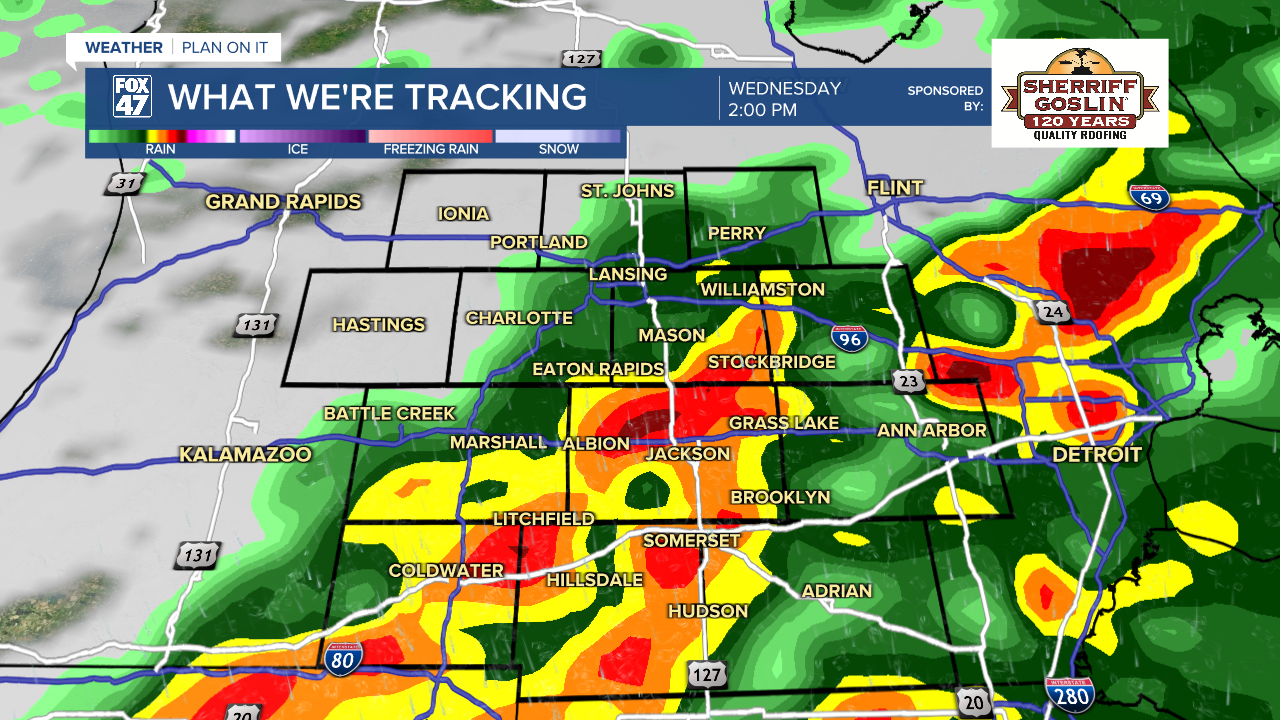
All severe impacts remain at play, however, coverage will be more scattered compared to what we saw overnight Tuesday. Flooding is a main risk with additional heavy rainfall rates interacting with the already saturated soil. Some estimated rainfall reports from Tuesday night ranged from 2-4 inches. Damaging winds remain possible with a low but not zero chance for an isolated tornado and hail.

Showers and storms come to an end on Friday with partly cloudy skies and high temperatures continuing in the 70's. We will cool down into the weekend with dry conditions Sunday and Monday. We could see showers return both Saturday with storms and Tuesday of next week.

Have a great weather picture or video to share? Send it our way and we may feature it on-air or online!

