
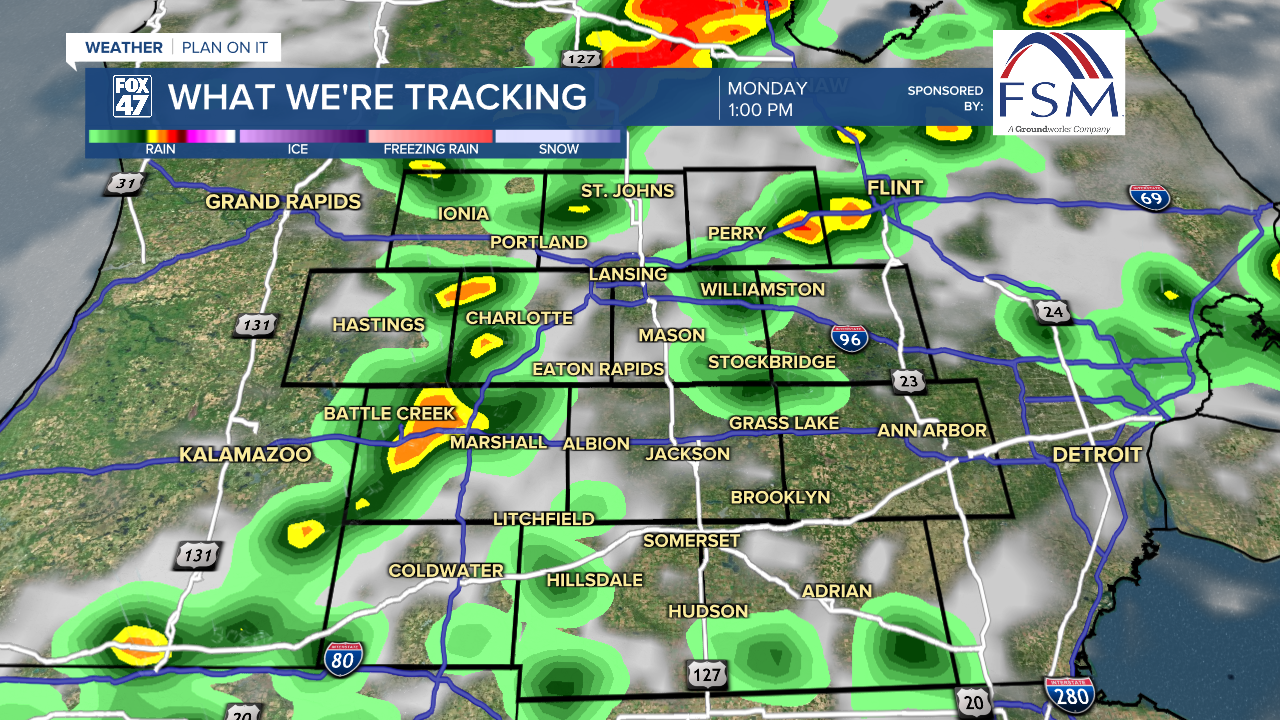
LANSING, Mich. — Following a decent break from showers and storms over the weekend, we will be starting the week needing the umbrella across Mid-Michigan.
A slow moving cold front affiliated with a shortwave trough will advance through our neighborhoods later Monday afternoon. Showers and storms will begin as early as 11 AM and last through the evening hours today.
WATCH THE FULL FORECAST BELOW
These storms will act similarly as to what we saw with last week's storms. Main impacts include damaging winds and heavy rainfall rates given the present moisture in our atmosphere. All of our neighborhoods are under a Marginal risk for isolated severe storms today. Make sure to grab the umbrella when heading out the door and to have a plan for if severe weather impacts your neighborhood.

High temps today will reach the mid 80's ahead of the cold frontal passage. This is seasonably average for this time of year where daytime highs should be in the lower 80's. Humidity will be high again today with dew points into the 70's. It will feel a bit sticky and uncomfortable when stepping out the door.
However, behind the cold front, surface high pressure will build in allowing for a drop in dew points and more comfortable conditions will prevail.
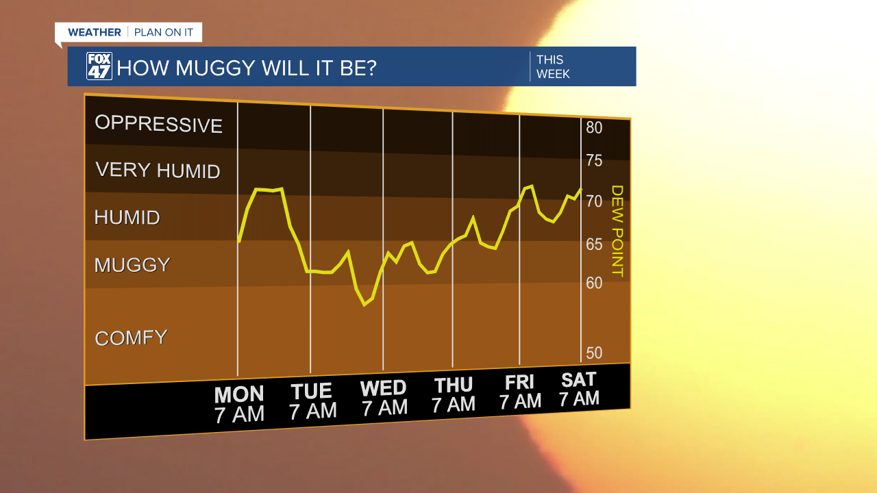
Temps from Tuesday through Thursday will range in the mid to lower 80's under high pressure allowing for more comfortable conditions and lots of sunshine.
Once we reach the 4th of July holiday, we will be staying dry with partly cloudy skies and temps beginning to warm again in the upper 80's. We have a chance to see high temps back in the 90's this weekend where storm potential returns to our neighborhoods.

Want to learn more about the Weather? Visit the FOX47News Website.
Stay in touch with us anytime, anywhere.
Sign up for newsletters emailed to your inbox.
Select from these options: Breaking News, Severe Weather, School Closings, Daily Headlines and Daily Forecasts.
