
LANSING, Mich. — Showers and storms continue off to the west of Michigan, ahead of the incoming frontal passage. Some tame showers were observed in our northern neighborhoods this morning, however, no major impacts were observed as we await more thunderstorm potential this afternoon.
WATCH THE FULL FORECAST BELOW
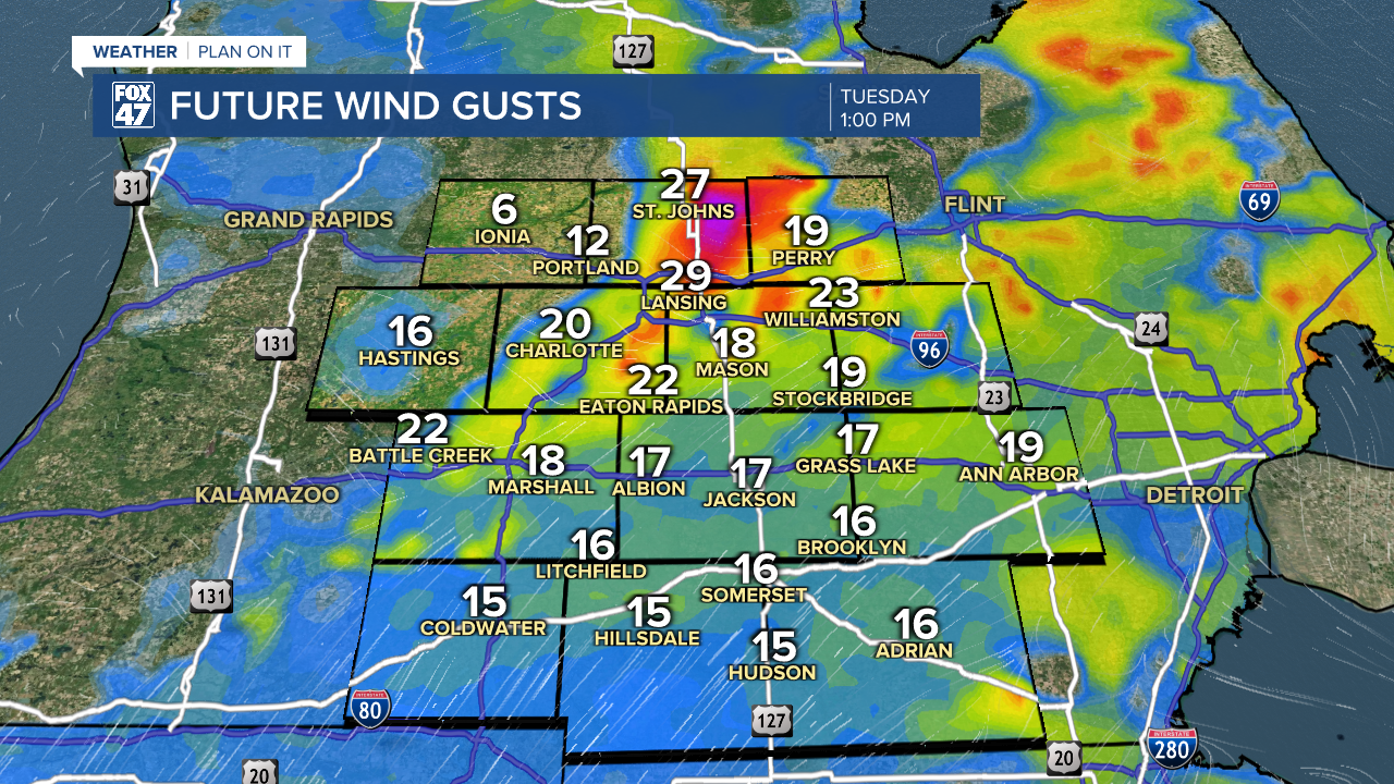
This same frontal passage we were looking at yesterday will start to make its track east across the state today. This will allow for showers and storms this afternoon. We are looking at time frames as early as 12 PM to as late as midnight. The evening extent of storm potential could see some minor changes depending on the first round of storms that moves through the area. Plan to keep the umbrella nearby during the entire afternoon and evening period.

Temperatures today will warm into the mid to upper 80's. Areas that see the most sunshine will have the better chance to see upper 80's as a daytime high as cloud cover reflects sunlight.

Isolated severe storms are possible with our setup today across all of our neighborhoods. Main impacts include damaging winds and heavy rainfall rates that could lead to some localized ponding on roadways and some flooding in low lying areas. Make sure to stay weather aware when stepping out the door today, especially in the PM hours.

Storms come to an end past midnight tonight with some lingering showers possible. We could see some of these tame showers creep into Wednesday morning. However, as the frontal passage moves further away from Michigan, high pressure will build in. This new setup will allow for more pleasant conditions Wednesday PM and Thursday.
Temps will be on the rise again as well as humidity once we reach the weekend with another 90 degree day possible across our neighborhoods. Thunderstorm chances on Saturday have decreased a bit, but we will continue to watch closely as we could still see changes.

Want more FOX 47 News? Here's how you download our Roku app
You can also see the latest news from across our mid-Michigan neighborhoods by liking us on Facebook or following us on X.
