


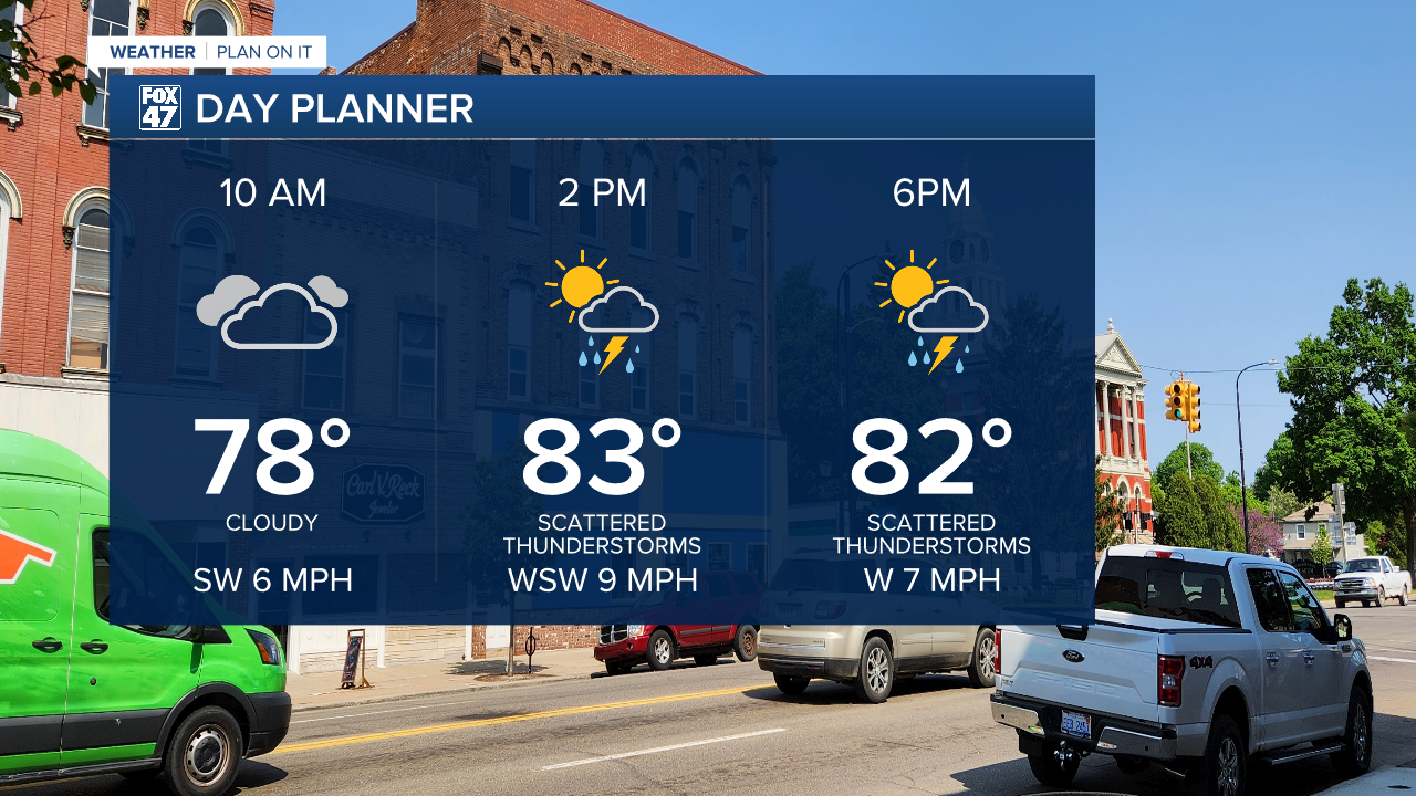
LANSING, Mich. — We are starting our day dry across Mid-Michigan, even with some sunshine. However, cloud cover will increase throughout the morning as the frontal passage at the surface sags south through our area slowly Thursday.
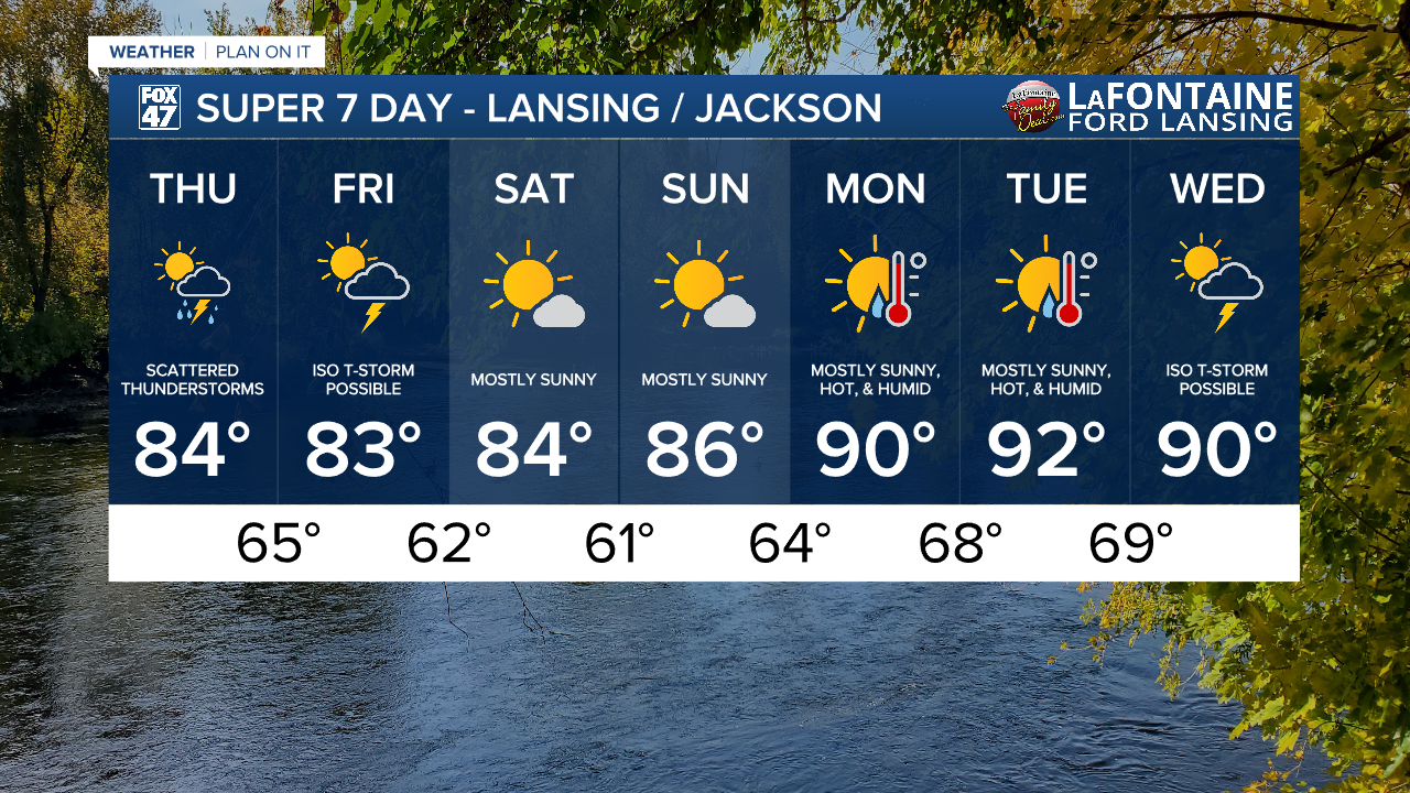
High temperatures should be able to reach the mid 80's with elevated humidity. Once showers and storms arrive, we can expect temps to halt and begin to drop as we continue through the day.
WATCH THE FULL FORECAST BELOW
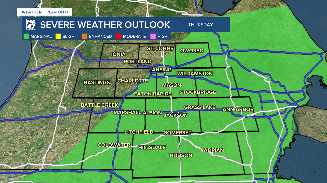
We still have some severe potential for these storms today. The marginal risk for isolated severe storms exists for much of the area for possible damaging wind gusts and heavy rainfall rates.
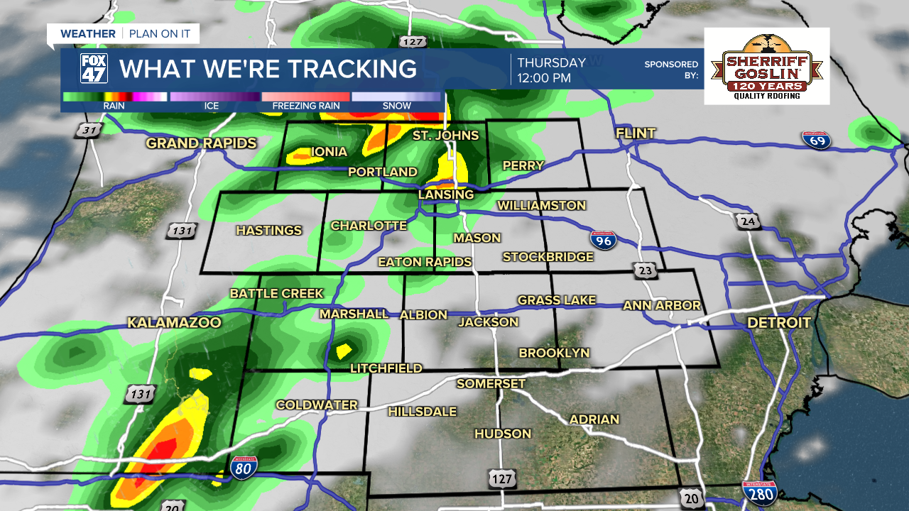
We could see storms arrive around lunchtime and as early as 12 PM. We will build instability throughout the AM hours due to continued winds out of the southwest and some more sunshine. Storms could continue into the evening hours and even during the overnight hours with a lingering isolated non-severe thunderstorm possible during the day Friday.
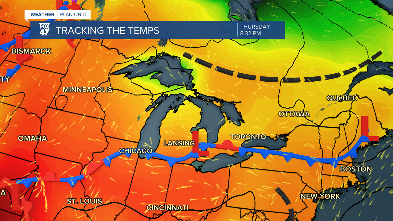
The timing and location of these storms depends on the slowly progressing frontal passage that is expected to halt at the state line late today into Friday morning. It is because of this stalling pattern at the state line that we could see isolated storms continue into tomorrow. Once we reach the weekend, however, we will clear up with lots of sunshine and gradually warming temperatures.
Those gradually warming temperatures will become extreme once we start a new week with air temperatures back in the 90's with mostly sunny skies on Monday and Tuesday. An isolated thunderstorm remain possible on Wednesday of next week, but we could still see some changes ahead of the event.
Have a great weather picture or video to share? Send it our way and we may feature it on-air or online!

