
LANSING, Mich. — We're starting our Wednesday watching the radar as a shortwave located south of Michigan is driving scattered showers across Indiana and Ohio with some of those showers creeping into Hillsdale County this morning. These showers are staying tame with little impacts to the morning commute. These showers will exit as that shortwave tracks east and away from the region.
However, this is not the end of the story for thunderstorm potential today. A weakening cold front approaching the state from the Northwest will drive more showers and storms starting at Noon Wednesday and lasting through the late evening hours tonight.

WATCH THE FULL FORECAST BELOW
Scattered storms from the early afternoon hours through the early evening hours should stay tame with possible heavy rainfall rates. We could see these scattered storms from Noon today to 6 PM.

During this same time, dew points will range in the lower 70's. This will allow for continued humid conditions outside. We will start to see improvement once we head into the end of the work week. Temperatures Wednesday afternoon will warm into the upper 80's, similar to what we saw Tuesday.
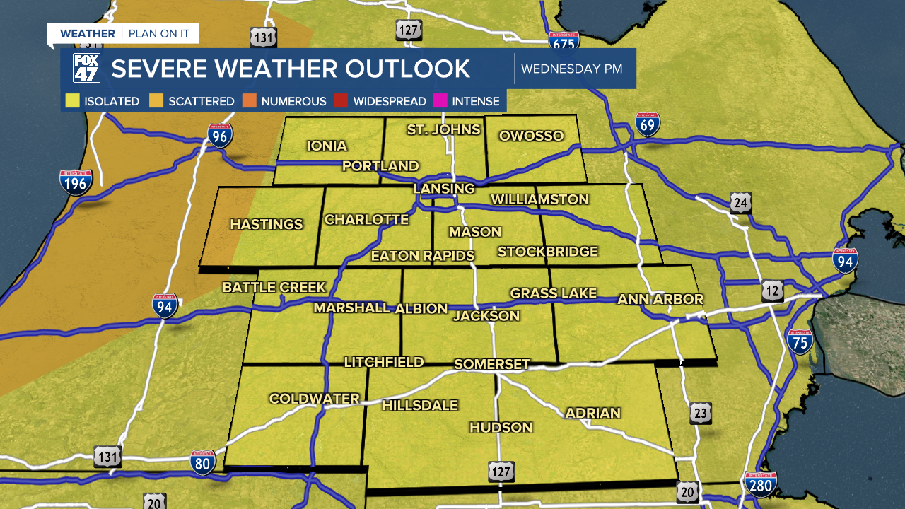
The late evening round of thunderstorms could bring severe impacts to our neighborhoods. A Marginal Risk is still out for all of our neighborhoods for possible isolated severe thunderstorms from 10 PM to 2 AM.
Impacts that we could see with this more organized line of storms ahead of the cold front include damaging winds and heavy rainfall rates. These heavier rainfall rates could lead to localized flooding in our neighborhoods.


Remnant showers are possible once we head into Thursday morning, however, we are looking at a drying trend post cold front advancement. Temps will dip into the lower 80's tomorrow with highs expected in the upper 70's on Friday. We will dry up with cloud cover to end the work week.
Showers and storms look to return to our neighborhoods this weekend.

Want more FOX 47 News? Here's how you download our Roku app
You can also see the latest news from across our mid-Michigan neighborhoods by liking us on Facebook or following us on X.
