
LANSING, Mich. — The Frost Advisory continues across all of our neighborhoods through 8 AM this morning as temperatures fall into the 30's skies clear with calm winds. Make sure to bundle up when heading out the door because feels like temperatures could drop below freezing in some of our neighborhoods.

WATCH THE FULL FORECAST BELOW
We will remain chilly today with temperatures ranging in the mid to lower 50's for daytime highs. Feels like temperatures could drop into the upper 40's for some with strong winds today gusting up to 30 mph.
Beginning this evening around 9 PM, we will be tracking the return of potential showers across our southern neighborhoods of Jackson and Hillsdale. Once we reach midnight, we could also see a stray thunderstorm with no severe impacts expected due to gaining instability. Showers will come to an end before daybreak, but lows in our southern neighborhoods tonight could range a bit warmer in the lower 40's because of this shower potential.

Northern neighborhoods have a better shot at seeing overnight lows drop into the mid to upper 30's allowing for more potential frost due to clearing skies and calm winds. The chance for frost will remain a bit less likely compared to today based on the fact temperatures will begin to warm gradually during the overnight period ahead of the weekend where temperatures are expected to return to the 60's.
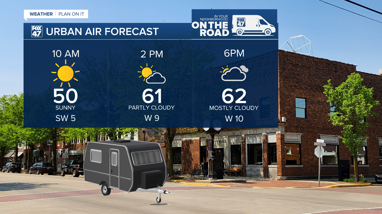
Friday, we are on the road in Eaton Rapids for the Urban Air even and we can expect a chilly morning if you are heading out early. However, highs will warm into the lower 60's during the afternoon and evening with a potential for a few showers to develop, mainly for southern neighborhoods. We could stay dry in Eaton Rapids during the entire day with some increased cloud cover during the evening hours. Any showers that might develop will stay tame with no major impacts.
Saturday remains the warmest day in our forecast with highs in the mid to upper 60's and returning chances for thunderstorms during the mid afternoon hours. Storm chances remain non-severe at the moment, but we can expect measurable rainfall and some strong winds with gusts potentially exceeding 40 mph.


After this system advances through, temperatures will cool again into the 50's. A dry Mother's Day is now expected with partly cloudy skies as overnight lows cool back into the mid to upper 30's. We will be watching for frost as another warm up arrives midweek with highs back in the 60's by Wednesday.
A look further out shows we have a chance to see above average temperatures during the mid to late May period. We will be watching closely to see if we can escape the cooler weather brought to us by an upper level low.

Expect showers to return Tuesday and Wednesday of next week with gradually warming temperatures. Take a jacket when heading out the door today and keep it around for tomorrow morning. Keep your plants inside or covered one ore night tonight before lows warm back into the 40's.

Have a great weather picture or video to share? Send it our way and we may feature it on-air or online!

