
LANSING, Mich. — We're starting our Wednesday morning off with an advancing cold front across our neighborhoods. Winds will shift out of the northwest briefly as our environment remains dry. Any precipitation struggles to reach the surface this morning allowing for a breezy and mostly cloudy start to the day.
High temperatures today will continue to warm as sunshine yesterday brought temps into the mid 30's. These conditions are more in line with where we should be at this time of year.
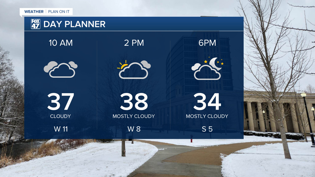
WATCH THE FULL FORECAST BELOW
Following the morning cold frontal passage, surface high pressure will builds into the region allowing clouds to part in the afternoon hours with chances to see some sunshine. Cloud cover will be a bit more increased than Tuesday, but we can still expect some nice conditions with feels like temperatures in the mid to lower 30's. If you need to do any outdoor activities, make sure to get it done today prior to the arrival of rain showers Thursday.
Winds will gradually weaken as high pressure builds in with gusts only up to 15mph Wednesday afternoon.

Winds will turn back out of the south as high pressure exits the region and our next system arrives Thursday. As temperatures remain above freezing, we are expecting scattered rainfall as our main precipitation type as early as 7 AM Thursday. Rain will turn more widespread once we reach the Thursday evening hours as the advancing cold front approaches our neighborhoods. We could see .25 - .5" of rainfall Thursday which will also aid, in part with above average temps, in melting our current snow pack.
We have already seen some snow melt from Tuesday and we will continue to see minimal snow melt today as temps continue to warm. Most of our snow melt will occur as rain falls Thursday and temperatures warm into the mid 40's.
On the back end of the cold front, temperatures will rapidly cool overnight Thursday into Friday morning with a lake effect snow setup bringing snow back to our neighborhoods. We could see an inch or two across our neighborhoods as we enter the Friday afternoon hours. However, the main concern is the Friday morning commute where we could see wet roadways refreeze. Slick spots are possible for the Friday morning commute.

Winds throughout the day Thursday will also remain strong, possibly exceeding 40 mph in the evening hours as the cold front approaches.

We will see temps rebound into the upper 30's on Saturday with renewed chances for rain and snow. As we start Astronomical Winter, conditions will remain dry with high temperatures hovering around freezing. Temps are looking to warm again as we inch closer to the holiday's midweek next week.

Want more FOX 47 News? Here's how you download our Roku app
You can also see the latest news from across our mid-Michigan neighborhoods by liking us on Facebook or following us on X.
