
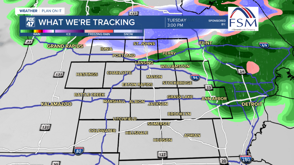
LANSING, Mich. — Precipitation in the form of rain begins in our neighborhoods Tuesday morning with potential for some freezing drizzle in areas north of I-94 where temperatures remain hovering around freezing. This threat will last through 9 AM where by that point temperatures will warm above freezing and rain will be our main precipitation type.
Forecast highs in Lansing continue to warm into the upper 30's. However, it is the I-96 corridor that is diving our two air masses as the influence of warm moist air comes from a shortwave that is tracking right through our neighborhoods. Areas north of I-96 are expected to be cooler than those to the south.

WATCH THE FULL FORECAST BELOW
The brunt of rainfall will be observed throughout the morning hours with heavier precipitation rates expected to fall along and north of I-96. We are not expecting any flooding concerns with this rainfall, however, it will aid in melting some of the snow and slush that are left across our neighborhoods.

Into the afternoon hours, we will see coverage of rain showers dwindle with most precipitation focused in our most northern neighborhoods in Clinton County. With temperatures possibly still hovering around freezing, we could see rain mix to snow as the shortwave advances through the neighborhoods and winds turn out of the north.
If we do see this mixing, we are not expecting major accumulations of snowfall, but slick spots on roadways could be renewed for the evening commute for areas north of I-96.
All precipitation will be coming to an end by the time we reach the overnight hours with one last round of rain expected to track through all of our neighborhoods late this evening. Some possible mixing is possible with this last round as well.
Temperatures will continue to warm as we take a break from showers Wednesday. Winds turning out of the southwest warms temperatures into the 40's Thursday and Friday with returning chances for showers in the form of rain. We will be tracking the return of winter weather once we enter the weekend.

Want more FOX 47 News? Here's how you download our Roku app
You can also see the latest news from across our mid-Michigan neighborhoods by liking us on Facebook or following us on X.
