
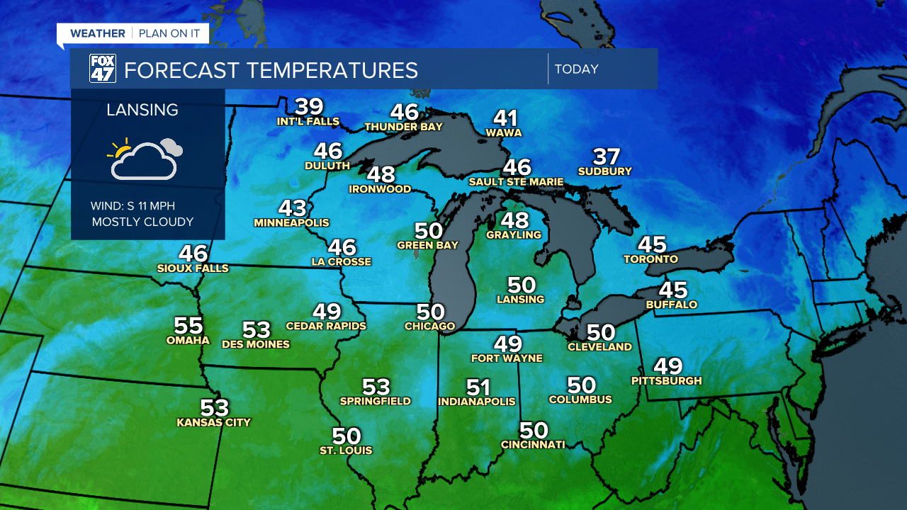
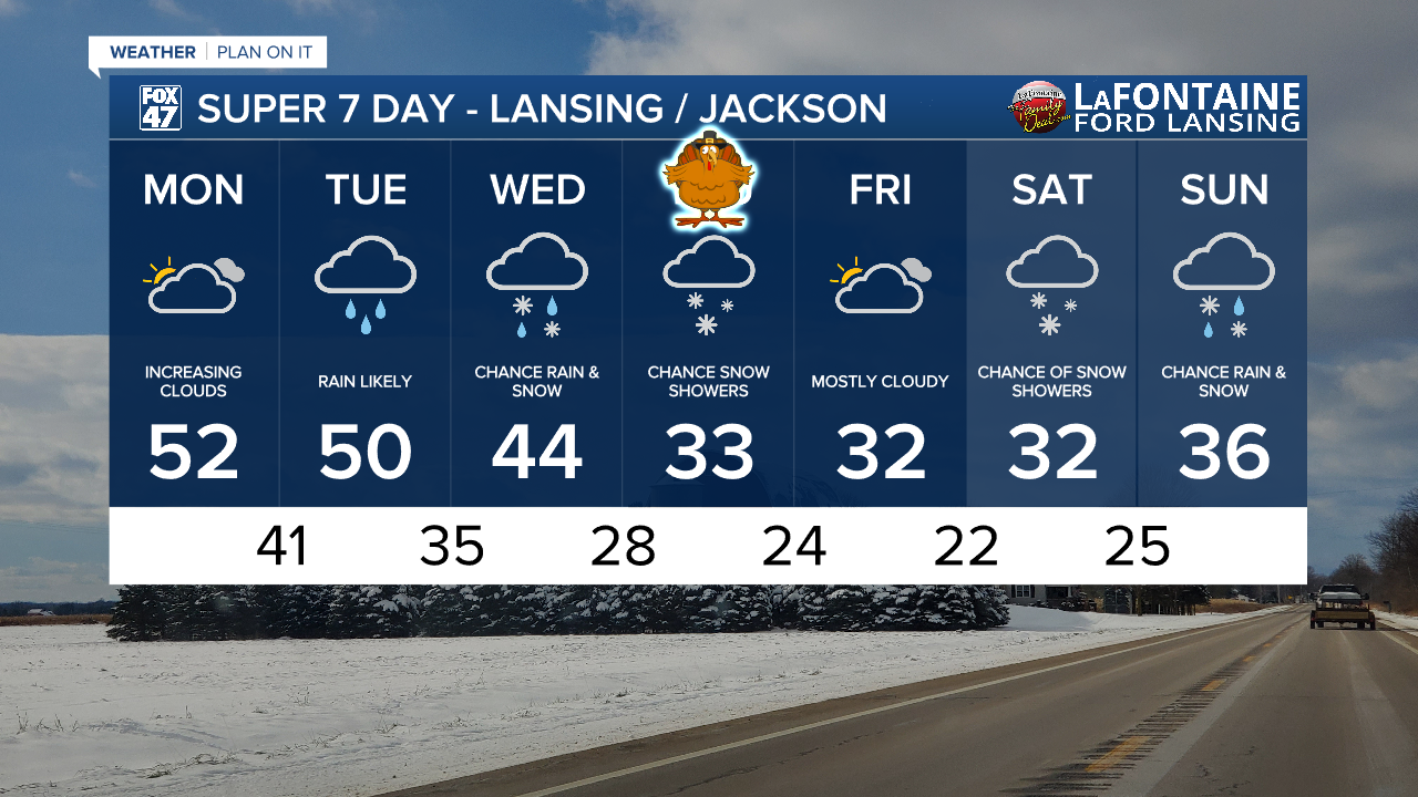
LANSING, Mich. — We ended the weekend with sunny skies across our neighborhoods with a change in our weather pattern to start the week. We will see daytime highs a bit mild for this time of year, tapping into the lower 50's possibly.
Cloud cover will increase throughout the daytime hours today with dry conditions prevailing. As high pressure at the surface exits, low pressure will drive returning rain showers beginning overnight tonight.
WATCH THE FULL FORECAST BELOW
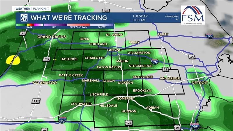
Showers could begin anytime after midnight tonight with the brunt of precipitation expected to track through the mid to late morning hours. These rain showers shouldn't bring any major impacts to our neighborhoods other than wind gusts up to 20 mph. Afternoon and evening shower potential will turn more scattered Tuesday. We could see up to .2" of rainfall in localize areas once these showers come to an end Tuesday evening.
Showers continue early Wednesday morning ahead of an incoming cold front. This area of low pressure will track through northern Michigan with rain turning to snow in the afternoon hours as temps begin to cool.

This lake effect snow could last through the day Thursday with accumulations possible. Some impacts for travel on Thanksgiving are possible with this lake effect snowfall. We will continue to keep you updated with snowfall amounts as we get closer to the event.

Lake effect snowfall looks to come to an end Friday with mostly cloudy skies. However, another system brews for the weekend with snowfall returning Saturday and into Sunday with accumulations possible. It is still too early to talk details with this weekend system, but make sure you have the winter gear ready for later this week for possible accumulating snowfall.
Want more FOX 47 News? Here's how you download our Roku app
You can also see the latest news from across our mid-Michigan neighborhoods by liking us on Facebook or following us on X.
