
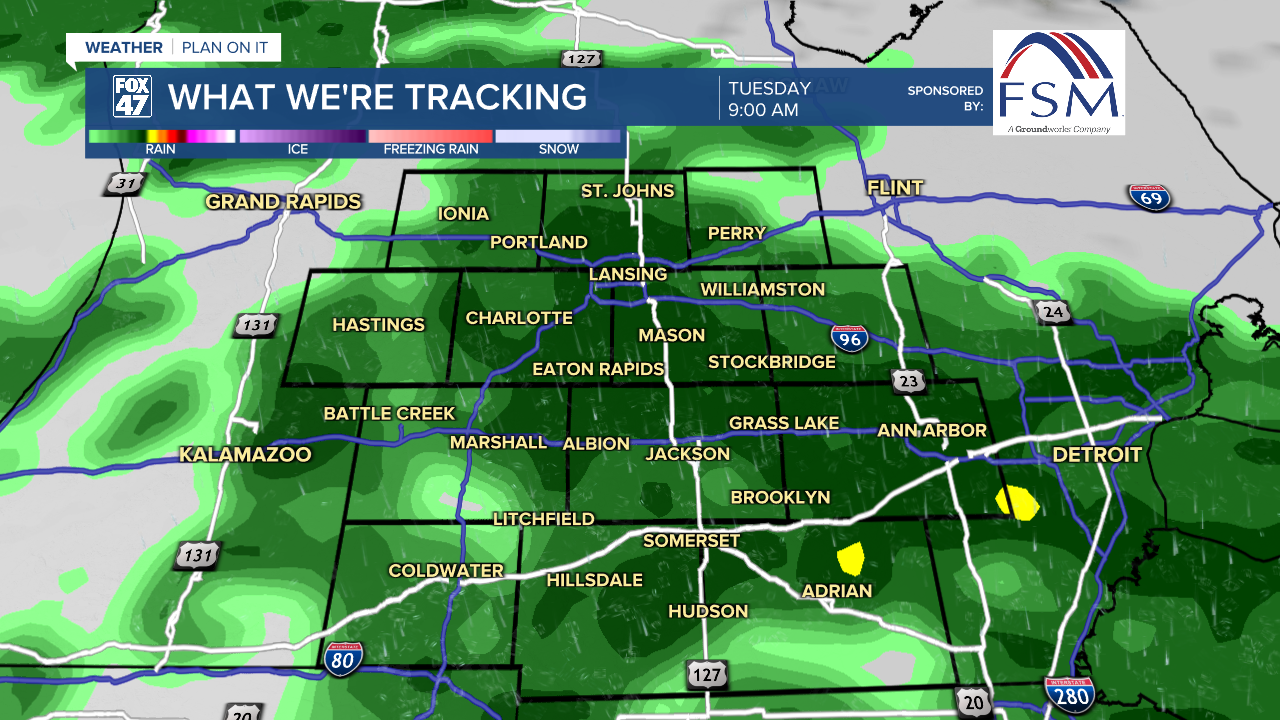
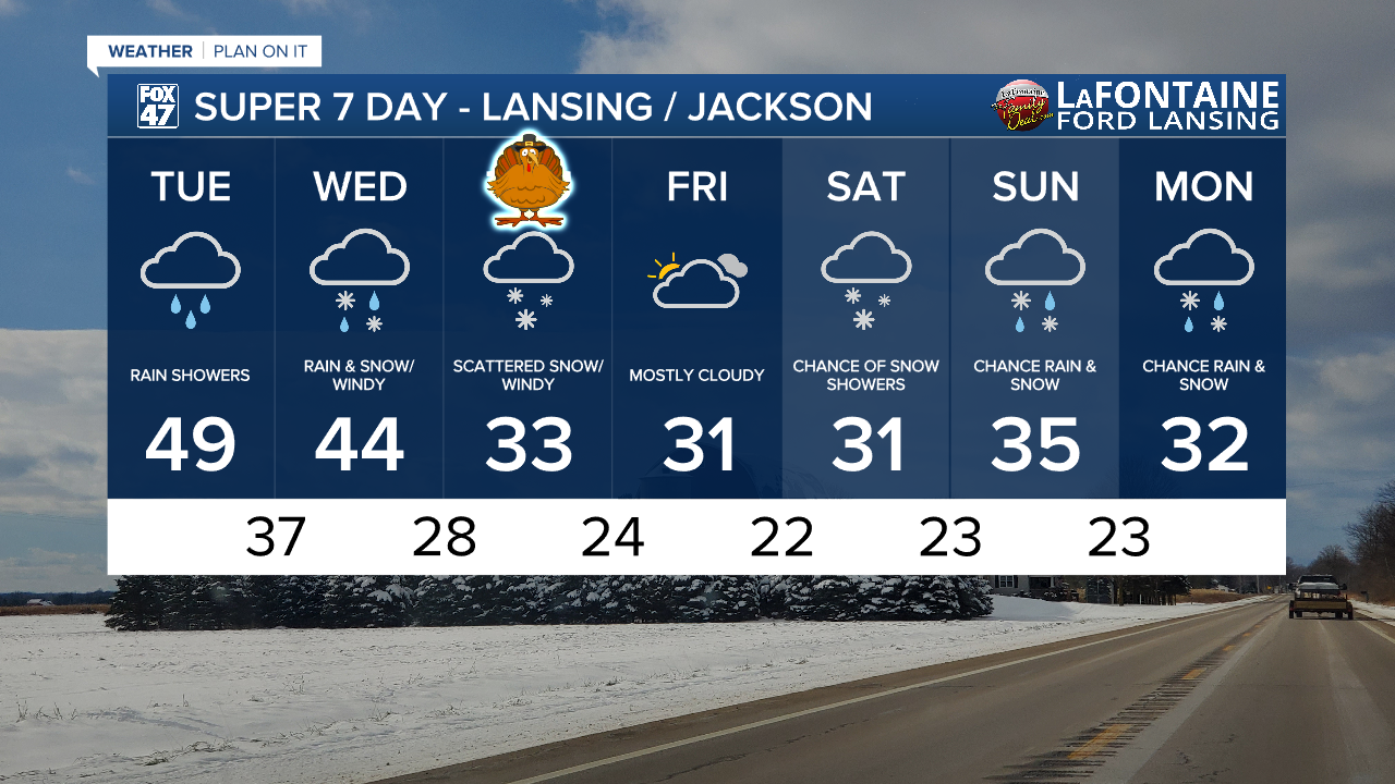
LANSING, Mich. — A few showers have already been observed prior to the 6 AM hour Tuesday morning in some of our neighborhoods including Lansing. We will see the main brunt of rain fall from the mid to late morning hours, turning a bit more scattered through the early afternoon hours. When all is said and done we could see up to .2" of rainfall. We should stay dry with mostly cloudy skies after 3 PM.
Daytime highs will stay mild due to winds out of the south with highs in the upper 40's and struggling to reach 50 today across our neighborhoods. This pattern will soon change once we reach tomorrow morning. Wind gusts today across our neighborhoods range from 15-20 mph.
WATCH THE FULL FORECAST BELOW
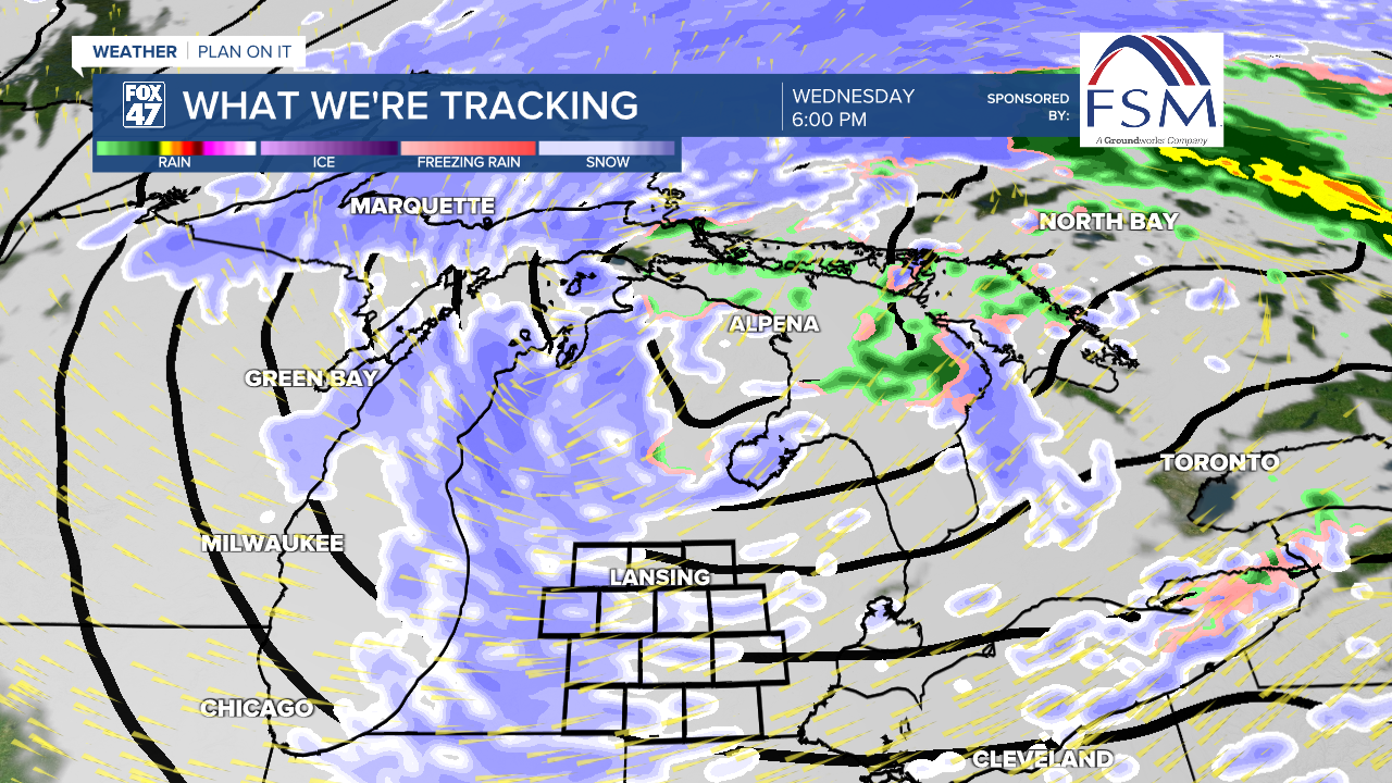
Wednesday morning, a cold front advances through our neighborhoods. Along and ahead of this cold front, another batch of rain showers is expected with no major impacts expected.
On the back end of this cold front, we will start to see winds shift out of the northwest and a lake effect snow pattern setup. Snow showers are looking to begin as early as the late morning hours Wednesday and continue through Wednesday night and throughout the day Thanksgiving.
When this event wraps up Friday morning, we could see areas in western Michigan with snowfall totals exceeding 4". In our neighborhoods, southern neighborhoods of Jackson and Hillsdale could see snow ranging from 3-4" inches with most of our northern neighborhoods seeing ranges from 1-3". These snowfall totals are over the two day period and are not expected to drop all at once. We could see some limited visibility when on the roads Wednesday and Thursday, so make sure to plan accordingly for holiday travel.

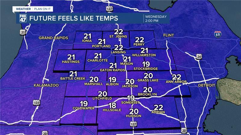
Winds will also be of concern Wednesday as the cold front advances through. We could see wind gusts exceed 45 mph Wednesday afternoon allowing for feels like temperatures to drop into the lower 20s/upper teens during the daytime hours. With the continuing snow, we could also see limited visibility out on the roadways.
Winds will gradually weaken into Thanksgiving with gusts potentially exceeding 35 mph. Still expect breezy conditions for the holiday as we will continue to weaken gradually into Friday with gusts around 25-30 mph.
Another batch of snow is expected to impact our neighborhoods once we reach the weekend with snow returning Saturday and into Sunday with possibly accumulations. It is still a bit early to talk details of the weekend system, but we will keep you updated.
Temps drop to around freezing Thanksgiving through Saturday as daytime highs with overnight lows dropping below freezing in the mid to upper 20's. Expect some cold mornings.
Want more FOX 47 News? Here's how you download our Roku app
You can also see the latest news from across our mid-Michigan neighborhoods by liking us on Facebook or following us on X.
