



LANSING, Mich. — After several days of warm, dry summer weather, rain chances are set to return to Mid-Michigan as we head into the weekend. While much of Friday will remain dry, a developing storm system will bring widespread showers Friday night into Saturday, with some locations potentially picking up over an inch of rainfall.
Dry Through Most of Friday
Friday will be another warm and pleasant day across the Lansing and Jackson area, although it will be cloudy.
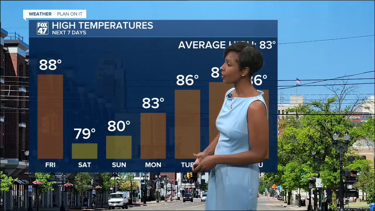
Expect a mix of sunshine and clouds with afternoon highs reaching 88 degrees. Most communities will stay dry through the daylight hours, although an isolated shower cannot be ruled out before sunset.
Steady Rain Arrives Friday Night
Rain becomes much more likely Friday night as an area of low pressure and an upper-level disturbance move into the Great Lakes.
Rain chances increase rapidly overnight, with widespread showers expected by Saturday morning. While thunderstorms are possible, they are expected to remain isolated.
Heavy Rain Possible Saturday
Saturday looks to be the wettest day of the forecast.
Periods of rain are expected through much of the day, and while many locations will receive less than one inch of rainfall, there is a chance that some communities receive more than one inch. An isolated few locations could even pick up more than two inches of rain.
Because of the potential for heavier downpours, the Weather Prediction Center has placed Mid-Michigan under a Marginal Risk for excessive rainfall Friday night into early Saturday morning. While widespread flooding is not expected, localized minor flooding could develop if heavier bands of rain repeatedly move over the same areas.
High temperatures Saturday will be much cooler, topping out around 79 degrees under cloudy skies.
Dry Weather Returns Sunday
Showers will gradually come to an end Saturday night, with rain clearing from west to east by Sunday morning.
Skies become partly sunny Sunday afternoon with highs near 80 degrees, setting the stage for another stretch of pleasant summer weather.
Dry conditions are expected to continue through Tuesday, with comfortable mornings and afternoon temperatures gradually warming back into the middle 80s.
Another Chance for Rain Midweek
Our next weather system arrives during the middle of next week.
A weak upper-level disturbance will move through the Great Lakes Tuesday night into Wednesday, bringing a 20 to 30 percent chance for scattered showers. An isolated thunderstorm cannot be ruled out Wednesday afternoon, but widespread heavy rain or severe weather is not anticipated at this time.
7-Day Forecast
Friday: Partly sunny. High 88°.
Saturday: Rain likely with a slight chance of thunderstorms. High 79°.
Sunday: Partly sunny and drier. High 80°.
Monday: Sunny. High 83°.
Tuesday: Sunny. High 86°.
Wednesday: Mostly sunny with a slight chance of a shower or thunderstorm. High 87°.
Thursday: Partly sunny. High 86°.
Looking Ahead
The biggest weather story over the next several days will be the return of beneficial rainfall Friday night into Saturday. While many communities will receive a healthy soaking, isolated areas could pick up over an inch of rain, with localized flooding possible where the heaviest rain falls. Once the weekend system departs, sunshine and comfortable temperatures return for the start of next week before another weaker chance of showers arrives by the middle of the week.
Have a great weather picture or video to share? Send it our way and we may feature it on-air or online!

