
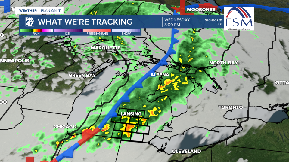
LANSING, Mich. — Winds out of the southwest strengthen today ahead of an incoming cold front. This same cold front will drive the return of showers and storms across our neighborhoods today. Make sure to pack the umbrella when heading outside.
High temperatures will reach the upper 70's by the early afternoon hours as once showers arrive in our neighborhoods, we will gradually cool. We will see increasing cloud cover throughout the morning hours Wednesday and staying dry.

WATCH THE FULL FORECAST BELOW
We could see a spotty shower develop in the early afternoon hours, however, more uniform areas of showers and storms will arrive as early as 2 PM Wednesday afternoon. This is also when we could start seeing impacts such as strong winds with gusts possibly exceeding 30 mph within stronger storms and heavy rainfall rates.
These showers could potentially last into the overnight hours through 3 AM with lake enhanced rain possible as we head into Thursday morning as winds shift out of the north. Rainfall totals for this system could range up to .5" or up to 1" within areas that see stronger storms with heavy rainfall.
A secondary, fast moving, low pressure system is looking to wrap around the already existing trough through the state of Michigan Friday. This will bring renewed chances for showers as well as strong winds. We could potentially see winds exceed 40 mph. If you have any flowers, plants, or light weight objects outdoors, make sure to bring them in, especially for Friday as we close the week breezy.

Fall like conditions will be favored beginning Thursday with highs cooling to the mid 60's. This high temperatures trend will last through the rest of the work week and through the weekend. A gradual warm up looks to begin as we begin a new week Monday.

Want more FOX 47 News? Here's how you download our Roku app
You can also see the latest news from across our mid-Michigan neighborhoods by liking us on Facebook or following us on X.
