


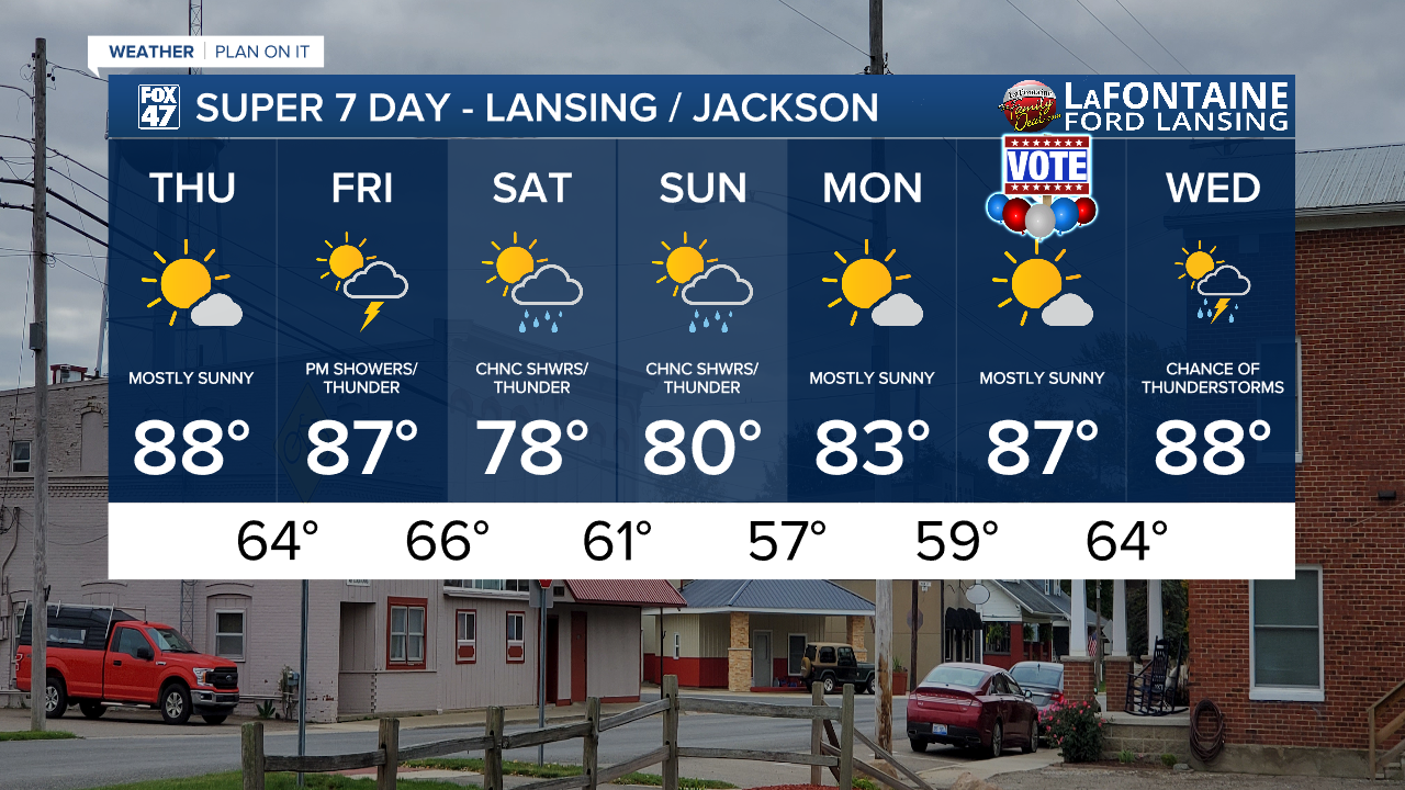
LANSING, Mich. — Temperatures are on the rise today across Mid-Michigan as we are trending a bit warmer today than what we discussed yesterday. Highs will warm to the upper 80's today in Lansing taking our trend above average. We will see one more day of mostly sunny skies across Mid-Michigan before showers and storms return to the forecast as we enter the weekend.
We could see a few afternoon clouds, but no major impacts are expected today. We could see wind gusts around 15 mph today with an isolated 20-25 mph gust possible.
WATCH THE FULL FORECAST BELOW
An area of low pressure out to the west tracks east, and paired with an upper level low, drives the return of showers and storms to our area beginning late Friday. A surface cold front will sag south through the state on Saturday and take us into Sunday where drier, cooler air will return to the forecast by the time we start a new week.
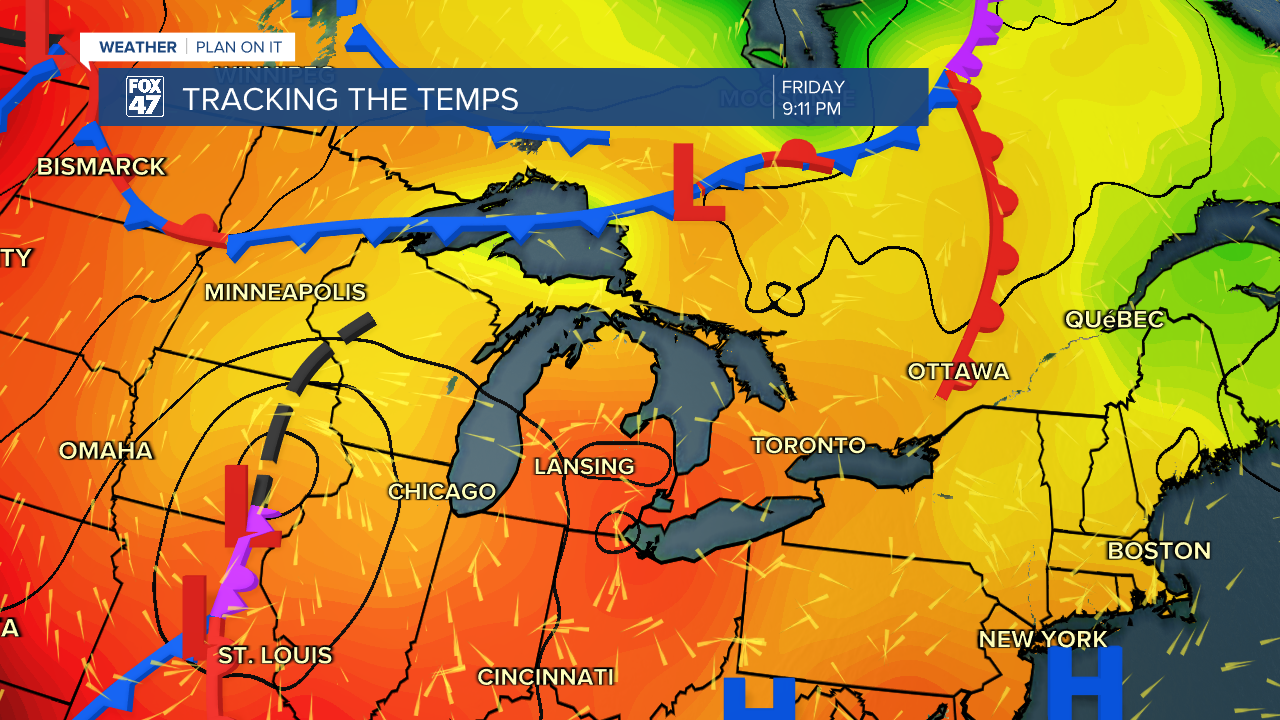
Cloud cover increases through the day Friday with some possible sunshine to start us out. However, once we reach the mid-afternoon hours, we will be turning a bit gloomier. Showers don't arrive until past 9 PM Friday with potential for tame thunderstorms as well.

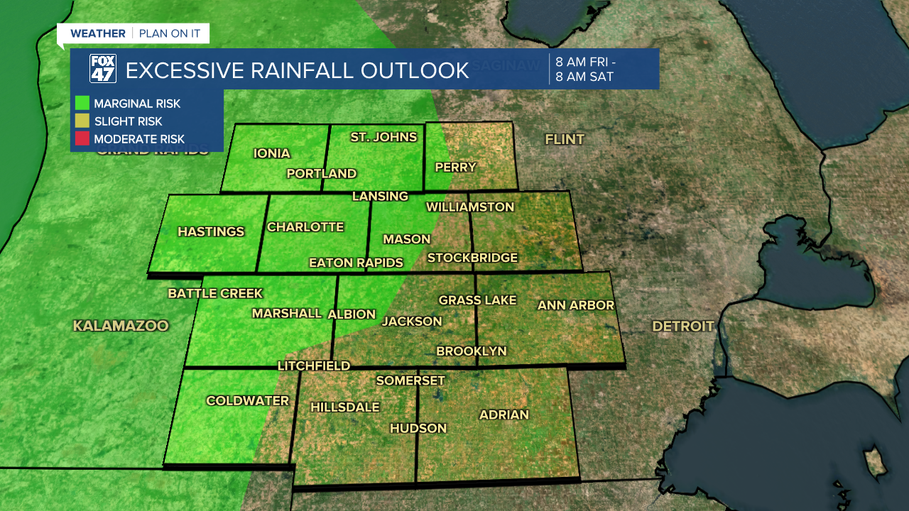
No severe impacts are expected at the moment with showers and storms both Friday and Saturday. However, the initial round of overnight showers and potential storms Friday into Saturday could bring some heavier rainfall rates that could lead to some localized ponding in areas like Clinton and Eaton counties. Stay weather aware while heading out on the roads Saturday morning.
Showers and tame storms continue through the daytime hours Saturday as we await the cold front to pass. We are lacking instability, a key ingredient for thunderstorm development, which is why no severe impacts are expected at the moment. Winds will only gust up to 25 mph Saturday with the front advancing during the AM hours Sunday.
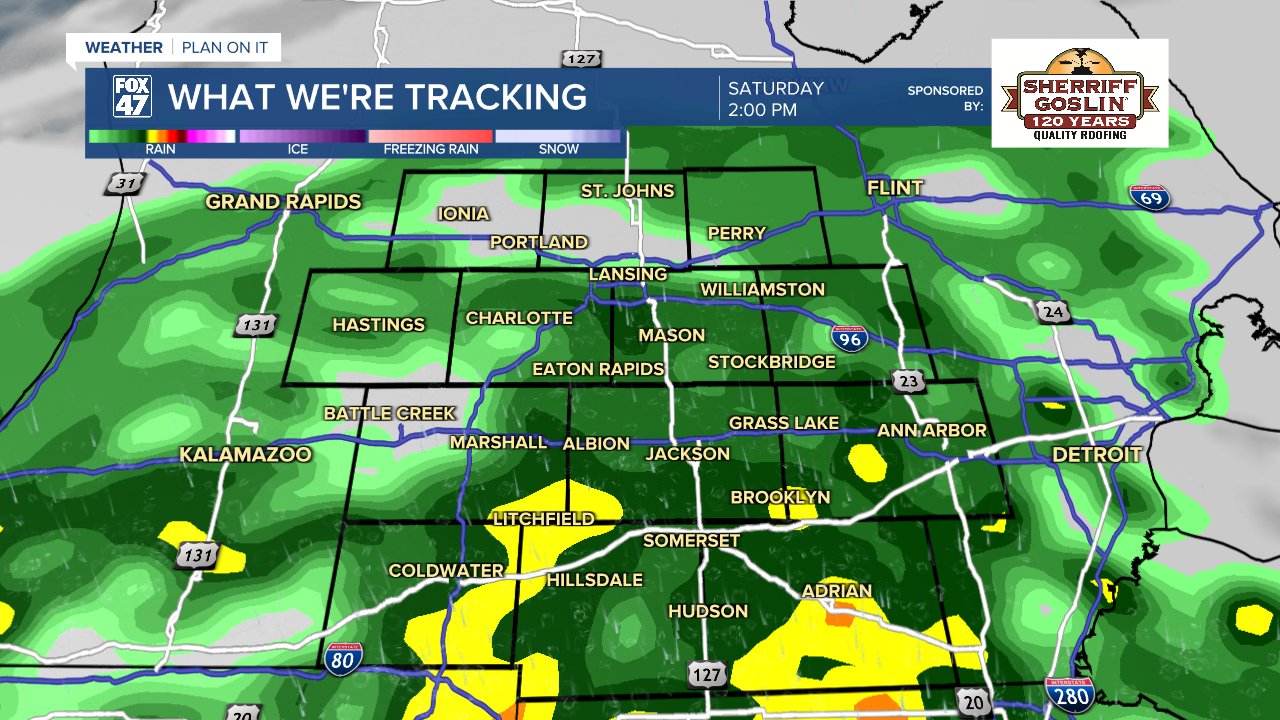
We could see some lingering showers and a potential rumble of thunder Sunday morning. However, we will be in a drying trend once the cold front passes through. Temperatures will drop back into the lower 80's early next week with, at the moment, mostly sunny skies. No major impacts are expected for election day at this time as we hope it sticks that way as we could see precipitation return as early as Wednesday next week.
Have a great weather picture or video to share? Send it our way and we may feature it on-air or online!

