
LANSING, Mich. — UPDATE
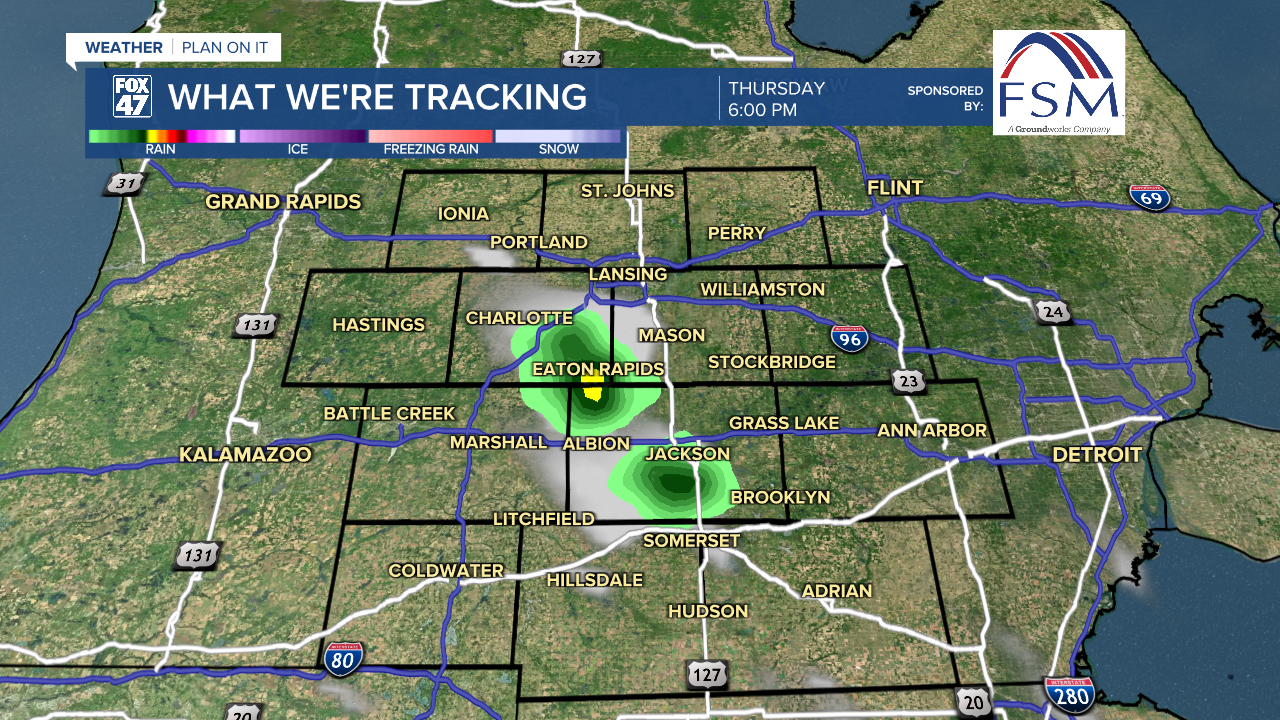
SEVERE THUNDERSTORM WARNING in effect for portions of CLINTON, EATON, and INGHAM Counties until 5:45 PM.
Seasonably average high temperatures continue in our neighborhoods today with highs in the mid 80's. Dew points will remain in the mid to lower 60's today allowing for more comfortable conditions outside.
As we enter the holiday weekend, we will see our temperatures rising as well as humidity returning.
WATCH THE FULL FORECAST BELOW
A weakening cold front approaches our neighborhoods today and is expected to stall out across Mid-Michigan this evening. We will not see much in the way drastic temperature changes, but isolated thunderstorm chances are renewed for the day today as well. These thunderstorms should stay tame and develop during peak heating times this afternoon. This trend will continue through Saturday.
Wind direction turns out of the south on Friday allowing for warm and mosit air to return to our neighborhoods. High temps for the fourth will warm into the upper 80's. with dew points climbing into the upper 60's. We will feel a bit more humid than what we have been observing this week.
Heat index values will climb into the upper 80's/lower 90's on Friday given the clear skies. We will be watching for a pop up shower or thunderstorm as well. Make sure to keep cool if you are planning on spending a lot of time outside on Friday.

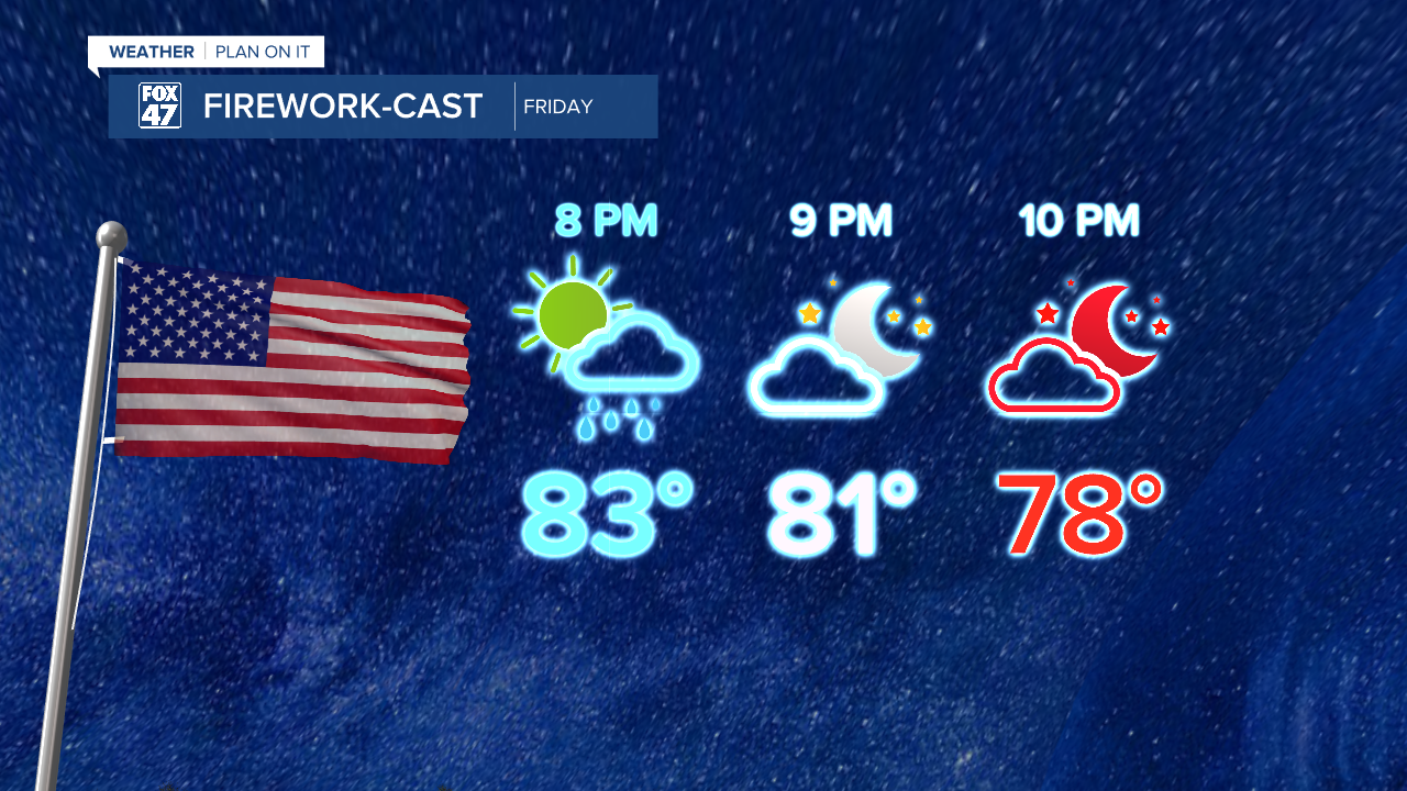
If seeing or using fireworks Friday night, showers chances diminish past sunset allowing for more good firework conditions. Temperatures will cool into the lower 80's/upper 70's during the early nighttime hours from 9 PM to 11 PM.
However, if using any fireworks, be cautious of your surroundings given the dry conditions across the state of Michigan.
Saturday high temperatures will warm into the lower 90's with heat index values into the 90's as well. We are still expecting to see clear skies with a small chance for a pop up shower and storm during peak heating hours. We will be watching closely.
Our next best chance for organized showers and storms comes on Sunday ahead of a cold frontal passage that will sweep through that evening. We will be watching closely for any severe impacts these storms could bring as we will begin to cool gradually heading into the new week.

Want to learn more about the Weather? Visit the FOX47News Website.
Stay in touch with us anytime, anywhere.
Sign up for newsletters emailed to your inbox.
Select from these options: Breaking News, Severe Weather, School Closings, Daily Headlines and Daily Forecasts.
