
LANSING, Mich. — High temperatures today in our neighborhoods are expected to range in the mid to lower 90's as this dangerous heat comes to an end.
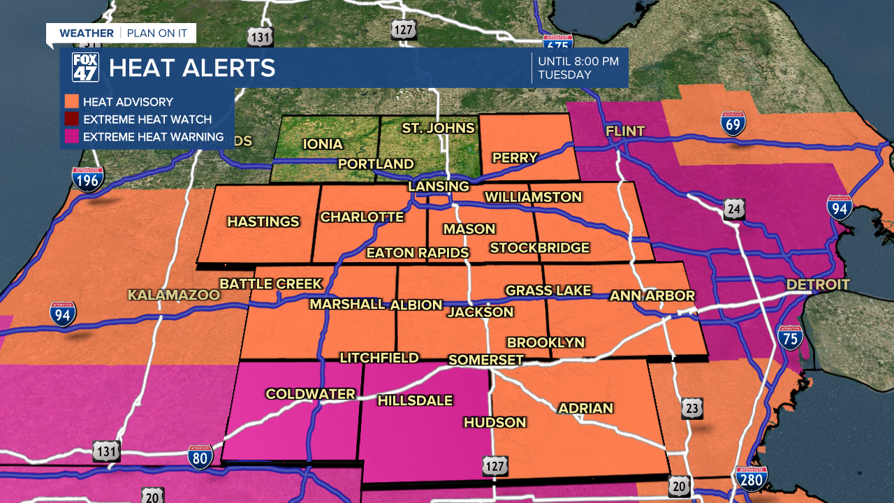
A Heat Advisory is still in effect for Eaton, Ingham, and Jakcson counties through 8 PM Tuesday evening. Hillsdale County is still under an Extreme Heat Warning through 8 PM Tuesday evening.
WATCH THE FULL FORECAST BELOW
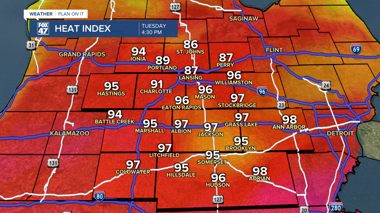
Heat index values today are still expected to flirt with triple digits as dew points in the mid 70's will allow for continued humid conditions. It is best to limit outdoor activities today and to refrain from any strenuous outdoor activity as well.
We will start to see a shift in our weather pattern as an incoming cold front will drive the return of thunderstorms in our neighborhoods. Showers and storms are expected to start later Tuesday afternoon at around 3 PM starting a bit more isolated turning scattered once we reach the 6 PM hour. These showers and storms will continue through about midnight tonight.
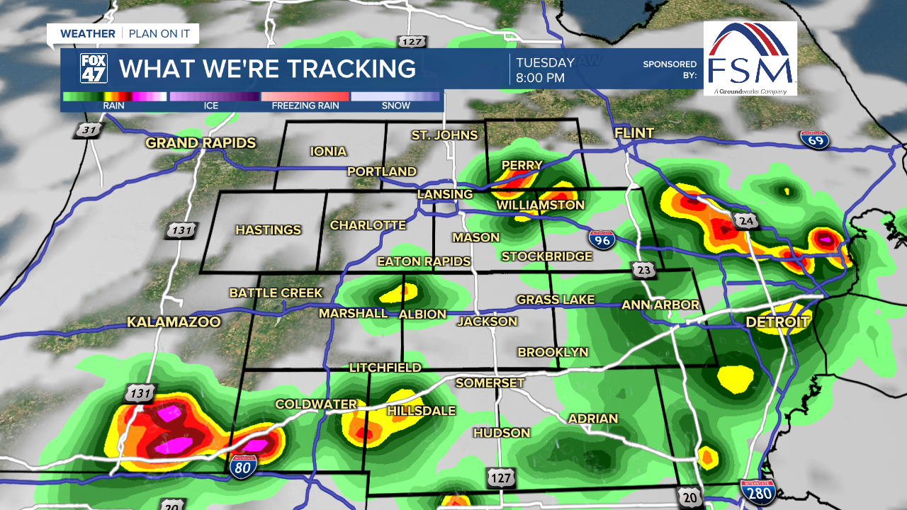
The Storm Prediction Center has issued a marginal risk for severe weather across all of our neighborhoods today with main impacts possible including damaging winds and heavy rainfall rates. Make sure to bring in any light or loose objects from outdoors this afternoon as well as watch out for flooding concerns as well.
LEARN MORE ABOUT DANGEROUS HEAT AND HEALTH CONCERNS BELOW
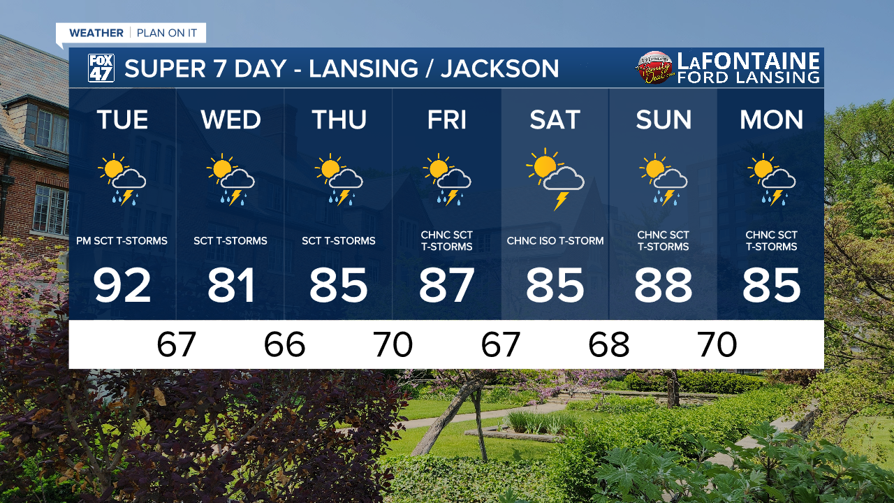
This trend will continue on throughout the week with renewed storm potential Wednesday through Friday as the passing cold front stalls out. Temperatures will drop back into the mid to upper 80's with humid conditions continuing. Overnight lows still look to stay on the warm side ranging from the upper 60's to lower 70's.
Want to learn more about the Weather? Visit the FOX47News Website.
Stay in touch with us anytime, anywhere.
Sign up for newsletters emailed to your inbox.
Select from these options: Breaking News, Severe Weather, School Closings, Daily Headlines and Daily Forecasts.
