
LANSING, Mich. — Clear skies this evening will gradually give way to increasing clouds as the first in a series of clipper systems begins to approach from the northwest. Temperatures will take a sharp dip toward the low teens before midnight, then climb toward the low 20s by daybreak. A few snow showers will be possible as early as 4:00 AM, becoming more widespread in time for the Tuesday morning commute.
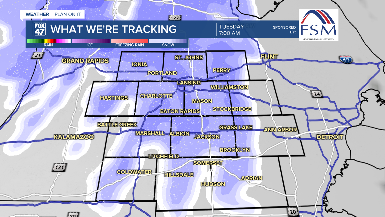
Snow showers will make for slick or snow-covered roads throughout the commute on Tuesday morning. Give yourself some extra time to reach your destination, and be sure to slow down. Snow will wrap up by lunchtime as the first disturbance departs.
Speaking on snow totals for this first round of snowfall, we could see up to 2 inches of snowfall for neighborhoods north of I-94 and up to an inch of snow for areas south of I-94. All of our neighborhoods could also see some freezing drizzle due to winds turning out of the south warming our temperatures to around freezing once we head into the afternoon hours. This could allow for some slick spots on roadways into the afternoon hours as well on Tuesday.

We only have a short break from precipitation ahead of the second clipper system that will bring rain and snow with temperatures staying in the mid to lower 30's. Snow will break out across our neighborhoods around 8:00 PM, gradually shifting to a split of rain and snow into the overnight hours. Neighborhoods along and north of I-96 will remain predominantly snow, while locations south will likely change to a few hours of plain rain.
GET YOUR FOX 47 FORECAST HERE
The back end of this system will bring more snow and rain into the daytime hours Wednesday with travel remaining hazardous for the morning commute. As winds turn back out of the north, temperatures will fall back into the 20's by Thursday with chances for remnant lake effect snow.

Snowfall totals on the second system will be more significant overall, although the change to rain will cut numbers down a bit for neighborhoods south of Lansing. The northern half of the area will pick up an additional 2-4" of snow from Tuesday night into Wednesday, with 1-2" possible along and south of I-94.

We are watching for another system late in the week Friday with renewed snowfall and possible hazards. Temperature swill remain chilly with highs in the lower 20's late in the week and overnight lows falling back into the single digits late this weekend.

Want more FOX 47 News? Here's how you download our Roku app
You can also see the latest news from across our mid-Michigan neighborhoods by liking us on Facebook or following us on X.
