
LANSING, Mich. — We are still monitoring continued river flooding at the Maple River in northern Clinton County and at the Red Cedar River in East Lansing. Flood warnings continue for both of these sites with river levels falling at the Red Cedar and cresting at the Maple River expected Tuesday afternoon. With dry conditions today and tomorrow, we will see improvements at both of these sites as water continues to recede.

WATCH THE FULL FORECAST BELOW
Temperatures across our neighborhoods this morning feel more like winter than spring with air temperatures trending in the mid to lower 20's and feels like temperatures down into the teens and single digits for most. Make sure to bundle up when heading out the door this morning and leave some extra time to warm the car up. The commute shouldn't see too many impacts this morning as sunshine is expected for the majority of the day.
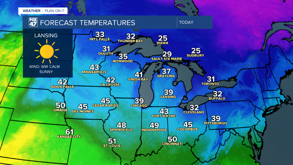
Surface high pressure builds in following the passing cold fronts Monday. This area of high pressure will weaken our winds today as well bring sunny skies during the daytime hours. Highs will only reach the upper 30's and possibly lower 40's across our neighborhoods today as we hold onto the colder air mass across the region.
Highs pressure gradually moves off to the east this evening with winds shifting out of the south overnight. This will bring clouds back to our neighborhoods to start the day Wednesday with partly cloudy skies and chances to see more sunshine Wednesday afternoon. Winds out of the south also means high temperatures will return to normal in the mid 50's.
However, we do have to get through the morning hours as we could still see wind chills down in the lower 20's and upper teens when we wake up Wednesday morning. This will be our last morning of well below average temperatures in the overnight hours in our 7-Day forecast.

Showers return to our neighborhoods overnight Wednesday and into Thursday morning in the form of rainfall. Showers should move out before we head into the afternoon hours and no major impacts are expected. Renewed chances for showers exist on Friday with no severe impacts expected for either round.

We will dry up Saturday with a big bump in temperatures Sunday with highs possibly back in the 70's. Thunderstorm chances arrive as we start a new week Monday. We could still see some changes to this early next week forecast and will be monitoring closely.

Have a great weather picture or video to share? Send it our way and we may feature it on-air or online!

